
40.2.267 Gran Enciclopedia Catalana (ed.). "Catalunya: El clima i la hidrografia". l'Enciclopèdia (in Catalan). Barcelona.[dead link] (in Catalan) Biodiversitat...
233 KB (22,290 words) - 19:15, 13 July 2024

Argentine Naval Hydrographic Service (redirect from Servicio de Hidrografia Naval)
The Argentine Hydrographic Service (Spanish: Servicio de Hidrografía Naval, abbreviated SHN) is the branch of the Ministry of Defense responsible for...
4 KB (235 words) - 22:32, 25 February 2023
Shn, may refer to: School health and nutrition services Servicio de Hidrografia Naval, the Argentine Naval Hydrographic Service SHN (theatres), a theatrical...
722 bytes (147 words) - 13:21, 5 November 2021

2020. "SPECIAL WARNING – SUBTROPICAL DEPRESSION "KURUMI"". Centro de Hidrografia da Marinha: MARINHA DO BRASIL. 25 January 2020. Archived from the original...
96 KB (8,493 words) - 22:04, 31 May 2024
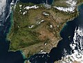
Spanish). 30 May 2013. Retrieved 1 September 2018. "2. El territorio y la hidrografía española: ríos, cuencas y vertientes". Junta de Andalucía. Archived from...
131 KB (14,032 words) - 04:06, 15 July 2024
missions. The Argentine Naval Hydrographic Service (Spanish: Servicio de Hidrografía Naval, abbreviated SHN) provides national hydrographics services.[citation...
55 KB (5,607 words) - 12:51, 4 July 2024
Hartog, Johan (1988). History of Saba. Saba: Saba Artisan Foundation. Hidrografía, Spain Dirección de (1826). Derrotero de las islas Antillas, de las costas...
73 KB (6,980 words) - 04:45, 14 July 2024

which entered service in 2015. Vital de Oliveira was named Patrono da Hidrografia da Marinha by decree on 21 January 1976. His date of birth is marked...
7 KB (771 words) - 04:48, 15 July 2024
original on February 15, 2024. Retrieved 15 February 2024. Alt URL "Hidrografia da Marinha - Special Warning". 16 February 2024. NCEI.Monitoring.Info@noaa...
58 KB (3,987 words) - 05:38, 16 July 2024

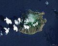
geográficos é hidrográficos sobre Chiloé. Departamento de Navegación e Hidrografía, Chile. 1897. Establecimiento Poligráfico "Roma". Santiago de Chile....
20 KB (2,103 words) - 06:32, 22 June 2024

Antillas, de las costas Tierra-Firme, y las del Seno Mejicano, Dirección de Hidrografía, España, Madrid, Imprenta Nacional, 1837. p. 266 "Man rescued from Cay...
5 KB (397 words) - 20:32, 24 August 2023
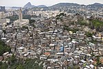
place to live near their work in the city's centre and port. "Geologia e Hidrografia da Cidade do Rio de Janeiro". www.educacaopublica.rj.gov.br. Retrieved...
3 KB (305 words) - 17:20, 24 April 2023
en la Organización de las Naciones Unidas. Buenos Aires: Servicio de Hidrografía Naval. July 1990 [1969]. Datos geográficos Datos en Mapcarta 51°39′00″S...
1 KB (105 words) - 03:01, 20 October 2023

Monte Fitz Roy. Salón Teniente Merino. "Fisonomía Provincial: Relieve e Hidrografía" (in Spanish). Gobierno de la Provincia de Santa Cruz. Archived from...
43 KB (3,368 words) - 04:28, 11 July 2024

Archived from the original on 22 July 2011. Retrieved 24 November 2010. "Hidrografia" [Hydrography] (in Spanish). Mexico City: Delegación de Coyoacán. 2009...
100 KB (12,839 words) - 09:30, 14 July 2024
Santerém - CFS) Northern Hydrographic and Navigation Center (Centro de Hidrografia e Navegação do Norte - CHN-4) 5th Naval District Command (Comando do...
106 KB (10,666 words) - 20:12, 26 June 2024
Antillas, de las costas Tierra-Firme, y las del Seno Mejicano, Dirección de Hidrografía, España, Madrid, Imprenta Nacional, 1837. p. 24 and p. 278 NOAA Navigational...
15 KB (1,987 words) - 17:07, 7 July 2024
Catarina state in southeastern Brazil. List of rivers of Santa Catarina "Hidrografia - Município de Cunha Porã". Prefeitura de Cunha Porã. Retrieved 5 November...
1 KB (35 words) - 17:33, 29 December 2020
"Lista de Faros Argentinos" [List of Argetinian Lighthouses]. Servicio de Hidrografía Naval (in Spanish). Archived from the original on 2007-08-08. Retrieved...
3 KB (306 words) - 18:40, 2 May 2024

Archived from the original on 4 August 2022. Retrieved 10 March 2019. "Hidrografia. - Estado de morelos". sites.google.com. Archived from the original on...
159 KB (16,746 words) - 01:55, 8 July 2024

Commons has media related to Les Eclaireurs Lighthouse. List of Lighthouses in Argentina Servicio de Hidrografía Naval Portals: Argentina Engineering...
3 KB (365 words) - 05:05, 11 February 2023
for the city of Punta Arenas. It drains to the Strait of Magellan. "Hidrografía Región de Magallanes". Biblioteca del Congreso Nacional de Chile (in...
3 KB (59 words) - 12:38, 6 March 2022
Spanish). 1 April 2012. Archived from the original on 22 April 2014. "Hidrografía Región de Magallanes". bcn.cl (in Spanish). Biblioteca del Congreso Nacional...
41 KB (3,583 words) - 17:45, 9 July 2024

Antártida (octubre 2013 - diciembre 2014) (PDF) (in Spanish), Servicio de Hidrografía Naval, p. 3, archived from the original (PDF) on 24 September 2015, retrieved...
6 KB (414 words) - 02:39, 26 June 2024

Archived from the original on July 22, 2011. Retrieved March 3, 2011. "Hidrografía" [Water Resources] (in Spanish). Mexico City: Borough of Iztapapala....
95 KB (10,401 words) - 10:34, 3 July 2024

Pinturas River Río Baker Archived 2007-07-06 at the Wayback Machine "Hidrografía Región de Aysén". Biblioteca del Congreso Nacional de Chile (in Spanish)...
5 KB (373 words) - 02:42, 29 April 2022
Niemeyer, Hans; Cereceda, Pilar (1983). Geografía de Chile — Tomo VIII: Hidrografía (1º edición, Santiago de Chile: Instituto Geográfico Militar ed.). v...
4 KB (301 words) - 10:20, 9 March 2024
Hill. Retrieved November 25, 2015. Cabo San Pablo Lighthouses Servicio de Hidrografía Naval Servicio de Hidrografía Naval Portals: Argentina Engineering...
3 KB (199 words) - 18:20, 2 May 2024

del estado. Atlas del estado Táchira: cartografía, geología, clima, hidrografía, geomorfología--suelos, vegetatión, vocaciones, socio cultural--población...
43 KB (4,932 words) - 08:27, 26 March 2024

Antillas, de las costas Tierra-Firme, y las del Seno Mejicano, Dirección de Hidrografía, España, Madrid, Imprenta Nacional, 1837. p. 266 Cay Sal Bank Lighthouse:...
8 KB (833 words) - 05:10, 3 January 2024