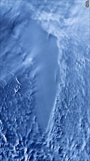
ICESat (Ice, Cloud, and land Elevation Satellite) was a NASA satellite mission for measuring ice sheet mass balance, cloud and aerosol heights, as well...
10 KB (921 words) - 04:47, 13 August 2024
ICESat-2 (Ice, Cloud, and Land Elevation Satellite 2), part of NASA's Earth Observing System, is a satellite mission for measuring ice sheet elevation...
21 KB (2,072 words) - 20:38, 17 September 2024
10 March 2018. Retrieved 11 March 2018. Neumann, Tom. "NASA: ICESat & ICESat-2". Icesat.gsfc.nasa.gov. Retrieved 10 August 2017. "OSTM: Home Page". Sealevel...
38 KB (1,190 words) - 10:23, 15 December 2024
60 Iridium communication satellites. The rocket flew its final mission, ICESat-2, on 15 September 2018, earning the launch vehicle a streak of 100 successful...
42 KB (4,117 words) - 19:44, 4 December 2024
utilizing airborne platforms to bridge the observational gap between the ICESat and ICESat-2 satellite missions. The program, which ran from 2009 to 2019, employed...
14 KB (1,413 words) - 05:04, 21 July 2024
Geo-IK-2 GEOS-3 Geosat Geosat Follow-On GFZ-1 GLONASS GRACE GOCE GPS ICESat-1 ICESat-2 LAGEOS LARES Larets H-IIA-LRE PAGEOS Seasat Starlette and Stella...
21 KB (2,338 words) - 10:15, 25 November 2024
Christoffersen (2023). "A hydraulic model of the Amur River informed by ICESat-2 elevation". Hydrological. 68 (14): 2027-2041. Bibcode:2023HydSJ..68.2027B...
45 KB (3,467 words) - 00:35, 22 November 2024
calibration than the surface of an ocean. Using Salar de Uyuni as the target, ICESat has already achieved the short-term elevation measurement accuracy of below...
29 KB (3,066 words) - 23:37, 29 October 2024
Survey (USGS) JPSS-2, weather and environmental satellite for NASA and NOAA ICESat-2, ice-topography satellite for NASA Transiting Exoplanet Survey Satellite...
14 KB (1,070 words) - 22:54, 19 August 2024
although initially thought to be from a remote-sensing altimeter satellite ICESat-2. Justin Davenport (15 April 2022), China launches Chang Zheng 4C from...
1 KB (106 words) - 19:28, 18 May 2023
Altimeter System (ATLAS) on NASA's Ice, Cloud, and land Elevation Satellite 2 (ICESat-2) is a photon-counting lidar that uses the return time of laser light pulses...
28 KB (3,825 words) - 01:26, 17 December 2024
Experiment Follow-on (GRACE FO), and Ice, Cloud, and land Elevation Satellite 2 (ICESat-2). In addition to systems already in orbit, NASA is designing a new set...
223 KB (20,720 words) - 22:09, 21 December 2024
Aura AVHRR CALIPSO CloudSat CERES DMC Envisat EROS GOES GOMOS GRACE Hydros ICESat IKONOS Jason-1 Landsat MERIS MetOp Meteor Meteosat MLS MIPAS MISR MODIS...
4 KB (260 words) - 21:25, 1 July 2024
considers remote sensing and climate monitoring. She was science lead for the ICESat-2 Mission, which used laser altimetry to make height maps of Earth. Farrell...
7 KB (776 words) - 03:19, 21 December 2024
NASA's ICESat satellite was key in developing this concept further and subsequent work demonstrated the pervasiveness of this phenomenon. ICESat ceased...
86 KB (9,894 words) - 00:36, 7 December 2024
ground below and the changes in the gravity field over the ice sheet. Thus ICESat, GPS and GRACE satellite mission are useful for such purpose. However, glacial...
44 KB (5,397 words) - 22:12, 21 November 2024
mission and the "Advanced Topographic Laser Altimeter System" (ATLAS) of the ICESat-2 satellite. IAU · 8791 8792 Christyljohnson 1978 VH11 Christyl Chamblee...
216 KB (435 words) - 19:42, 18 November 2024
Operational Earth Science Division Terra 1999 Operational Aqua 2002 Operational ICESat 2003 2010 Aura 2004 Operational Joint Polar Satellite System (JPSS) ─ a...
10 KB (723 words) - 20:43, 6 December 2024
and Climate Experiment (SORCE) Ice, Cloud and Land Elevation Satellite (ICESat) Quick Scatterometer Mission (QuikSCAT) TIMED (Thermosphere Ionosphere Mesosphere...
5 KB (541 words) - 17:49, 25 October 2024
Topographic Laser Altimeter System (ATLAS), a space-based lidar instrument on ICESat-2 Asteroid Terrestrial-impact Last Alert System (ATLAS) Atlas (computer)...
11 KB (1,310 words) - 23:58, 15 December 2024
the NASA ICESat Science Team from 2006–present, as part of the Ice, Cloud and land Elevation (ICESat) mission from 1999–present and the ICESat-2 Science...
10 KB (982 words) - 22:46, 20 October 2024
engine variant was used from 1989 and retired at the conclusion of the ICESat-2 launch on 15 September 2018. "AJ10-118". Encyclopedia Astronautica. Archived...
8 KB (662 words) - 23:17, 14 July 2024
subtle amounts of growth or decline. A satellite-based system, the NASA ICESat, includes a lidar sub-system for this purpose. The NASA Airborne Topographic...
130 KB (14,777 words) - 21:19, 17 December 2024
systems (Envisat, European Remote-Sensing Satellite, GRACE and GRACE-FO and ICESat) indicated annual mass loss of only about 12 Gt from 2012 to 2016. This...
208 KB (21,955 words) - 15:48, 19 December 2024
Delta 7000 variants ("Lite" and "Heavy"). The rocket flew its final mission ICESat-2 on 15 September 2018, earning the launch vehicle a streak of 100 successful...
88 KB (2,326 words) - 00:57, 26 May 2024
Antarctic ice sheet 1992–2016: reconciling results from GRACE gravimetry with ICESat, ERS1/2 and Envisat altimetry". Journal of Glaciology. 67 (263): 533–559...
55 KB (11,602 words) - 00:00, 11 December 2024
systems – Envisat, European Remote-Sensing Satellite, GRACE and GRACE-FO, and ICESat – indicated an annual mass loss of about 12 Gt from 2012 to 2016 due to...
36 KB (10,032 words) - 17:48, 24 September 2024
being constantly improved. The Ice, Cloud, and land Elevation Satellite (ICESat), measured ice sheet mass balance, cloud and aerosol heights, and land topography...
6 KB (673 words) - 14:59, 3 December 2024
7000 variants ("Light" and "Heavy"). The rocket flew its final mission ICESat-2 on 15 September 2018. A nearly-complete Delta II, made from flight-qualified...
91 KB (8,806 words) - 15:59, 26 November 2024
the Austfonna ice cap by combining differential SAR interferometry with ICESat laser altimetry. Polar Res 31, 18460, https://doi.org/10.3402/polar.v31i0...
4 KB (300 words) - 02:57, 19 February 2024


