
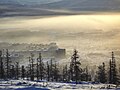
Ilirney (Russian: Илирней; Chukchi: Иԓирӈэй, Iḷirňèj, lit. mountain island) is a rural locality (a selo) in Bilibinsky District of Chukotka Autonomous...
16 KB (1,478 words) - 20:04, 4 February 2024
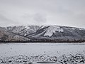
The Ilirney Range (Russian: Илирнейский кряж) is a range of mountains in Chukotka Autonomous Okrug, Russian Far East. Administratively the range is part...
4 KB (328 words) - 13:13, 2 September 2024

Ilirney (Chukchi Элер-нэй) is a group of two lakes in Bilibinsky District, Chukotka Autonomous Okrug, Russia. Archaeological remains of the Neolithic...
3 KB (197 words) - 13:13, 2 September 2024
east of Lake Ilirney, at the feet of the southern slopes of the Ilirney Range, in the upper reaches of the Maly Anyuy River, 55 km from Ilirney village. Its...
2 KB (104 words) - 01:37, 20 August 2023

Gorkoye-Peresheyechnoye (Горькое-Перешеечное) Gornostalevo (Горносталево) Ilirney (Илирней) Ilmen (Ильмень) Imandra (Имандра) Inder (Индерь) Ioni (Иони)...
7 KB (375 words) - 07:40, 25 September 2024
Kongin Range Maymandzhin Range Anadyr Highlands Anadyr Plateau Anyuy Range Ilirney Range Kyrganay Range Chuvanay Range Shchuchy Range Chukotka Mountains Chantal...
7 KB (595 words) - 00:14, 23 January 2024

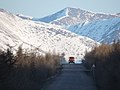
Highway, revitalizing the old road to Omsukchan, then passes through Omolon, Ilirney, Palyavaam, then along the existing extended winter road to Valunistoye...
8 KB (818 words) - 20:02, 28 February 2024

the Kolyma Highway to Anadyr in Chukotka passes Omsukchan, Omolon, and Ilirney with branch roads to Bilibino and Egvekinot, involving construction of...
14 KB (1,170 words) - 02:57, 17 February 2024

the Pyrkanay Range, Rauchuan Range, Kyrganay Range, Chuvan Mountains, Ilirney Range and Anyuy Range, covering substantial parts of it. It is also home...
22 KB (2,627 words) - 09:58, 5 December 2023
Okrug (400 km northwest of the city of Anadyr). The nearest village is Ilirney, located 96 km from airport. The airport is placed in the permafrost zone...
4 KB (265 words) - 22:29, 28 May 2024

April 1896 Verkhoyansk, Sakha Republic May −35.8 °C (−32.4 °F) 2 May 1964 Ilirney, Chukotka AO June −22.2 °C (−8.0 °F) 2 June 1964 Strait of Sterlegova,...
46 KB (981 words) - 19:17, 24 August 2024
site on the banks of the Orlovka River, as well as at Lakes Tytyl and Ilirney. Interest in the area around the present day site of the town began in...
15 KB (1,802 words) - 02:11, 11 July 2024

the Chuvanay Range. The ghost town of Aliskerovo, beyond which rises the Ilirney Range, lies at the eastern end of the Kyrganay Mountains. The highest point...
4 KB (356 words) - 13:44, 22 July 2024
168°07′15″E / 67.51611°N 168.12083°E / 67.51611; 168.12083 (Dvukh Tsirkov) Ilirney Range Anadyr Highlands Chukotka Autonomous Okrug Highest peak of the Anadyr...
119 KB (2,491 words) - 11:16, 16 July 2024
Russia. The Maly Anyuy flows roughly westwards, south and west of the Ilirney Range, making a wide bend by the Chuvanay Range —flowing first northwards...
4 KB (243 words) - 16:09, 24 February 2021
was discovered at the Sentyabr'skoe deposit (of silver and gold) in the Ilirney Range, Western Chukotka, Russia. Ilirneyite is a trivalent-manganese-analogue...
3 KB (166 words) - 01:23, 10 February 2023

kilometres (8,900 sq mi). The Chaun originates in rivers flowing from the Ilirney Range and the northwestern edge of the crater of Lake Elgygytgyn (Maly...
3 KB (182 words) - 19:11, 12 June 2020

northwesternmost Rauchuan Range, highest point Mount Belaya, 1,649 metres (5,410 ft) Ilirney Range, highest point Dvukh Tsirkov (Двух Цирков) 1,785 metres (5,856 ft)...
5 KB (493 words) - 01:07, 25 August 2023
bank of the river. The ghost town of Aliskerovo, beyond which rises the Ilirney Range, lies to the northeast, on the other side of the river, near its...
4 KB (353 words) - 20:30, 16 September 2023

in Anadyr: Tavayvaam Rural localities in Bilibinsky District: Anyuysk Ilirney Keperveyem Omolon Ostrovnoye Rural localities in Chaunsky District: Apapelgino...
3 KB (213 words) - 21:41, 4 August 2024

frozen mammoths have been found near the Rauchua. Its source is in the Ilirney Range. It passes through the sparsely populated areas of the Siberian tundra...
2 KB (153 words) - 16:45, 28 March 2024

uninhabited. To the north rises the Chuvanay Range and to the northeast the Ilirney Range, on the other side of the Maly Anyuy River. The Anyuy Range is part...
5 KB (397 words) - 13:51, 22 July 2024
census). Keperveyem is located just southeast of Bilibino, west of the Ilirney Range and east of Keperveyem and the Kyrganay Range. The Chuvanay Range...
9 KB (1,007 words) - 14:46, 3 March 2024