
Maryland Route 2 (MD 2) is the longest state highway in the U.S. state of Maryland. The 79.24-mile (127.52 km) route runs from Solomons Island in Calvert...
77 KB (7,822 words) - 14:31, 10 October 2024
following is a list of state highways in Maryland shorter than one mile (1.6 km) in length with route numbers between 2 and 699. Most of these highways act...
89 KB (7,684 words) - 00:26, 17 October 2024
The following is a list of state highways in Maryland shorter than one mile (1.6 km) in length with route numbers between 900 and 999. Most of these highways...
97 KB (8,007 words) - 20:58, 13 August 2024
The following is a list of state highways in Maryland shorter than one mile (1.6 km) in length with route numbers between 800 and 899. Most of these highways...
96 KB (7,931 words) - 02:37, 5 May 2024
was extended east to MD 212 in 1929. The route was removed from the state highway system in 1955. Maryland Route 205 was the designation for Edmonston Road...
104 KB (12,452 words) - 18:24, 21 August 2023
from the state highway system in 1955. Maryland Route 164 was the designation for Carpenters Point Road, which ran 2.63 miles (4.23 km) from Carpenter Point...
86 KB (9,107 words) - 03:50, 9 October 2024
is a list and description of the local, express and commuter bus routes of the Maryland Transit Administration, which serve Baltimore and the surrounding...
42 KB (262 words) - 04:52, 2 September 2024
Maryland Route 503 was the designation for Olivet Road from the community of Olivet at the confluence of Mill Creek and St. John Creek north to MD 2 (now...
53 KB (5,661 words) - 04:31, 5 November 2023
was transferred from state to municipal maintenance in 2005. Maryland Route 606 was the 2.27-mile-long (3.65 km) designation for Corsica Neck Road from...
71 KB (8,267 words) - 22:03, 30 October 2023
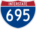
I-95 northeast of Baltimore and I-97 south of Baltimore was officially Maryland Route 695 (MD 695) and was not part of the Interstate Highway System but is...
61 KB (5,211 words) - 12:41, 7 October 2024

at the intersection of Pasadena Road and Governor Ritchie Highway (Maryland Route 2), is now assigned by the U.S. Census Bureau to the Severna Park census-designated...
10 KB (849 words) - 23:02, 18 May 2024

City, Maryland, on the Atlantic Ocean. In the U.S. state of Maryland, US 50 exists in two sections. The longer of these serves as a major route connecting...
88 KB (8,117 words) - 15:21, 11 October 2024
The following is a list of state highways in Maryland shorter than one mile (1.6 km) in length with route numbers between 700 and 799. Most of these highways...
48 KB (3,469 words) - 02:44, 5 May 2024
Roads Commission of Maryland (1943–1944 ed.). Baltimore: Maryland State Roads Commission. p. 77. Retrieved July 8, 2016. Maryland Route 714 was the designation...
54 KB (6,340 words) - 07:53, 22 June 2023
respective lists. Maryland Route 400 was the designation for Mount Wilson Lane, which ran from MD 140 west to the Western Maryland Railway (now CSX's...
72 KB (8,399 words) - 01:10, 30 October 2023

Maryland Route 450 (MD 450) is a state highway in the U.S. state of Maryland. The state highway runs 30.19 miles (48.59 km) from U.S. Route 1 Alternate...
41 KB (4,734 words) - 04:02, 9 October 2024
Sunderland, Route 4 meets Maryland Route 2 (traveling south as a two-lane road from Annapolis) and the two roads merge as Maryland Route 2–4. Route 2-4 continues...
50 KB (4,292 words) - 23:34, 6 October 2024

Gambrills and Millersville. Severna Park is split by Ritchie Highway (Maryland Route 2), which runs between Baltimore and Annapolis and directly through Severna...
15 KB (1,358 words) - 00:40, 1 July 2024

center, tearing part of the roof off the structure and landing it on Maryland Route 2. The hurricane drops up to 4 in (100 mm) of rainfall which results...
91 KB (8,049 words) - 16:00, 9 October 2024

Maryland Route 45 (MD 45) is a state highway in the U.S. state of Maryland. Known for most of its length as York Road, the state highway runs 30.06 miles...
35 KB (2,564 words) - 01:15, 5 August 2024

Maryland Route 200 (MD 200), also known as the Intercounty Connector or ICC, is an 18.8-mile (30.3 km) controlled-access toll road in the U.S. state of...
109 KB (10,791 words) - 01:13, 5 August 2024
St. Paul and Calvert streets (redirect from Maryland Route 2 in Baltimore)
Downtown Baltimore and areas north. The streets, which are part of Maryland Route 2, are two of Baltimore's best-known streets in the downtown area. St...
11 KB (1,324 words) - 00:38, 28 August 2024

Harwood is a crossroads in Anne Arundel County, Maryland, United States, south of Annapolis on Maryland Route 2 (Solomons Island Road). Southern High School...
6 KB (271 words) - 03:42, 15 August 2024

include Maryland Route 181, Maryland Route 387, Maryland Route 393, Maryland Route 435, Maryland Route 436, Maryland Route 450, Maryland Route 788 and...
91 KB (7,853 words) - 04:09, 24 August 2024

Maryland Route 7 (MD 7) is a collection of state highways in the U.S. state of Maryland. Known for much of their length as Philadelphia Road, there are...
38 KB (4,259 words) - 04:18, 10 September 2024

Maryland Route 980 (MD 980) is a designation used for a collection of five service roads in the U.S. state of Maryland along MD 4, four in Bristol and...
11 KB (1,214 words) - 18:08, 16 February 2024
The Maryland Transit Administration (MTA) is a state-operated mass transit administration in Maryland, and is part of the Maryland Department of Transportation...
40 KB (4,179 words) - 23:56, 2 September 2024

Maryland Route 32 (MD 32) is a state highway in the U.S. state of Maryland. The road runs 51.79 miles (83.35 km) from Interstate 97 (I-97) and MD 3 in...
49 KB (5,532 words) - 04:02, 9 October 2024

Maryland Route 404 (MD 404) is a major highway on Maryland's Eastern Shore in the United States. Signed east-west, it runs 24.61 miles (39.61 km) from...
40 KB (3,879 words) - 01:15, 5 August 2024

Maryland Route 3 (MD 3), part of the Robert Crain Highway, is the designation given to the former alignment of U.S. Route 301 (US 301) from Bowie, Maryland...
18 KB (1,900 words) - 19:36, 8 January 2024