
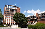
Nanmoku (南牧村, Nanmoku-mura) is a village located in Gunma Prefecture, Japan. As of 31 July 2020[update], the village had an estimated population of 1...
11 KB (758 words) - 17:25, 2 October 2024

mountainous southwestern portion of Gunma Prefecture, bordered by Saitama Prefecture to the south. Gunma Prefecture Fujioka Nanmoku Shimonita Ueno Saitama Prefecture...
12 KB (491 words) - 17:23, 2 October 2024

Gunma Prefecture (群馬県, Gunma-ken) is a landlocked prefecture of Japan located in the Kantō region of Honshu. Gunma Prefecture has a population of 1,937...
27 KB (2,124 words) - 18:24, 27 September 2024

Osutaka (1639m) Mount Takamagahara (1979m) Rivers Kanna River Gunma Prefecture Kanna Nanmoku Nagano Prefecture Kawakami Kitaaiki Minamiaiki Sakuho Saitama...
10 KB (610 words) - 17:22, 2 October 2024

Mount Myogi, Mount Monomi Rivers: Kabura River Gunma Prefecture Annaka Fujioka Kanna Kanra Nanmoku Tomioka Nagano Prefecture Karuizawa Saku Shimonita...
9 KB (440 words) - 17:24, 2 October 2024

with a population density of 62.8 people per square kilometer. Kanra Nanmoku Shimonita The southern part of the city of Takasaki and all of the city...
3 KB (363 words) - 17:26, 2 October 2024

beast smaller than a fox and resembled a polecat, and around Nanmoku, Kanra District, Gunma Prefecture, it was something like a mixture between polecat...
6 KB (879 words) - 00:08, 27 February 2024

Myōgi-Arafune-Saku Kōgen Quasi-National Park (category Parks and gardens in Gunma Prefecture)
the park are Mounts Arafune (荒船山) (1,423 m) and Myōgi (1,104 m). Gunma: Annaka, Nanmoku, Shimonita, Tomioka, Ueno Nagano: Karuizawa, Kitaaiki, Miyota, Saku...
3 KB (147 words) - 20:54, 27 January 2023

Itakura Kanna Kanra Katashina Kawaba Kusatsu Meiwa Minakami Naganohara Nanmoku Nakanojō Ōizumi Ōra Shimonita Shintō Shōwa Takayama Tamamura Tsumagoi Ueno...
30 KB (510 words) - 13:44, 13 July 2024

River, Ōishi River, Nukui River Lakes: Futago Pond, Shirakoma Pond Gunma Prefecture Nanmoku Ueno Nagano Prefecture Chino Kitaaiki Koumi Saku The town has a...
8 KB (348 words) - 18:28, 2 October 2024
of the Places of Scenic Beauty of Japan located within the Prefecture of Gunma. As of 1 August 2020, eight Places have been designated at a national level;...
10 KB (249 words) - 03:25, 14 March 2022
Ibaraki Naka 37.98 Miho 美浦村 Inashiki 66.61 Shintō 榛東村 Gunma Kitagunma 27.92 Ueno 上野村 Tano 181.85 Nanmoku 南牧村 Kanra 118.83 Tsumagoi 嬬恋村 Agatsuma 337.58 Takayama...
34 KB (315 words) - 09:31, 30 August 2024
people commute to Tokyo, which is one hour away. Gunma Prefecture Kanra District: Shimonita, Nanmoku Nagano Prefecture Komoro, Chino, Tōmi Minamisaku...
24 KB (2,026 words) - 21:13, 2 October 2024