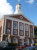
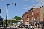
New Hampshire Route 13 is a 43.38-mile (69.81 km) long north–south state highway in the state of New Hampshire, United States. The highway runs from Brookline...
8 KB (495 words) - 02:39, 25 March 2023
New Hampshire Route 130 (abbreviated NH 130) is a 12.739-mile-long (20.501 km) secondary east–west state highway in New Hampshire. The road runs between...
3 KB (175 words) - 03:07, 25 March 2023
New Hampshire Route 101 (NH 101) is a state-maintained highway in southern New Hampshire extending from Keene to Hampton Beach. It is the major east–west...
37 KB (3,355 words) - 06:55, 18 November 2024
census-designated place and is located at the junctions of New Hampshire routes 114 and 13. Goffstown also includes the villages of Grasmere and Pinardville...
33 KB (3,474 words) - 02:32, 16 November 2024
New Hampshire Route 3A is a designation held by two separate state highways in New Hampshire. The two segments, although not directly connected, are linked...
15 KB (853 words) - 06:22, 2 November 2024
New Hampshire Route 11 is a 108.223-mile-long (174.168 km) east–west state highway in New Hampshire, running completely across the central part of the...
24 KB (1,613 words) - 16:42, 20 February 2024
New Hampshire Route 16 (NH 16) is a 154.771-mile (249.080 km), north–south state highway in New Hampshire, United States, the main road connecting the...
22 KB (1,569 words) - 14:08, 4 November 2024
New Hampshire Route 114 (abbreviated NH 114) is a 60.433-mile-long (97.257 km) secondary north–south highway in central New Hampshire. The highway runs...
15 KB (1,397 words) - 13:50, 22 September 2023
New Hampshire Route 111 (abbreviated NH 111) is a 50.027-mile-long (80.511 km) east–west highway in Hillsborough and Rockingham counties in southeastern...
17 KB (1,377 words) - 02:52, 25 March 2023
U.S. Route 3 (US 3) is a United States Numbered Highway running 277.90 miles (447.24 km) from Cambridge, Massachusetts, through New Hampshire, to the Canada–United...
55 KB (3,182 words) - 17:14, 8 October 2024
census-designated place (CDP), and is located at the junction of New Hampshire routes 13 and 101A. Milford separated from neighboring Amherst in 1794. Like...
22 KB (1,574 words) - 03:07, 12 October 2024
New Hampshire Route 25 is a 96.62-mile (155.49 km) long east–west state highway in New Hampshire. It runs completely across the state from Vermont to Maine...
22 KB (1,714 words) - 13:19, 28 December 2023
along New Hampshire Route 27 just west of New Hampshire Route 125. Epping was originally part of Exeter, one of the four original New Hampshire townships...
23 KB (1,744 words) - 18:13, 4 November 2024
town by area in New England. U.S. Route 3 is the only major highway in the town, although the northern terminus of New Hampshire Route 145 also lies within...
20 KB (1,510 words) - 12:26, 17 September 2024
diagonal routes). The Massachusetts Highway Commission convinced the rest of southern New England and New York to use this system in 1915 (New Hampshire and...
158 KB (6,445 words) - 17:10, 1 February 2024
New Hampshire Route 9 (abbreviated NH 9 and also known as the Franklin Pierce Highway) is a 109.910-mile-long (176.883 km) state highway located in southern...
24 KB (1,535 words) - 06:59, 18 November 2024
New Hampshire, United States. The population was 1,068 at the 2020 census. It is located at the intersection of U.S. Route 3 and New Hampshire Route 110...
13 KB (1,186 words) - 00:28, 13 April 2024
New Hampshire Route 10 is a 122.25-mile-long (196.74 km) north–south state highway in western New Hampshire, United States. Its southern terminus is in...
18 KB (1,257 words) - 02:38, 25 March 2023
New Hampshire Route 112 (abbreviated NH 112) is a 56.39-mile-long (90.75 km) east–west state highway in northern New Hampshire. The highway winds across...
13 KB (1,096 words) - 13:33, 28 October 2024
large fraction of the area that was once railroad track is now New Hampshire Route 13. The town received national attention in 1997, when people participating...
15 KB (1,266 words) - 03:00, 12 October 2024
New Hampshire (/ˈhæmpʃər/ HAMP-shər) is a state in the New England region of the Northeastern United States. It borders Massachusetts to the south, Vermont...
128 KB (11,707 words) - 17:53, 15 November 2024
Interstate 293 (redirect from New Hampshire Route 193)
shares the road with New Hampshire Route 101 (NH 101) and passes near Manchester–Boston Regional Airport and The Mall of New Hampshire. The western portion...
10 KB (731 words) - 06:57, 18 November 2024
census-designated place (CDP), and is located at the junction of U.S. Route 3 with New Hampshire Route 26. The town also includes the villages of Kidderville, Upper...
27 KB (2,479 words) - 00:56, 5 November 2024
and lies along the Contoocook River at the junction of U.S. Route 202 and New Hampshire Route 101. Peterborough is 38 miles (61 km) west of Manchester and...
28 KB (2,487 words) - 03:19, 12 October 2024
the Charlestown census-designated place (CDP) and is located along New Hampshire Route 12. The town also includes the villages of North Charlestown, South...
24 KB (2,200 words) - 07:11, 5 October 2024
(/ˈplæstaʊ/, traditionally /-toʊ/) is a town in Rockingham County, New Hampshire, United States. The population was 7,830 at the 2020 census. Plaistow...
13 KB (1,163 words) - 04:55, 5 October 2024
S. Route 3 New Hampshire Route 3A New Hampshire Route 28 New Hampshire Route 28A NH 28 Bypass, known as Londonderry Turnpike. New Hampshire Route 101...
87 KB (6,752 words) - 17:09, 7 November 2024
Merrimack County, New Hampshire, United States. At the 2020 census, the population was 8,741, the lowest figure of New Hampshire's 13 cities. Franklin...
16 KB (1,212 words) - 21:00, 14 March 2024
Whitehall, New York, eastward through Vermont was New England Route 13 (Route 13). From the Vermont–New Hampshire state line to Franklin, New Hampshire, it was...
10 KB (913 words) - 22:50, 10 October 2024
from 2,105 at the 2010 census. It is located at the junctions of New Hampshire routes 31, 45, and 123. Once a part of Mason called "Mason Village", Greenville...
18 KB (1,156 words) - 03:15, 12 October 2024


