
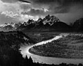
The North Fork Watershed Protection Act of 2013 (H.R. 2259) is a bill that would withdraw 430,000 acres of federal lands in Montana from programs to develop...
10 KB (1,016 words) - 05:56, 16 April 2024
step towards protection of the North Fork Flathead River". Montana Public Radio. Retrieved March 4, 2014. "North Fork Watershed Protection Act Would Protect...
12 KB (1,294 words) - 20:55, 26 June 2024

Steve Daines (category Republican Party members of the United States House of Representatives from Montana)
of the state's 56 counties. On June 5, 2013, Daines introduced the North Fork Watershed Protection Act of 2013, which would withdraw 430,000 acres of...
65 KB (5,364 words) - 21:39, 21 August 2024

John Walsh (Montana politician) (category United States Army personnel of the Iraq War)
Congress (2013–2014)". congress.gov. February 28, 2014. Retrieved June 6, 2014. Scott, Tristan (March 4, 2014). "North Fork Watershed Protection Act Passes...
43 KB (3,475 words) - 20:45, 21 September 2024

Big River (California) (redirect from North Fork Big River)
Mendocino, about 10 miles south of Fort Bragg. The Big River watershed borders the watersheds of the Noyo River to the north, the Eel and Russian rivers to...
17 KB (1,864 words) - 19:50, 16 April 2024

Potomac River (redirect from North Fork South Branch)
follows the western side of Cave Mountain through the 20-mile (32 km) long Smoke Hole Canyon, until its confluence with the North Fork at Cabins, where it...
90 KB (6,101 words) - 02:41, 25 September 2024

San Gabriel River (California) (redirect from Fish Fork)
west of the San Gabriel watershed, but did burn much of the upper West Fork. With urban development expanding toward mountain areas, the threat of property...
107 KB (13,359 words) - 03:34, 11 September 2024

Powhatan Lake Louise Left Fork Swannanoa River Little Pole Creek Long Valley Lake Newfound Creek North Fork Reservoir North Fork Swannanoa River Pole Creek...
34 KB (2,867 words) - 20:00, 31 August 2024

South Fork Catawba watershed. Eastern parts of Belmont north of the Norfolk Southern Railway belong to the Catawba Heights watershed, while those to the...
30 KB (3,318 words) - 03:51, 2 October 2024
Snake River (redirect from History of the Snake River)
Rivers (part of the Mississippi River system which drains to the Gulf of Mexico). On the north it borders the watersheds of the Clark Fork and Spokane...
153 KB (16,206 words) - 22:52, 22 September 2024

Klamath River (category Lists of coordinates)
000-square-mile (41,000 km2) watershed stretches from the high desert of south-central Oregon to the temperate rainforest of the North Coast. Unlike most rivers...
115 KB (12,307 words) - 21:50, 2 October 2024

John Day River (category Rivers of Oregon)
Species Act (ESA) protections, and the Chinook salmon have been proposed for such protection. The river was named for John Day, a member of the Pacific...
12 KB (1,087 words) - 12:14, 4 December 2023

Owyhee River (redirect from South Fork Owyhee River)
flowing north in a zigzag course west of the Idaho border. It merges with the West Little Owyhee River from the south, then receives the Middle Fork Owyhee...
20 KB (2,083 words) - 03:42, 24 August 2024

Drainage basin (redirect from Sub-watershed)
North America, they are commonly called a watershed, though in other English-speaking places, "watershed" is used only in its original sense, that of...
24 KB (2,801 words) - 09:08, 16 September 2024

Carson River (category Rivers of the Sierra Nevada in California)
Nevada in its upper watershed region. The 74-mile-long (119 km) East Fork rises on the north slopes of Sonora Peak (itself just north of Sonora Pass at about...
35 KB (3,888 words) - 12:14, 4 May 2024
Little Miami River (category Rivers of Ohio)
380 m3/s). Tributaries of the Little Miami include Beaver Creek, Sugar Creek, the East Fork Little Miami, North Fork, Todd's Fork, Duck Creek, Caesar Creek...
18 KB (1,751 words) - 20:52, 5 September 2024
cost of $155,000); (7) the construction of the flood protection project at Bassett Creek Watershed, Minnesota ($7,593,000); (8) to survey the Navajo Nation...
8 KB (1,131 words) - 18:25, 4 July 2024
of proposed projects on existing recreational facilities. Amends the Watershed Protection and Flood Protection Act to require that certain watershed projects...
42 KB (6,231 words) - 21:52, 4 July 2024

Ventura River (category Rivers of Ventura County, California)
areas in the region. However, all of the watershed major waterbodies are on the Clean Water Act Section 303(d) list of impaired waterbodies. Surface waters...
30 KB (3,095 words) - 05:57, 24 September 2024

Kuwohi (redirect from Smoky Dome (Tennessee–North Carolina))
Creek, both of which are tributaries of the Tuckasegee River, on the south slope. The mountain is located entirely within the watershed of the Tennessee...
26 KB (2,689 words) - 19:35, 24 September 2024

Noyo River (category Rivers of Mendocino County, California)
owned by the California Department of Forestry and Fire Protection, makes up about one fifth of the watershed. The rest of the land is split into smaller...
12 KB (1,163 words) - 00:04, 6 January 2023

Elkhorn Slough (category Bodies of water of Monterey County, California)
Department of Fish and Game. "California Fish and Game Code section 2853 (b)(3) Archived March 26, 2013, at the Wayback Machine". Marine Life Protection Act. Retrieved...
20 KB (1,963 words) - 20:26, 14 April 2024

Santa Clara River (California) (category Rivers of Los Angeles County, California)
portions of San Francisquito Creek and the South Fork of the Santa Clara River north of Lyons Avenue in Newhall. Two wildlife corridor protection ordinances...
42 KB (4,487 words) - 20:41, 3 September 2024

Santa Ana River (category Watersheds of California)
Lytle Creek enters from the north. Lytle Creek is one of the largest tributaries of the Santa Ana river, rising from three forks in the San Gabriel Mountains...
71 KB (7,582 words) - 07:30, 28 July 2024

Koyuk River (category Rivers of Nome Census Area, Alaska)
river"). The Seward map of 1867 gives Koipak, and later as Kayuk, Koyuk, and Kuyuk. The Kanguksuk is also known as the Left Fork of the Kviguk (Koyuk). The...
16 KB (1,602 words) - 17:59, 29 May 2023

San Joaquin River (redirect from North Fork San Joaquin River)
affluents: the Middle Fork, which rises from Thousand Island Lake at almost 10,000 ft (3,000 m) above sea level, meets the North Fork, which starts 1.8 mi...
126 KB (14,233 words) - 19:13, 22 September 2024

Columbia River (redirect from River of the West)
the north, mostly in British Columbia, the Columbia watershed borders the Fraser River watershed. To the west and southwest the Columbia watershed borders...
196 KB (18,315 words) - 03:07, 2 October 2024

Chicago River (redirect from North Branch of the Chicago River)
source of the North Branch is in the northern suburbs of Chicago where its three principal tributaries converge. The Skokie River—or East Fork—rises from...
67 KB (6,950 words) - 19:07, 9 September 2024
New River (Kanawha River tributary) (category Rivers of North Carolina)
begins in the Blue Ridge Mountains of North Carolina, and its North Fork and South Fork meet near the City of Boone, North Carolina. It flows generally northeastward...
33 KB (3,576 words) - 15:06, 26 August 2024
Permanente Creek (category Rivers of Santa Clara County, California)
the north at the base of the foothills and continues another eight miles (13 km) along the valley floor. It has two major tributaries, the West Fork Permanente...
34 KB (3,594 words) - 12:34, 17 January 2024