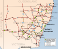
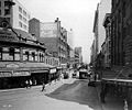
Taren Point Road is a major road found in Taren Point and Caringbah, New South Wales, Australia. Taren Point Road starts from Captain Cook Bridge, Taren...
10 KB (927 words) - 01:19, 9 September 2024
Taren Point Road and to the east towards Woolooware Bay. Taren Point was originally called Comyns Point, then Cummins Point and later Commins Point,...
5 KB (444 words) - 12:21, 18 October 2024
M6 Motorway (Sydney) (category Toll roads in Australia)
existing freeway-grade section of Taren Point Road in Taren Point, and "Section C" would connect Taren Point Road with the A1 road (Princes Highway) in Loftus...
14 KB (1,434 words) - 09:48, 20 October 2024
Captain Cook Bridge, Sydney (category Road bridges in New South Wales)
The Captain Cook Bridge is a road bridge that carries Taren Point and Rocky Point Roads across the Georges River in southern Sydney, in the state of New...
9 KB (743 words) - 21:45, 19 September 2024
services. A large commercial and industrial area is also centred on Taren Point Road and surrounding areas. Commercial developments here include many home...
8 KB (811 words) - 17:50, 14 October 2024
Princes Motorway (redirect from Mount Ousley Road)
the six-lane Captain Cook Bridge and a short connecting section of Taren Point Road to the south have been built. Establishment of the bridge section of...
33 KB (2,766 words) - 00:31, 9 September 2024
Barrenjoey Road is a main urban road along the northern coast of the Northern Beaches suburbs of Sydney, Australia. In 1978, the Barrenjoey Road area came...
10 KB (821 words) - 06:03, 13 August 2024
along its full length, while to the south is Central station. Three lanes of road traffic run in each direction. On its northern side it has a row of bus stops...
3 KB (302 words) - 06:54, 24 March 2024
Pittwater Road Princes Highway Prospect Highway Richmond Road Ryde Road Southern Cross Drive Syd Einfeld Drive Taren Point Road Victoria Road Windsor Road Wolseley...
3 KB (192 words) - 05:15, 19 October 2024
the Princes Highway officially and is allocated route A36. Like Parramatta Road, King Street is believed to follow the line of ancient Aboriginal track that...
9 KB (790 words) - 03:00, 16 January 2024
Sydney central business district to Windmill Street in Millers Point. Originally a two way road throughout, in connection with the opening of the Western Distributor...
2 KB (114 words) - 05:16, 19 October 2024
Wolseley Road is a road in the Sydney suburb of Point Piper. It is one kilometre long. It starts at New South Head Road and curves around the west side...
6 KB (471 words) - 21:44, 27 September 2023
Pittwater Road Princes Highway Prospect Highway Richmond Road Ryde Road Southern Cross Drive Syd Einfeld Drive Taren Point Road Victoria Road Windsor Road Wolseley...
3 KB (216 words) - 04:34, 19 October 2024
History The Barracks How do you repair one of Sydney’s busiest, oldest roads? In the dark of night, with 120,000 glass jars Sydney Morning Herald 13...
2 KB (167 words) - 04:38, 19 October 2024
Joseph Street, Rookwood Road,Stacey Street, Fairford Road, Davies Road, Alfords Point Road, NewIllawarra Road & Heathcote Road (Metroad 6) (Decommissioned)"...
119 KB (2,044 words) - 00:25, 3 July 2024
George Street, Sydney (category Infobox Australian road articles with an infobox mapframe map)
George Street turning westwards, leading to the western suburbs as Parramatta Road. The origins of George Street lie in the layout of the Sydney Cove colony...
20 KB (1,810 words) - 05:08, 19 October 2024
Burnt Bridge Creek Deviation (category WikiProject Australian Roads articles with a junction list using templates)
Burnt Bridge Creek Deviation is a 1.7-kilometre-long (1.1 mi) major arterial road in the Northern Beaches area of Sydney, Australia, and is a constituent part...
11 KB (1,077 words) - 16:54, 22 September 2024
Alfred Street, Sydney (category Infobox Australian road articles with an infobox mapframe map)
In February 1999, Alfred Street was closed outside Customs House with the road converted to a plaza. Until the line closed in 1957, trams terminated in...
3 KB (276 words) - 09:22, 14 October 2024
Church Presbytery Surrey Hotel Sky News Australia CBD Studio Australian Roads portal Gregory's 2002 Street Directory, 66th Edition, Maps 345,375 Anzac...
12 KB (1,019 words) - 05:07, 19 October 2024
Pittwater Road Princes Highway Prospect Highway Richmond Road Ryde Road Southern Cross Drive Syd Einfeld Drive Taren Point Road Victoria Road Windsor Road Wolseley...
3 KB (220 words) - 05:14, 19 October 2024
Cumberland Highway (category WikiProject Australian Roads articles with a junction list using templates)
Road, James Ruse Drive, Briens Road, Old Windsor Road, Hart Drive, Freame Street, Emert Street, Jersey Road, Betts Road, Warren Road, Smithfield Road...
24 KB (1,773 words) - 22:52, 23 October 2024
Pennant Hills Road is a 16.1-kilometre-long (10.0 mi) arterial road located in Sydney, New South Wales, Australia. The road links the suburb of Wahroonga...
21 KB (1,969 words) - 01:13, 9 September 2024
James Ruse Drive (category WikiProject Australian Roads articles with a junction list using templates)
interchange with Victoria Road and another interchange with Kissing Point Road and Pennant Street, where it narrows to a four-lane road, and continues in a...
19 KB (1,447 words) - 17:24, 28 September 2024
King Georges Road is a 9.0-kilometre-long (5.6 mi) major suburban arterial road through south-western Sydney, Australia. It is a constituent part of the...
12 KB (931 words) - 06:28, 13 August 2024
City West Link (redirect from City West Link Road)
City West Link is a 5.0-kilometre (3.1 mi) link road connecting Parramatta Road and the Western Distributor through the Inner West suburbs of Sydney,...
16 KB (1,387 words) - 01:04, 9 September 2024
York Street, Sydney (category Infobox Australian road articles with an infobox mapframe map)
Pittwater Road Princes Highway Prospect Highway Richmond Road Ryde Road Southern Cross Drive Syd Einfeld Drive Taren Point Road Victoria Road Windsor Road Wolseley...
7 KB (833 words) - 05:29, 19 October 2024
Captain Cook Bridge, which opened in 1965 and connects Sans Souci to Taren Point; and the Tom Uglys Bridge, which opened in 1929 and connects Blakehurst...
6 KB (361 words) - 08:08, 21 October 2024
William Street, Sydney (category Pages using infobox Australian road with a mapframe parameter)
easterly direction as a four-lane, single carriageway road, widening into a dual-carriageway road just before it enters the Kings Cross Tunnel, before...
16 KB (1,323 words) - 05:28, 19 October 2024
Anzac Parade, Sydney (category WikiProject Australian Roads articles with a junction list using templates)
Anzac Parade is a major road in the south-eastern suburbs of Sydney, Australia which travels south-east from the CBD, named in memory of members of the...
14 KB (1,138 words) - 01:23, 9 September 2024
Ryde Road is a 3.3-kilometre-long (2.1 mi) arterial road in Sydney, Australia. It is a constituent part of the A3 (Sydney) route. Ryde Road commences at...
10 KB (829 words) - 06:23, 13 August 2024


