2°57′42″W / 53.0971°N 2.9616°W / 53.0971; -2.9616 The Rofft was a historic site at Marford in the Wrexham County Borough. It was initially a pre-historic...
7 KB (790 words) - 12:45, 3 September 2022
Valley Woods and Alyn Gorge Caves Berwyn Bryn Alyn Caeau Pen-y-coed Cefn Rofft Cambrian Quarry (Chwarel Cambrian), Gwernymynydd Chwarel Pant Glas Cil-y-groeslwyd...
2 KB (143 words) - 13:18, 10 May 2024
Nags Head, Wrexham (redirect from The Nag's Head, Wrexham)
under the Soames family. The Grade II listed building was also home to a brewery, known as the Nag's Head Brewery, which started brewing by 1834. The brewery...
10 KB (938 words) - 22:55, 24 January 2024
Montgomery or Hen Domen Morganstown Castle Mound New Radnor Prestatyn Castle The Rofft Ruperra Motte St Quentins Castle Tomen Castell Twmpath Castle Wiston Castle...
7 KB (598 words) - 16:50, 11 December 2024
Butchers' Market, Wrexham (redirect from The Butcher's Market, Wrexham)
design. The windows in the side wings of the building were designed in the earlier drawing to be wider, with lower windows later replaced from the earlier...
19 KB (1,749 words) - 11:20, 29 November 2024
Marford (category The Lordship of Bromfield and Yale)
sense of "boundary". The Rofft was the site of an Iron Age hill fort and later a motte and bailey castle. Due to the history of the Rofft no physical remains...
9 KB (1,024 words) - 22:52, 31 July 2023
Queen's Square, Wrexham (category Pages using the Kartographer extension)
adjacent to the Wrexham Guildhall and Old Library. It is a main site for various events in the city, in particular outdoor markets. The Old Library and...
11 KB (895 words) - 10:18, 23 October 2024
the church yard between Bridge Street and Church Street. Included in the listing is the lych gate and churchyard walls. The church is listed on the National...
4 KB (335 words) - 07:51, 6 September 2024
General Market, Wrexham (category Pages using the Kartographer extension)
The General Market (Welsh: Y Farchnad Gyffredinol; or Marchnad Gyffredinol) is an indoor market in Wrexham city centre, North Wales. It is situated inside...
22 KB (2,082 words) - 00:51, 21 December 2024
The Glyn Valley Tramway was a narrow-gauge railway that ran through the Ceiriog Valley in north-east Wales, connecting Chirk with Glyn Ceiriog in Denbighshire...
19 KB (1,857 words) - 23:07, 25 November 2024
Croesnewydd Hall (category Pages using the Kartographer extension)
Technology Park, in the west of Wrexham, North Wales. It was built in 1696 as a small mansion, with a farmhouse, possibly to the designs of Peter Ellice...
7 KB (573 words) - 13:24, 10 September 2024
Old Library, Wrexham (category Pages using the Kartographer extension)
The Old Library (sometimes Old Carnegie Library) is a building on Queen's Square in Wrexham city centre, Wales. Built as a carnegie library in 1907, the...
11 KB (1,028 words) - 05:24, 20 November 2024
The Talbot is a former pub and hotel in Wrexham city centre, North Wales. It was built and opened by 1905 replacing an older inn also known as The Talbot...
8 KB (655 words) - 07:15, 21 December 2024
Grosvenor Lodge, Wrexham (category Pages using the Kartographer extension)
of the suburban development in the southern parts of Wrexham in the 19th century. Shone lost his council seat in 1879 and thereafter vacated the residence...
6 KB (588 words) - 22:17, 10 June 2024
Elephant and Castle, Wrexham (category Pages using the Kartographer extension)
The pub is named after the area of London with the same name. The pub was dependent on the trading occurring in the adjacent Beast Market. Behind the...
9 KB (872 words) - 15:49, 26 August 2024
Presbyterian Chapel, Rossett (category Pages using the Kartographer extension)
The Presbyterian Chapel, Rossett, is on Station Road, in Rossett, Wrexham County Borough, Wales. It continues to be active as a Welsh Presbyterian church...
2 KB (119 words) - 22:04, 8 July 2024
Gresford Methodist Church (category Pages using the Kartographer extension)
cresting, the height from the floor line to the wall plate being 12 feet and to the apex of the roof 28 feet 6 inches". The ceremony to lay the foundation...
9 KB (1,142 words) - 19:01, 5 August 2023
Wrexham Library (category Pages using the Kartographer extension)
Wrecsam) is the main public library of Wrexham, Wales. Located in the city centre, adjacent to Llwyn Isaf, it opened in 1972, superseding the old carnegie...
17 KB (1,577 words) - 23:02, 22 November 2024
Guildhall, Wrexham (category Pages using the Kartographer extension)
The house later became known as Llwyn Isaf, whose name survives as the name of the field in front of the Guildhall. The house was purchased by the council...
10 KB (897 words) - 11:43, 9 November 2024
Halghton Hall (category Houses completed in the 17th century)
from the Middle Ages. To the north of the present hall is the site of a Medieval moated manor house, although nothing but the platform and the moat now...
5 KB (460 words) - 16:08, 2 September 2024
Central Arcade, Wrexham (category Pages using the Kartographer extension)
The Central Arcade, historically known as the Hope Street Arcade or Wrexham Arcade, is a shopping arcade in Wrexham city centre, Wales. Connecting Wrexham's...
10 KB (962 words) - 23:04, 20 December 2024
coordinates) GPX (primary coordinates) GPX (secondary coordinates) In the United Kingdom, the term listed building refers to a building or other structure officially...
11 KB (611 words) - 19:55, 21 May 2024
Grove Park School, Wrexham (category Pages using the Kartographer extension)
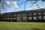
The Grove Park School (or simply the Groves School) is a former school building in Wrexham, North Wales, which was home to a school between 1939 and 2003...
21 KB (2,149 words) - 22:54, 22 November 2024
Feathers Hotel, Wrexham (redirect from The Plume of Feathers)
The Feathers Hotel is a former pub and coaching inn in Wrexham city centre, North Wales. First known as The Plume of Feathers, the building was popular...
8 KB (680 words) - 15:56, 26 August 2024
coordinates) GPX (primary coordinates) GPX (secondary coordinates) In the United Kingdom, the term listed building refers to a building or other structure officially...
6 KB (397 words) - 02:00, 24 March 2024
School of Creative Arts, Wrexham (redirect from The Infirmary, Wrexham)
centre double doors. The institution of the Wrexham Infirmary preceded the construction of the building. The Wrexham Dispensary (later the Wrexham Infirmary)...
17 KB (1,502 words) - 00:13, 11 November 2024
coordinates) GPX (primary coordinates) GPX (secondary coordinates) In the United Kingdom, the term listed building refers to a building or other structure officially...
27 KB (1,501 words) - 01:58, 24 March 2024
coordinates) GPX (primary coordinates) GPX (secondary coordinates) In the United Kingdom, the term listed building refers to a building or other structure officially...
29 KB (1,486 words) - 22:18, 12 June 2024
Turf Hotel (category Pages using the Kartographer extension)
The Turf Hotel, also known as The Turf, is a public house in Wrexham, Wales, located on the corner of Wrexham A.F.C.'s Racecourse Ground, it has been...
5 KB (514 words) - 14:44, 6 December 2024
Abbotsfield, Wrexham (redirect from The Lemon Tree, Wrexham)
into the Abbotsfield Priory Hotel in the 1970s, later adding a restaurant and bar. The building is now The Lemon Tree restaurant, bar and hotel. The building...
8 KB (645 words) - 13:46, 14 October 2024


