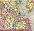
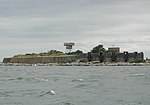
Willoughby Spit is a peninsula of land in the independent city of Norfolk, Virginia in the United States. It is bordered by water on three sides: the...
7 KB (860 words) - 01:00, 23 July 2024
several places called Willoughby Bay. These include: Willoughby Bay, adjacent to Willoughby Spit, Virginia, United States Willoughby Bay (Antigua) This disambiguation...
187 bytes (53 words) - 20:51, 30 December 2019
unincorporated community Willoughby Park, Friendship Heights, Washington, D.C. Willoughby Run, a waterway in Adams County, Pennsylvania Willoughby Spit, a peninsula...
3 KB (440 words) - 22:29, 2 November 2023
West Ocean View Avenue (U.S. Route 60) near Fourth View Street in the Willoughby Spit area. The Route 168 designation formerly continued northwesterly along...
21 KB (1,436 words) - 02:21, 7 June 2024
independent city of Hampton near Fort Monroe on the Virginia Peninsula with Willoughby Spit in the city of Norfolk in South Hampton Roads and is part of the Hampton...
19 KB (1,926 words) - 03:16, 12 July 2024
Elizabeth River. In 1923, the city expanded to include Sewell's Point, Willoughby Spit, the town of Campostella, and the Ocean View area. The city included...
144 KB (13,787 words) - 21:41, 19 October 2024
miles of shoreline on the Chesapeake Bay to the north, starting with Willoughby Spit to the west and the Joint Expeditionary Base -- Little Creek in the...
10 KB (1,270 words) - 07:35, 20 September 2024
incorporated town of Berkley as well as the areas of Sewell's Point, Willoughby Spit, and Ocean View were annexed successively by Norfolk. By 1960, the...
9 KB (772 words) - 16:57, 30 October 2024
Willoughby may refer to: Willoughby, Albemarle County, Virginia, an unincorporated community Willoughby Spit, a neighborhood in Norfolk This disambiguation...
162 bytes (51 words) - 20:52, 30 December 2019
Spit Sazalniksk Spit Yasensk Spit Yeysk Spit Ukraine Belosaraysk Spit Berdyansk Spit Fedotova Spit Krivaya Spit Obytichna Spit Arabat Spit Tuzla Spit...
5 KB (429 words) - 23:26, 8 October 2024
and sits near Old Point Comfort, Old Point Comfort Light, Willoughby Beach and Willoughby Spit, approximately one mile south of Fort Monroe. Originally...
20 KB (2,183 words) - 18:24, 23 September 2024
6 m) above normal, sand spit was washed up at Sewells Point. With the help of the Great Coastal Hurricane of 1806, Willoughby Spit was formed. The area of...
32 KB (4,410 words) - 20:05, 8 October 2023
Heights Wards Corner Business District West Freemason West Ocean View Willoughby Spit Young Terrace Historic Districts in Norfolk Many of Norfolk's neighborhoods...
3 KB (189 words) - 06:44, 22 February 2024
lightship was established at Hampton Roads. It was first placed at Willoughby Spit, on the south side of the harbor. The weather conditions proved to...
10 KB (1,012 words) - 17:07, 24 June 2024
States government. The first US lightship was put in place off of Willoughby Spit in Chesapeake Bay, Virginia, in 1820. Lightships remained in service...
52 KB (1,773 words) - 17:04, 9 February 2024
Between the tip of the Virginia Peninsula near Old Point Comfort and the Willoughby Spit area of Norfolk in South Hampton Roads, a channel leads from Hampton...
25 KB (2,617 words) - 15:54, 28 September 2024
Fort Monroe. At this point, Lincoln directed the invasion to be on Willoughby Spit, away from the Confederate batteries, the next day. On the morning...
45 KB (5,677 words) - 21:39, 19 October 2024
the Chesapeake Bay and Hampton Roads, directly across from Norfolk's Willoughby Spit. Mill Creek was located in Elizabeth Cittie [sic], one of four corporations...
10 KB (1,147 words) - 18:47, 22 October 2024
are the Hampton Roads Bridge–Tunnel between Phoebus in Hampton and Willoughby Spit in Norfolk and the Monitor–Merrimac Memorial Bridge–Tunnel between...
130 KB (13,457 words) - 01:36, 10 November 2024
automobile-ferry service from Old Point Comfort across Hampton Roads to Willoughby Spit was replaced on November 1, 1957 by the new Hampton Roads Bridge-Tunnel...
14 KB (2,078 words) - 18:05, 30 April 2024
Beach, and Fort Monroe, before crossing Hampton Roads and passing over Willoughby Spit en-route to the Norfolk Navy Base. The crash of the Roma was caused...
11 KB (1,136 words) - 07:17, 7 September 2024
Virginia at Kitty Hawk, North Carolina. Other early flights took place at Willoughby Spit near Norfolk. In modern times, major commercial airports are located...
33 KB (3,474 words) - 22:27, 14 September 2024
cruiser USS Birmingham at Hampton Roads, Virginia and landed nearby on Willoughby Spit after some five minutes in the air. On 18 January 1911, he became the...
60 KB (7,232 words) - 23:58, 3 November 2024
Route 337 Battle of Hampton Roads Jamestown Exposition Sewell's Point Willoughby Spit Ocean View Lambert's Point Bower's Hill Craney Island Military Highway...
10 KB (1,112 words) - 19:56, 16 September 2024
Roads to Norfolk 1957 36°59′14″N 76°18′20″W Replaced ferries from Willoughby Spit to Old Point Comfort and Pine Beach to Small Boat Harbor Monitor-Merrimac...
10 KB (62 words) - 23:02, 19 September 2024
Park Manor VA 10.0 inches (25 cm) Stone Bridge VA 10.0 inches (25 cm) Willoughby Spit VA 9.0 inches (23 cm) Gliden NC 7.3 inches (19 cm) Pleasantville NJ...
20 KB (2,158 words) - 04:28, 31 October 2024
to Spit Junction 53: Chatswood to Milson Point wharf 95: Gladesville to Spit Junction 144: Manly to Spit Junction 149: Manly to Newport 214: Spit Junction...
3 KB (238 words) - 03:45, 21 November 2020
Bridge–Tunnel City of Norfolk 272.54 438.61 70 272 W. Ocean View Avenue – Willoughby Spit 274.28 441.41 71 273 US 60 east (4th View Street) – Ocean View East...
63 KB (4,031 words) - 08:05, 11 September 2024
number of low-lying and flood prone neighborhoods were inundated, while Willoughby Spit became impassable. Cars parked at Hague Tower apartments were submerged...
71 KB (6,970 words) - 05:14, 22 October 2024
hurricane produced a huge tidal surge of 15 feet. Responsible for creating Willoughby Spit, a small area of land near Norfolk that was inside the Chesapeake Bay...
110 KB (5,096 words) - 12:30, 30 June 2024


