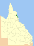
Woopen Creek is a rural locality in the Cairns Region, Queensland, Australia. In the 2021 census, Woopen Creek had a population of 135 people. The Russell...
9 KB (757 words) - 04:47, 31 May 2024
locality split between the Cairns Region and the Cassowary Coast Region, Queensland, Australia. In the 2021 census, Eubenangee had a population of 247 people...
6 KB (520 words) - 22:05, 25 May 2024
Waugh Pocket (redirect from Waugh Pocket, Queensland)
Waugh Pocket is a locality in the Cairns Region, Queensland, Australia. In the 2021 census, Waugh Pocket had a population of 46 people. Waugh Pocket is...
7 KB (442 words) - 03:04, 31 May 2024
State School (site))). About 1951, the school building was relocated to Woopen Creek State School. In 1958, Dr Allan Maruff started the first commercial tea...
9 KB (659 words) - 04:35, 29 May 2024
Ngatjan (redirect from Ngatjan, Queensland)
Place Names. Queensland Government. Retrieved 29 December 2017. "Queensland Globe". State of Queensland. Retrieved 22 April 2018. "Waraker Creek – watercourse...
5 KB (403 words) - 04:44, 29 May 2024
(secondary coordinates) This is a list of schools in the Far North Queensland region of Queensland, Australia. The region's largest population centre is Cairns...
124 KB (3,479 words) - 07:25, 16 November 2024
Russell River (redirect from Russell River, Queensland)
The Russell River is a river in Far North Queensland, Australia. The 59-kilometre (37 mi)-long river flows towards the Coral Sea and is located approximately...
6 KB (379 words) - 13:46, 13 May 2022
Bartle Frere is a rural locality in the Cairns Region, Queensland, Australia. In the 2021 census, Bartle Frere had a population of 169 people. The locality...
7 KB (536 words) - 04:18, 19 May 2024
Cairns Region (category Articles incorporating text from the State Library of Queensland)
The Cairns Region is a local government area in Far North Queensland, Queensland, Australia, centred on the regional city of Cairns. It was established...
25 KB (1,153 words) - 08:09, 21 June 2024
Falls, Bellenden Ker, Babinda, Mirriwinni (to the east), Bartle Frere, Woopen Creek, Ngatjan, Nerada, East Palmerston, Palmerston (to the south), Middlebrook...
17 KB (2,132 words) - 13:24, 15 June 2024
government area surrounding the City of Cairns in the Far North region of Queensland. The shire, administered from Cairns, covered an area of 1,718.3 square...
13 KB (825 words) - 11:20, 23 August 2024
City of Cairns (category Cairns, Queensland)
The City of Cairns was a local government area centred on the Far North Queensland city of Cairns. Established in 1885, for most of its existence it consisted...
11 KB (769 words) - 17:58, 20 August 2024
passage. Although only inconsequential residential damage occurred at Woopen Creek and Yungaburra, damage at Tully was more serious, with considerable flooding...
33 KB (3,708 words) - 08:12, 31 August 2024


