
The Angeles Forest Highway is a 25-mile (40 km) road over the San Gabriel Mountains in Los Angeles County, California. It connects the Los Angeles Basin...
11 KB (1,398 words) - 09:44, 22 May 2024

The Angeles Crest Highway is a two-lane (one lane of travel in each direction) highway over the San Gabriel Mountains, in Los Angeles County, California...
16 KB (1,701 words) - 01:24, 24 November 2023

The Angeles National Forest (ANF) of the U.S. Forest Service is located in the San Gabriel Mountains and Sierra Pelona Mountains, primarily within Los...
40 KB (3,782 words) - 02:26, 19 March 2024
Philippines Angeles National Forest, a national forest on the outskirts of Los Angeles Angeles Forest Highway, a road in said forest Angeles River, Puerto...
1 KB (164 words) - 12:10, 5 April 2024

California State Route 14 (redirect from California State Highway 14)
north–south state highway in the U.S. state of California that connects Los Angeles to the northern Mojave Desert. The southern portion of the highway is signed...
37 KB (3,395 words) - 01:12, 21 November 2023

San Gabriel Mountains (category Angeles National Forest)
Big Pines Highway to the Route 138 junction. Another key county route through, the mountains is Angeles Forest Highway. Angeles Forest Highway begins 11...
29 KB (3,411 words) - 08:59, 26 May 2024

Southern California freeways (redirect from Freeway system of Los Angeles)
SR 2 north of La Cañada Flintridge with SR 14 south of Palmdale. Angeles Forest Highway (CR N3) follows the general alignment, but Caltrans has no plans...
42 KB (4,119 words) - 06:46, 20 June 2024

Angeles County between La Cañada Flintridge and Wrightwood Angeles Forest Highway Tunnel/Singing Springs Tunnel/Hidden Springs Tunnel, Angeles Forest...
19 KB (1,723 words) - 21:27, 15 June 2024

Angeles. Sunland-Tujunga is also served by the Interstate 210 freeway. Big Tujunga Canyon Road connects Sunland-Tujunga to the Angeles Forest Highway...
72 KB (8,225 words) - 17:09, 9 June 2024
California State Route 2 (redirect from California State Highway 2)
to SR 138 is designated as the Angeles Crest Highway. SR 2 is known as the Angeles Crest Scenic Byway, a National Forest Scenic Byway, from SR 2's east...
35 KB (3,398 words) - 05:21, 26 February 2024
Mill Creek Summit (category Transportation in Los Angeles County, California)
500 m), is a mountain pass in northern Los Angeles County, California. It is located along the Angeles Forest Highway that ascends south into the San Gabriel...
2 KB (116 words) - 23:35, 9 May 2024

Vincent, California (category Census-designated places in Los Angeles County, California)
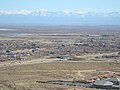
also within Los Angeles County, that is located at the summit of Soledad Pass near the junction of SR 14 and Angeles Forest Highway. Vincent is located...
10 KB (1,023 words) - 05:53, 25 April 2024
sequences were filmed on the Sierra Highway, Agua Dulce Canyon Road, Soledad Canyon Road, and Angeles Forest Highway. Spielberg insisted on shooting outside...
53 KB (6,465 words) - 11:56, 11 July 2024
county routes are typically referred to by their street name (e.g. Angeles Forest Highway or Kanan Dume Road) rather than their route designation. These routes...
50 KB (444 words) - 00:29, 25 April 2024

Ridge Route (redirect from Ridge Alternate Highway)
Angeles National Forest about one mile (1.6 km) south of Templin Highway, with the Forest Service road designation 8N04. Establishments in the forest...
34 KB (4,021 words) - 16:51, 5 April 2024
listed by the Federal Highway Administration as National Forest Scenic Byways as of August 2013: U.S. Roads portal United States Forest Service (n.d.). "Tour...
25 KB (430 words) - 17:51, 8 July 2024

California's 30th congressional district (category Government of Los Angeles County, California)
30th and 27th are partitioned by Angeles National Forest, B P and L Rd, Mt Emma Rd, BPL Rd, Angeles Forest Highway, NF-3N17, Moody Canyon, NF-4N53, Soledad...
62 KB (982 words) - 19:52, 7 March 2024

California State Route 39 (redirect from California State Highway 39)
SR 39's northern terminus is at Islip Saddle on Angeles Crest Highway (SR 2) in the Angeles National Forest, but its northernmost 4.5-mile (7.2 km) segment...
28 KB (2,538 words) - 12:18, 4 May 2024

California county routes in zone N (redirect from Los Angeles County Route N8)
entire route is in Los Angeles County. County Route N3 (CR N3), known as the Angeles Forest Highway, is a county highway in Los Angeles County, California...
22 KB (1,206 words) - 15:53, 22 October 2023

U.S. Route 101 (redirect from US Highway 101)
as a primary route. The highway's southern terminus is at a major interchange with Interstate 5 (I-5) and I-10 in Los Angeles. US 101 follows several...
123 KB (10,942 words) - 21:00, 30 June 2024
Nikki Catsouras photographs controversy (redirect from Catsouras v. Department of the California Highway Patrol)
battle, Los Angeles Times May 15, 2010. (accessed July 17, 2011) Frank, Ted (May 10, 2010). "Catsouras v. Department of California Highway Patrol". Point...
10 KB (1,309 words) - 16:11, 3 July 2024

California State Route 118 (redirect from California State Highway 118)
Route 118 (SR 118) is a state highway in the U.S. state of California that runs west to east through Ventura and Los Angeles counties. It travels from State...
18 KB (1,555 words) - 02:31, 8 June 2024

This is a list of state highways in the U.S. state of California that have existed since the 1964 renumbering. It includes routes that were defined by...
106 KB (856 words) - 02:21, 22 May 2024
trail formed in the 19th century, rebuilt as highways in the early 20th century, that ran from Los Angeles to Lake Tahoe following parts of modern State...
24 KB (1,974 words) - 07:37, 27 September 2023
unincorporated communities share Sierra Highway, Angeles Forest Highway, Angeles Crest Highway (State Route 2), and the Antelope Valley Freeway (State...
14 KB (1,558 words) - 05:00, 2 March 2024
Highway to Heaven is an American fantasy drama television series that ran on NBC from September 19, 1984, to August 4, 1989. The series starred its creator...
28 KB (2,913 words) - 21:23, 25 May 2024

Gabriel Mountains National Monument and Angeles National Forest. It is located south of the Pearblossom Highway (CA Route 138), near the towns of Littlerock...
9 KB (957 words) - 22:17, 21 December 2023
Scenic Highway System; however, only a few stretches between Los Angeles and San Francisco have officially been designated as a scenic highway, meaning...
136 KB (9,232 words) - 07:44, 3 July 2024
Gavin Smith (film studio executive) (category People from West Hills, Los Angeles)
close." On May 8, a male body was found in the Angeles National Forest near the Angeles Crest Highway above La Cañada Flintridge, but it was not Smith's...
37 KB (4,121 words) - 19:38, 3 July 2024
Springs. The Mill Creek valley provides a major part of the route of Angeles Forest Highway (County Road N3). Mill Creek Summit, 4,910 feet (1,500 m), is the...
3 KB (175 words) - 07:40, 10 August 2020