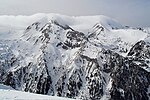
The Banderitsa (Bulgarian: Бъндерица) is a river in south-western Bulgaria, a left tributary of the Glazne, which flows into the Iztok, itself a right...
4 KB (320 words) - 19:14, 9 November 2024
discoverer, forest ranger Kostadin Baikushev, and is located near the Banderitsa refuge. With an approximate age of about 1,300 years, Baikushev's pine...
2 KB (156 words) - 15:22, 29 October 2024
itself divided into two zones by the Kabata Saddle and the valleys of the Banderitsa and Vlahinska rivers. The northern zone consists of the steep marble Vihren...
50 KB (5,493 words) - 08:51, 29 October 2024
mountain range. The river takes its source from the confluence of the rivers Banderitsa (13 km, left) and Demyanitsa (13.6 km, right) at an altitude of 1,063 m...
4 KB (323 words) - 23:17, 1 November 2024
southwestern Bulgaria. They are situated in the Banderitsa valley and mark the beginning of the Banderitsa river. There are 17 lakes in all but only 5 have...
3 KB (435 words) - 21:03, 1 November 2024
nation's total. The highest diversity is found in the valleys of the rivers Banderitsa and Damyanitsa. The Plecoptera are represented by 40 species, forming...
42 KB (4,447 words) - 06:30, 29 October 2024
valleys of the rivers Vlahina reka of the Struma drainage to the west and Banderitsa of the Mesta drainage to the east. Seen from the town of Bansko, situated...
12 KB (1,130 words) - 09:13, 29 October 2024
(L) Mesta (Ms) Cherna Mesta (L) Byala Mesta (R) Iztok (R) Glazne (R) Banderitsa (L) Demyanitsa (R) Disilitsa (R) Retizhe (R) Kanina (L) Vishteritsa (R)...
15 KB (1,312 words) - 14:35, 12 November 2024
summit in Pirin. Banderishki Chukar is situated at the bottom on the Banderitsa valley. It forms the southernmost point of this part of the main ridge...
3 KB (252 words) - 12:16, 2 November 2024
furrowed with deep gullies that reach all the way to the bed of the river Banderitsa. To the northeast towards Kabata, the slopes are heavily eroded, in places...
3 KB (275 words) - 17:10, 1 November 2024
Bansko at an altitude of 1,063 m, the Demyanitsa merges with the river Banderitsa, forming the river Glazne. Its drainage basin covers a territory of 37 km2...
4 KB (347 words) - 09:06, 2 November 2024
route between the Vihren refuge and Demyanitsa refuge. To the west is the Banderitsa valley which makes a peculiar twist following the twist of the Todorka...
5 KB (507 words) - 19:20, 21 October 2024


