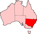
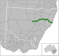
Bruxner Highway, and its former western alignment as Bruxner Way, are a 420-kilometre (260 mi) state highway and rural road respectively, located in New...
17 KB (1,321 words) - 06:21, 13 August 2024
Bruxner Highway, state highway in New South Wales, Australia Berlyn Brixner (1911–2009), photographer This page lists people with the surname Bruxner...
358 bytes (79 words) - 01:48, 10 December 2021
(North to South): Bruxner Highway Big River Way Oxley Highway New England Highway Hunter Expressway Newcastle Link Road Central Coast Highway Mona Vale Road/Ryde...
11 KB (667 words) - 10:04, 22 August 2023
eastern suburb of Lismore, New South Wales, Australia, and is on the Bruxner Highway. At the 2006 census, Goonellabah had a population of 12,527 people...
1 KB (155 words) - 12:08, 27 December 2021
and tighter curves than on the rest of the highway. The Newell intersects the following highways: Bruxner (at Boggabilla), Carnarvon and Gwydir (at Moree)...
30 KB (2,352 words) - 23:07, 7 November 2024
surrounding area with a range of services. The city is also located on the Bruxner Highway which crosses the Wilsons River at Lismore, and was formerly a stop...
57 KB (5,996 words) - 05:48, 23 October 2024
inline-six petrol engine primarily used in the Daimler Ferret armoured car Bruxner Highway has route number B60 between Ballina and Tenterfield in New South Wales...
632 bytes (121 words) - 20:40, 7 December 2021
Summerland Way (category Highways in Australia)
with Great Northern Highway near Woodenbong, via Kyogle to the intersection with Tenterfield-Lismore Road (today Bruxner Highway) at Casino, and Main...
24 KB (2,104 words) - 12:38, 18 August 2024
March 1938, from the intersection with Tenterfield-Yetman Road (later Bruxner Highway) just north of Tenterfield to the state border with Queensland at Wallangarra;...
41 KB (2,871 words) - 23:58, 1 November 2024
Pacific Motorway. South of here, the section between Brunswick Heads and Bruxner Highway near Ballina is also signposted Pacific Motorway, however it is not...
138 KB (8,660 words) - 04:08, 14 September 2024
of the region known as the Northern Rivers. Alstonville is on the Bruxner Highway between the town of Ballina (13 km to the east) and city of Lismore...
12 KB (1,322 words) - 12:53, 8 August 2024
kilometres (350 mi) north of Sydney and can be located via Kyogle via the Bruxner Highway and the Summerland Way. The park is part of the Focal Peak Group World...
5 KB (226 words) - 23:07, 25 December 2023
kilometres (394 mi) north of Sydney and can be located via Kyogle via the Bruxner Highway and the Summerland Way. The average elevation of the terrain is 746...
5 KB (267 words) - 23:07, 25 December 2023
The present highway network in New South Wales, Australia was established in August 1928 when the Main Roads Board (the predecessor of the Department...
9 KB (366 words) - 05:39, 12 August 2024
Bonshaw is located in Inverell Shire and Arrawatta County. It is on the Bruxner Highway between Tenterfield and Goondiwindi. It is a village designed to serve...
2 KB (143 words) - 22:27, 12 August 2021
banks of the Richmond River and is situated at the junction of the Bruxner Highway and the Summerland Way. It is located 726 km (451 mi) north of Sydney...
18 KB (1,425 words) - 12:12, 14 October 2024
Kings Highway is an interstate highway located within the Australian Capital Territory and New South Wales, Australia. The highway connects Canberra with...
19 KB (1,680 words) - 05:47, 12 September 2024
Sturt Highway is an Australian national highway in New South Wales, Victoria, and South Australia. It is an important road link for the transport of passengers...
38 KB (3,120 words) - 06:39, 13 August 2024
of Goondiwindi, the Cunningham Highway links to the Newell, Leichhardt, and Barwon highways, with the Bruxner Highway nearby. From northeast to southwest...
20 KB (1,363 words) - 22:27, 27 January 2024
605 kilometres (376 mi) north of Sydney. It is located north of the Bruxner Highway in the southern portion of the Richmond Range mountains, part of the...
3 KB (150 words) - 05:31, 7 December 2021
The following highways are numbered 60: AH60 Asian Highway 60 E60 European route E60 Bruxner Highway Dawson Highway (Rolleston to Gladstone) – Queensland...
6 KB (447 words) - 16:10, 27 August 2024
Kamilaroi Highway is a 605-kilometre (376 mi) state highway located in the north-western region of New South Wales, Australia, and links Bourke via Walgett...
17 KB (1,407 words) - 06:37, 13 August 2024
The Old Hume Highway, an urban and rural road, may be described as any part of an earlier route of the Hume Highway, which traverses Victoria and New South...
12 KB (1,107 words) - 14:15, 29 August 2024
Monaro Highway is a 285-kilometre-long (177 mi) highway in Victoria, New South Wales, and the Australian Capital Territory, in Australia, linking Cann...
49 KB (4,378 words) - 06:03, 19 October 2024
Gwydir Highway is a 568-kilometre (353 mi) state highway in northern New South Wales, Australia. The highway was named after the Gwydir River, which in...
14 KB (913 words) - 09:46, 20 October 2024
kilometres (392 mi) north of Sydney and can be located via Kyogle via the Bruxner Highway and the Summerland Way. The park's north-eastern limits define the...
5 KB (236 words) - 23:07, 25 December 2023
Oxley Highway is a rural highway in New South Wales, Australia, linking Nevertire, Gilgandra, Coonabarabran, Tamworth, and Walcha to Port Macquarie, on...
16 KB (1,281 words) - 06:02, 13 August 2024
Rivers region of New South Wales, Australia. The town is located on the Bruxner Highway between the towns of Lismore and Alstonville. Wollongbar Public School...
3 KB (174 words) - 21:46, 22 January 2024
Olympic Highway is a 317-kilometre (197 mi) rural road in the central western and south-eastern Riverina regions of New South Wales, Australia. It services...
19 KB (1,510 words) - 14:30, 22 June 2024
area. The area under management is located adjacent to the Bruxner Highway, Pacific Highway, and the North Coast railway line. It is a rural area for the...
15 KB (997 words) - 04:56, 23 September 2024


