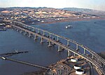
The Carquinez Bridge is a pair of parallel bridges spanning the Carquinez Strait at the northeastern end of San Francisco Bay. They form the part of Interstate...
25 KB (2,680 words) - 09:58, 16 November 2024
The Carquinez Strait (/kɑːrˈkiːnəs/; Spanish: Estrecho de Carquinez) is a narrow tidal strait located in the Bay Area of Northern California, United States...
12 KB (1,301 words) - 08:09, 25 October 2024
The Benicia–Martinez Bridge refers to three parallel bridges which cross the Carquinez Strait just west of Suisun Bay in California; the spans link Benicia...
23 KB (1,914 words) - 09:32, 16 November 2024
FasTrak (section Toll bridges)
"Antioch Bridge". Bay Area FasTrak. Retrieved October 25, 2020. "Benicia–Martinez Bridge". Bay Area FasTrak. Retrieved October 25, 2020. "Carquinez Bridge"....
63 KB (4,834 words) - 20:00, 2 September 2024
(link) "Carquinez Bridge". Mtc.ca.gov - Metropolitan Transportation Commission. 11 May 2021. Retrieved May 21, 2023. "Third Carquinez Strait Bridge". Opacengineers...
111 KB (5,118 words) - 23:20, 15 October 2024
American Toll Bridge Company (Aven Hanford and Oscar Klatt), who went on to build the original span of the Carquinez Bridge. The bridge was opened on...
23 KB (2,197 words) - 02:00, 12 May 2024
Francisco across the San Francisco–Oakland Bay Bridge to Oakland, where it turns north and crosses the Carquinez Bridge before turning back northeast through the...
70 KB (4,692 words) - 04:56, 22 November 2024
Francisco and Sacramento, and is the location for the northern half of the Carquinez Bridge. It is also accessible by Interstate 780 from neighboring Benicia to...
58 KB (4,673 words) - 19:04, 14 November 2024
Crockett, California (category Carquinez Strait)
all of it land. Crockett is located where the Carquinez Strait meets San Pablo Bay. The Carquinez Bridge, part of Interstate 80, links Crockett with the...
24 KB (2,187 words) - 06:51, 18 October 2024
– the Carquinez Bridge in May 1927, the San Francisco–Oakland Bay Bridge in 1936, the Golden Gate Bridge in 1937, the Richmond–San Rafael Bridge in 1956...
59 KB (6,000 words) - 13:43, 1 November 2024
all-land connection between the Bay Area and Sacramento until the Carquinez Bridge opened in 1927 and carried the Lincoln Highway and later US Route 50...
20 KB (1,979 words) - 07:54, 15 September 2024
Vallejo to I-680 just north of the Benicia–Martinez Bridge in Benicia. It closely parallels the Carquinez Strait for its entire route. Originally, this segment...
14 KB (1,593 words) - 06:44, 22 August 2023
Alexandra Bridge Astoria–Megler Bridge Battersea Bridge Bolte Bridge Bridge of the Gods (modern structure) Carquinez Bridge Champlain Bridge Commodore...
2 KB (190 words) - 04:12, 12 September 2024
of the highest bridges in the United States by height over land or water. Height in this list refers to the distance from the bridge deck to the lowest...
37 KB (1,170 words) - 21:16, 3 August 2024
Napa Valley, and less than 15 miles (24 km) from both the Carquinez Bridge and the Benicia Bridge. The use of "Green Valley" as a place name predates the...
12 KB (1,086 words) - 11:38, 10 October 2024
after having served in that role for the recently completed Carquinez Bridge. The Long bridge would have spanned San Pablo Bay between Point Orient (in...
69 KB (7,248 words) - 16:58, 23 October 2024
by the Golden Gate Bridge and to the East Bay by the Richmond–San Rafael Bridge, Carquinez Bridge and the Benicia–Martinez Bridge. Several ferry routes...
5 KB (529 words) - 01:01, 21 November 2024
toll bridges: Golden Gate Bridge, Carquinez Bridge, Benicia-Martinez Bridge, Dumbarton Bridge, the Richmond-San Rafael Bridge, and the Bay Bridge. In the...
7 KB (761 words) - 17:51, 4 January 2024
Area Toll Bridges. Benicia–Martinez Bridge Seismic Retrofit. Retrieved September 20, 2009. Caltrans. Bay Area Toll Bridges. Carquinez Bridge Seismic Retrofit...
86 KB (9,732 words) - 01:54, 24 November 2024
Francisco–Oakland Bay Bridge. On September 16, 1940, the Authority purchased two private toll bridges, the Carquinez Bridge and the Antioch Bridge. On December...
4 KB (452 words) - 07:11, 16 November 2024
list of cantilever bridges ranks the world's cantilever bridges by the length of their main span. A cantilever bridge is a bridge built using cantilevers:...
12 KB (153 words) - 21:27, 23 November 2024
Bridge Opening, June 17, 1926 California Department of Transportation, Toll Bridge Home > Bridges, accessed December 2007 Oakland Tribune, Carquinez Bridge...
30 KB (3,535 words) - 10:04, 19 August 2024
first Carquinez Bridge, designed by David B. Steinman and completed in 1927 (demolished 2007). Studies for the replacement of the Smith River Bridge began...
12 KB (1,024 words) - 19:16, 22 April 2024
near I-80, and, after a discontinuity bridged by Parker Avenue in Rodeo, the road approaches the Carquinez Bridge and arrives in Crockett as Pomona Street...
11 KB (1,317 words) - 06:26, 6 February 2024
Washington Sydney Harbour Bridge, Australia 660 Fifth Avenue, New York Robert F. Kennedy Bridge (Triborough Bridge), New York Carquinez Bridge, San Francisco Bay...
15 KB (1,354 words) - 23:18, 9 February 2024
photography project on the demolition of the 1927 Carquinez Bridge. A book on that project, titled Carquinez Bridge: 1927-2007, was published in November 2016...
9 KB (1,099 words) - 23:37, 14 April 2024
Vallejo Admirals Vallejo Chiefs Transportation Vallejo Transit Center Carquinez Bridge Interstate 80 Interstate 780 Route 37 Route 29 U.S. Route 40 People...
5 KB (432 words) - 02:50, 9 November 2024
San Francisco. The Napa River forms its eastern side as it enters the Carquinez Strait juncture with the east side of San Pablo Bay. Mare Island is a...
22 KB (2,424 words) - 18:42, 17 June 2024
from all tolls levied on the seven state-owned toll bridges: Antioch, Benicia-Martinez, Carquinez, Dumbarton, Richmond – San Rafael, San Francisco – Oakland...
11 KB (1,046 words) - 09:42, 13 August 2024
Transportation in the San Francisco Bay Area (redirect from San Francisco bridge)
complex multimodal transportation infrastructure consisting of roads, bridges, highways, rail, tunnels, airports, seaports, and bike and pedestrian paths...
69 KB (3,962 words) - 19:36, 15 October 2024


