
State Route 60 (SR 60) is a 90.1-mile-long (145.0 km) state highway that travels southeast-to-northwest through portions of Jackson, Hall, Lumpkin, Union...
29 KB (3,085 words) - 14:03, 4 October 2023

This is a list of former state routes in the U.S. state of Georgia. This list represents routes that traveled through the state but are no longer in operation...
142 KB (14,613 words) - 12:19, 25 October 2023
Georgia State Route 60 is a state highway from east of Braselton to the Tennessee state line in McCaysville Georgia State Route 60 could also refer to:...
502 bytes (100 words) - 02:06, 6 July 2017
This is a list of former state routes in the U.S. state of Georgia. This list represents routes that traveled through the state but are no longer in operation...
131 KB (11,496 words) - 22:52, 6 February 2024
This is a list of former state routes in the U.S. state of Georgia. This list represents routes that traveled through the state but are no longer in operation...
82 KB (7,572 words) - 13:34, 7 February 2024

State Route 11 (SR 11) is a 376-mile-long (605 km) state highway in the U.S. state of Georgia, traveling through portions of Echols, Lanier, Berrien,...
78 KB (6,739 words) - 13:54, 8 February 2024

State Route 15 (SR 15) is a 346-mile-long (557 km) state highway that travels south-to-north across the entire length of the U.S. state of Georgia, east...
83 KB (7,377 words) - 03:26, 13 June 2024

State Route 5 (SR 5) is a 155.325-mile-long (249.971 km) state highway that travels south-to-north through portions of Carroll, Douglas, Cobb, Cherokee...
70 KB (7,337 words) - 16:56, 26 February 2023

the U.S. state of Georgia. It travels from Atlanta to Turners Corner, north-northeast of Dahlonega. It is concurrent with U.S. Route 19 (US 19) from its...
24 KB (3,099 words) - 18:04, 26 February 2023

State Route 3 (SR 3) is a 351-mile-long (565 km) state highway that travels south-to-north through portions of the western part of the U.S. state of Georgia...
75 KB (6,578 words) - 03:05, 31 January 2024

State Route 92 (SR 92) is a 97.81-mile-long (157.41 km) state highway in the U.S. state of Georgia. Its southern terminus is an intersection with US 19...
37 KB (4,011 words) - 01:19, 16 February 2024
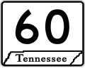
State Route 60 (SR 60) is a north-south major state route in East Tennessee. It covers 54 miles (87 km) and runs from the Tennessee-Georgia state line...
18 KB (1,451 words) - 22:38, 20 February 2024

State Route 6 (SR 6) is a 72.1-mile-long (116.0 km) state highway that travels northwest-to-southeast in the U.S. state of Georgia. It is known as Jimmy...
35 KB (3,456 words) - 05:35, 29 March 2023

State Route 52 (SR 52) is a 124.697-mile-long (200.680 km) state highway that travels west to east through portions of Whitfield, Murray, Gilmer, Dawson...
22 KB (1,850 words) - 03:14, 2 July 2023
Route 60 Alabama State Route 60 Arkansas Highway 60 California State Route 60 Colorado State Highway 60 Florida State Road 60 Georgia State Route 60 Georgia...
6 KB (445 words) - 23:08, 4 April 2024

State Route 8 (SR 8) is a 183-mile-long (295 km) state highway that travels west-to-east through portions of Haralson, Carroll, Douglas, Cobb, Fulton,...
55 KB (5,202 words) - 01:12, 16 February 2024

State Route 25 (SR 25) is a state highway in the eastern part of the U.S. state of Georgia. It travels south-to-north near the Atlantic Ocean, serving...
65 KB (6,805 words) - 10:54, 23 May 2024

State Route 53 (SR 53) is a 172.146-mile-long (277.042 km) west-to-east state highway located in the northern part of the U.S. state of Georgia. The highway...
34 KB (2,920 words) - 13:10, 29 February 2024

State Route 13 (SR 13) is a 49.5-mile-long (79.7 km) state highway in the north-central part of the U.S. state of Georgia, that travels through portions...
43 KB (4,567 words) - 15:54, 21 June 2024

State Route 49 (SR 49) is a 122.8-mile-long (197.6 km) state highway that travels southwest-to-northeast through portions of Terrell, Sumter, Macon, Peach...
30 KB (1,959 words) - 13:50, 19 June 2024

Wikidata Georgia Roads (Routes 41 - 60) Georgia State Route 54 CONN on State-Ends.com Archived 2010-07-21 at the Wayback Machine Georgia Routes 241-260...
21 KB (1,287 words) - 14:44, 30 May 2024

KML/Georgia State Route 22 KML is from Wikidata Media related to Georgia State Route 22 at Wikimedia Commons Georgia Roads (Routes 21 - 40) Georgia State...
53 KB (4,740 words) - 14:30, 30 May 2024

counties in the southeastern and east-central parts of the U.S. state of Georgia. The route connects the Reidsville and Augusta areas, via Swainsboro and...
23 KB (1,343 words) - 03:14, 2 July 2023

State Route 4 (SR 4) is a state highway in the eastern part of the U.S. state of Georgia. Except for its northernmost portion, it is completely concurrent...
70 KB (7,783 words) - 08:31, 11 January 2024

State Route 365 (SR 365) is a 69.5-mile-long (111.8 km) state highway that travels within portions of Gwinnett, Hall, Habersham, and Stephens counties...
26 KB (2,454 words) - 14:40, 30 May 2024

The State Routes in the U.S. state of Georgia (typically abbreviated SR) are maintained by the Georgia Department of Transportation (GDOT). Routes from...
301 KB (3,329 words) - 23:06, 5 June 2024

KML/Georgia State Route 27 KML is from Wikidata Media related to Georgia State Route 27 at Wikimedia Commons Georgia Roads (Routes 21 - 40) Georgia State...
45 KB (4,559 words) - 14:34, 30 May 2024

counties in the central and north-central parts of the U.S. state of Georgia. The route connects Byron with the Atlanta metropolitan area, via Forsyth...
22 KB (1,338 words) - 14:43, 30 May 2024

Georgia State Route 400 (SR 400; commonly known as Georgia 400) is a freeway and state highway in the U.S. state of Georgia serving parts of Metro Atlanta...
44 KB (4,597 words) - 14:42, 30 May 2024

related to Georgia State Route 43. KML file (edit • help) Template:Attached KML/Georgia State Route 43 KML is from Wikidata Georgia Roads (Routes 41 - 60)...
12 KB (1,415 words) - 21:08, 11 July 2023