
Mount Hikurangi (or Te Ara ki Hikurangi in Māori) is a 1,752 m (5,748 ft) peak in the eastern corner of New Zealand's North Island, about 80 kilometres...
25 KB (2,487 words) - 06:47, 13 April 2024
Mount Hikurangi may refer to: Mount Hikurangi (Gisborne District), New Zealand Mount Hikurangi (Northland), New Zealand Hikurangi, a volcanic cone near...
332 bytes (72 words) - 17:26, 9 December 2021

Gisborne District or the Gisborne Region (Māori: Te Tairāwhiti or Te Tai Rāwhiti) is a local government area of northeastern New Zealand. It is governed...
19 KB (1,698 words) - 08:52, 14 June 2024
Auckland, New Zealand Mount Hikurangi (Gisborne District), a mountain near Ruatoria on the East Coast, New Zealand Mount Hikurangi (Northland), a mountain...
771 bytes (140 words) - 21:17, 26 April 2022

978 ft) Walter Peak – 1,800 m (5,900 ft) Mount Arthur – 1,795 m (5,889 ft) Mount Hikurangi (Gisborne District) – 1,754 m (5,755 ft) (highest peak in the...
58 KB (2,217 words) - 07:10, 11 June 2024

Raukūmara Range (category Landforms of the Gisborne District)
the Gisborne-East Cape region". New Zealand Journal of Geology and Geophysics. 10 (1): 217–231. doi:10.1080/00288306.1967.10428192. "Mount Hikurangi - Te...
5 KB (304 words) - 05:54, 13 April 2024

Waiapu Valley (category Landforms of the Gisborne District)
(670 sq mi). The Raukumara Range forms the western side of the valley, with Mount Hikurangi in the central west. The towns of Ruatoria and Tikitiki are in the...
31 KB (3,253 words) - 12:21, 3 April 2024
Raukumara Conservation Park (category Protected areas of the Gisborne District)
340 acres) of the Raukumara Range and surrounding area, including Mount Hikurangi and the Mōtū River. The park was established in 1979. "DOC Profile"...
2 KB (87 words) - 07:39, 13 April 2024
Horahora Broncos Pawarenga Broncos Otaua Valleys Warriors Otaika Eagles Hikurangi Stags Hokianga Pioneers Marist United Manaia RL Club Muriwhenua Falcons...
8 KB (705 words) - 01:35, 8 July 2023
boundaries. This informal usage is jealously guarded. The district government of the town of Gisborne, for example, adamantly described itself as the first...
33 KB (2,030 words) - 23:36, 2 July 2024

Tokomaru Bay (category Populated places in the Gisborne District)
Zealand's North Island. It is 91 km north of Gisborne, on State Highway 35, and close to Mount Hikurangi. The district was originally known as Toka-a-Namu, which...
13 KB (1,389 words) - 02:06, 1 April 2024
Creek in Gisborne in 1912. Pāoa wished to capture this kiwi and therefore set a giant snare at Tāwhiti-a-Pāoa, with its base at Mount Hikurangi. Rongokako...
10 KB (1,134 words) - 02:05, 28 May 2024
Havelock Havelock North* Hāwera* Helensville* Henley Herbert Herekino Hikuai Hikurangi* Hikutaia Hinuera Hokitika* Honikiwi Hope* Horeke Horotiu Horsham Downs...
15 KB (942 words) - 19:24, 18 June 2024
North District) Russell Forest-Rawhiti Moerewa Kawakawa Maromaku Mangakahia-Hūkerenui Whangaruru Inlets other Whangārei District Matarau Hikurangi Kauri...
62 KB (4,617 words) - 07:52, 29 June 2024
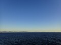
along the eastern side of the North Island between the Gisborne District and Wellington. Mount Raukūmara is clearly visible from a great distance at sea...
1 KB (122 words) - 06:48, 13 April 2024

range, which rises (in the neighbouring Gisborne District) to 1,754 metres (5,755 ft) at Mount Hikurangi. The district stretches from Kutarere and the eastern...
26 KB (2,969 words) - 04:13, 2 June 2024
711556 (Hedgehope) Hikurangi Bay of Islands 35°32′21.2″S 173°54′53.4″E / 35.539222°S 173.914833°E / -35.539222; 173.914833 (Hikurangi) Horokaka Whangārei...
19 KB (1,501 words) - 23:40, 25 May 2024
More FM (section Gisborne/Wairoa)
show between 6am-12pm. 98-9 More FM Gisborne & Wairoa is a local radio station broadcasting from the heart of Gisborne City. The station was originally branded...
38 KB (4,973 words) - 22:29, 2 July 2024

resulting from an oblique convergence with the Pacific Plate in the Hikurangi subduction zone. In this region the Moho discontinuity starts about 25–30 km...
53 KB (4,816 words) - 04:29, 6 July 2024

from Hikurangi to Portland. Auckland (1,570,100) is divided into four urban zones: Northern Auckland Urban Zone (323,500): the part of Rodney District known...
63 KB (2,910 words) - 03:30, 24 June 2024

plate under the other, producing the Puysegur Trench to the south, the Hikurangi Trench east of the North Island, and the Kermadec and Tonga Trenches further...
266 KB (22,272 words) - 10:35, 5 July 2024
Karaha, Ngāti Hāmua, Warahoe), Ngāti Whare Te Whāiti Waiōhau Marae Tama ki Hikurangi Tūhoe (Ngāti Haka, Patuheuheu) Waiōhau Waireporepo Marae No wharenui Ngāti...
22 KB (94 words) - 17:18, 5 July 2024
Government: Uawa County". Historic Poverty Bay and the East Coast, N.I., N.Z. Gisborne, New Zealand: Joseph Angus Mackay. p. 404. Retrieved 28 May 2012 – via...
84 KB (2,488 words) - 19:44, 25 June 2024

Rakai-hiku-roa. They came from Tūranga, near what is now Gisborne, and defeated the Hikurangi pā. Unable to take Ōtātara at that time, Taraia set up a...
37 KB (4,556 words) - 10:23, 12 April 2024

hauled up to the surface of the ocean, the canoe getting caught atop Mount Hikurangi which according to Ngāti Porou, is still there.: 5 Māui went to examine...
58 KB (7,051 words) - 03:29, 8 July 2024

Rotorua Lakes Council. Retrieved 15 June 2024. "Our Cover Gisborne City Coat of Arms - Gisborne Photo News - No 168 : June 19, 1968". photonews.org.nz....
57 KB (2,590 words) - 23:24, 8 July 2024

Raukokore River (category Rivers of the Gisborne District)
northeast of New Zealand's North Island. it flows north from the slopes of Mount Hikurangi, reaching the sea at Papatea Bay close to the small settlement of Raukokore...
573 bytes (57 words) - 02:39, 13 April 2024
Waiapu County (category Politics of the Gisborne District)
from 1890 until the council was merged with other councils to form Gisborne District Council in 1989. NB: This section is derived from text in Mackay,...
19 KB (2,532 words) - 08:01, 13 April 2024

(2016). 120 days at Astrolabe: the Rena, the Reef, & the Go Canopus. Hikurangi, NZ: Kevin Judkins. ISBN 9780473369316. Wikimedia Commons has media related...
36 KB (3,748 words) - 02:16, 20 January 2024

around Tonga in the north, through the Tonga Trench, Kermadec Trench, and Hikurangi Trough to the east of the North Island of New Zealand, down to Cook Strait...
52 KB (6,177 words) - 14:53, 26 May 2024