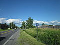
New York State Route 12B (NY 12B) is a state highway in the central part of New York in the United States. NY 12B is a north–south highway connecting...
16 KB (1,458 words) - 07:20, 8 January 2023
12B: New England Route 12B (former) County Road 12B (Gadsden County, Florida) Missouri Route 12B (former) Nebraska Spur 12B New York State Route 12B County...
638 bytes (83 words) - 15:56, 26 June 2024

New York State Route 5 (NY 5) is a state highway that extends for 370.80 miles (596.74 km) across the state of New York in the United States. It begins...
91 KB (7,590 words) - 19:59, 26 August 2024

numbered state highways in the U.S. state of New York. Signed state highways in New York, referred to as "touring routes" by the New York State Department...
167 KB (908 words) - 11:59, 30 April 2024

New York State Route 12 (NY 12) is a state highway extending for 222.27 miles (357.71 km) through central and northern New York in the United States....
49 KB (4,046 words) - 02:17, 18 March 2023
12B is a 2001 Tamil movie. 12B may also refer to: New York State Route 12B, a state highway in the central part of New York Missouri Route 12B Nebraska...
626 bytes (117 words) - 02:09, 3 June 2024

New York State Route 46 (NY 46) is a state highway in Central New York in the United States. It extends from NY 12B in the Madison County town of Eaton...
20 KB (1,947 words) - 07:43, 8 January 2023

a junction with NY 12B (Franklin Avenue). College Street continues east from this point as part of NY 12B. The state of New York assumed maintenance...
5 KB (481 words) - 03:16, 4 February 2023
NY 12B in the hamlet of Deansboro, located in the town of Marshall. NY 315 was assigned as part of the 1930 renumbering of state highways in New York. At...
4 KB (299 words) - 02:05, 3 February 2023

cities of the state, bypassing Syracuse and Utica by great distances to the south while the New York State Thruway and New York State Route 5 (NY 5), which...
95 KB (8,617 words) - 03:57, 10 June 2024

Springs is a hamlet in Oneida County, New York, United States. The community is located along New York State Route 12B, 1.1 miles (1.8 km) southwest of Clinton...
3 KB (97 words) - 07:09, 1 May 2024

New York State Route 233 (NY 233) is a state highway in Oneida County, New York, United States. The southern terminus of the route is at an intersection...
7 KB (553 words) - 14:20, 12 May 2024

0.5 square mile (1.3 km2) (1.23%) is water. U.S. Route 20, conjoined with New York State Route 12B forms an east-west highway across the town. As of...
11 KB (695 words) - 10:05, 21 August 2024

New York State Route 26 (NY 26) is a north–south state highway that runs for 203.80 miles (327.98 km) through Central New York in the United States. Its...
51 KB (4,800 words) - 21:56, 20 February 2024

New York State Route 12, a north-south highway, intersects New York State Route 12B north of Sherburne village and intersects New York State Route 80...
23 KB (2,330 words) - 05:55, 9 June 2024
yellow-on-blue pentagon route marker. County routes in New York "County Roads Listing - Madison County" (PDF). New York State Department of Transportation. June...
33 KB (54 words) - 17:02, 9 February 2024

replacing New York State Route 2 (NY 2), a route assigned three years earlier as part of the creation of the modern New York state route system. The...
57 KB (4,498 words) - 01:38, 5 August 2024
County routes in Cayuga County, New York, are not signed in any form, serving as little more than references for inventory purposes. Route numbers below...
46 KB (153 words) - 16:33, 9 February 2024

New York state line at Montvale. Its name refers to New Jersey's nickname, the "Garden State". The parkway has an unsigned reference number of Route 444...
213 KB (18,799 words) - 21:10, 31 August 2024

The New England road marking system was a regional system of marked numbered routes in the six-state region of New England in the United States. The routes...
158 KB (6,445 words) - 17:10, 1 February 2024

New York State Route 31B (NY 31B) was a state highway in central New York in the United States. It served as a connector between NY 31, its parent route...
8 KB (640 words) - 20:31, 25 August 2024
yellow-on-blue pentagon route marker. County routes in New York List of former state routes in New York (401–500) CR 32 is discontinuous at the villages...
20 KB (155 words) - 17:04, 9 February 2024
New York State Route 291 (NY 291) is a state highway in Oneida County, New York, in the United States. The route extends from an intersection with NY 69...
14 KB (1,439 words) - 04:16, 31 January 2023
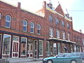
village has a total area of 1.1 square miles (2.8 km2), all land. New York State Route 12B, a north–south highway, passes through the center of the village...
11 KB (816 words) - 13:53, 21 August 2024
County routes in Oneida County, New York, are generally signed with the Manual on Uniform Traffic Control Devices-standard yellow-on-blue pentagon route marker...
38 KB (229 words) - 16:40, 9 February 2024

traversing Vermont. In New York, US 4 is signed north–south to reflect its alignment in the state. In Vermont and New Hampshire, the route is signed east–west...
10 KB (913 words) - 04:59, 1 August 2024
Interstate 678 (redirect from New York State Route 678)
or /væn ˈwaɪk/ van WYKE) from JFK Airport to Northern Boulevard (New York State Route 25A or NY 25A), the Whitestone Expressway from NY 25A north to the...
83 KB (6,850 words) - 19:20, 31 August 2024

Interstate 390 (redirect from New York State Route 401 (1970–1973))
entirely within New York in the United States. The southern terminus of the route is at the Southern Tier Expressway (I-86 and New York State Route 17, or NY 17)...
28 KB (2,429 words) - 22:49, 13 May 2024

Route 18 is a 47.9-mile-long (77.1 km) state highway in the central part of the US state of New Jersey. It begins at an intersection with Route 138 in...
43 KB (3,381 words) - 22:41, 30 August 2024

overlapped with U.S. Route 5 to the city of Newport via Coventry. Between Hardwick and Coventry, VT 12 had an alternate route, Vermont Route 12B, that took a...
22 KB (2,068 words) - 04:10, 7 June 2024