Puerto Rico Highway 143 (PR-143) is a secondary highway that connects the town of Adjuntas to the town of Barranquitas. Heading east from Adjuntas, PR-143...
11 KB (307 words) - 18:25, 1 August 2024

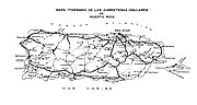
The highway system in Puerto Rico is composed of approximately 14,400 kilometers (8,900 mi) of roads in Puerto Rico, maintained by the Puerto Rico Department...
171 KB (3,630 words) - 01:06, 5 August 2024

Puerto Rico Highway 723 (PR-723) is a rural road that goes from the municipality of Aibonito to southern Barranquitas via northeastern Coamo, Puerto Rico...
8 KB (520 words) - 01:54, 6 February 2024

Puerto Rico Highway 2 (PR-2) is a road in Puerto Rico that connects the cities of San Juan and Ponce. At 156 miles (230 km) long, it is Puerto Rico's...
53 KB (3,465 words) - 22:22, 4 August 2024

Puerto Rico Highway 577 (PR-577) is a short tertiary mountainous state road that connects PR-143 (also known as Ruta Panorámica [Scenic Route] in this...
5 KB (472 words) - 14:51, 24 August 2023
Puerto Rico Highway 139 (PR-139) is a two-way secondary highway in the municipality of Ponce in Puerto Rico. With a length of 25.2 km (15.7 mi), it extends...
12 KB (864 words) - 01:54, 6 February 2024

ends at PR-143 in Caonillas Arriba. The entire route is located in Villalba. Puerto Rico portal U.S. Roads portal 1953 Puerto Rico highway renumbering...
4 KB (148 words) - 02:35, 6 February 2024
Puerto Rico Highway 511 (PR-511) is a tertiary state highway in the municipality of Ponce in Puerto Rico. With a length of 16.4 km (10.2 mi), it extends...
8 KB (611 words) - 01:58, 6 February 2024

Delicias. The road's northern terminus is at its intersection with Puerto Rico Highway 143 in Utuado's barrio Consejo, about 1/4 mile north of Utuado's borderline...
9 KB (667 words) - 01:53, 6 February 2024

Puerto Rico Highway 10 (PR-10) is a major highway in Puerto Rico. The primary state road connects the city of Ponce in the south coast to Arecibo in the...
38 KB (3,440 words) - 01:31, 5 August 2024

Puerto Rico (Spanish for 'rich port'; abbreviated PR), officially the Commonwealth of Puerto Rico, is a Caribbean island, Commonwealth, and unincorporated...
261 KB (26,135 words) - 21:03, 24 August 2024

primary highways in the contiguous United States, there are signed Interstates in Hawaii and unsigned Interstates in Alaska and Puerto Rico. There are...
56 KB (669 words) - 17:02, 27 August 2024

Puerto Rico Highway 123 (PR-123) is a secondary highway that connects the city Arecibo to the city of Ponce. It runs through the towns of Utuado and Adjuntas...
25 KB (1,625 words) - 14:38, 5 September 2023

Puerto Rico Highway 152 (PR-152) is a rural road that travels from Barranquitas to Naranjito in Puerto Rico. This road extends from PR-156 in downtown...
9 KB (422 words) - 01:48, 6 February 2024

Cerro Maravilla (category Mountains of Puerto Rico)
Rico Highway 577, which is accessible via Puerto Rico Highway 143, traveling either westbound or eastbound. PR-143 is a secondary two-way, two-lane mountainous...
9 KB (514 words) - 12:16, 21 January 2024
Puerto Rico Highway 149 (PR-149) is a secondary highway in Puerto Rico that connects the towns of Manatí in the north coast of Puerto Rico, from PR-22...
14 KB (445 words) - 02:37, 6 February 2024

Spanish: [ˈponse] ) is a city and a municipality on the southern coast of Puerto Rico. The most populated city outside the San Juan metropolitan area, was...
220 KB (21,915 words) - 19:39, 22 August 2024

Puerto Rico Highway 155 (PR-155) is a rural road that goes from Coamo, Puerto Rico to Vega Baja through Orocovis and Morovis. It extends from PR-14 in...
12 KB (315 words) - 01:27, 6 February 2024
Ruta Panorámica (redirect from Puerto Rico Highway 7718)
of Puerto Rico from west to east along its Cordillera Central (Central Mountain Range). Most of the route consists of three roads, PR-105, PR-143, and...
25 KB (905 words) - 06:05, 22 November 2023

Humacao (Spanish pronunciation: [umaˈkao]) is a city and municipality in Puerto Rico located in the eastern coast of the island, north of Yabucoa; south of...
45 KB (3,795 words) - 12:33, 18 August 2024
Ciales and Florida. This highway begins at PR-143 in Pica barrio and ends at PR-2 in Florida Afuera barrio. Puerto Rico Highway 140 by municipality Heading...
8 KB (211 words) - 02:29, 6 February 2024

downtown Barranquitas. Puerto Rico Highway 162 by municipality Northbound sign in Aibonito Southbound sign in Helechal, Barranquitas PR-143 east near PR-162...
7 KB (219 words) - 02:39, 6 February 2024

pronunciation: [doˈɾaðo]) is a town and municipality on the northern coast of Puerto Rico, 15 miles (24 km) west of San Juan and is located in the northern region...
92 KB (10,468 words) - 15:03, 19 August 2024

Jayuya (Spanish pronunciation: [xaˈʝuʝa]) is a town and municipality of Puerto Rico located in the mountainous center region of the island, north of Ponce;...
33 KB (2,623 words) - 00:56, 13 August 2024

Toro Negro State Forest (category Tourist attractions in Puerto Rico)
495861000). The forest includes Puerto Rico's highest peak, Cerro de Punta, which is located at km. 17.0 on Puerto Rico Highway 143. It is at 18.1722°N, 66.5917°W...
99 KB (10,192 words) - 02:52, 24 May 2024
1953, the Puerto Rico Department of Transportation and Public Works implemented a major renumbering of its insular highways. Before 1953, highway routes...
41 KB (1,131 words) - 14:58, 5 March 2024

Puerto Rico Highway 144 (PR-144) is a rural road that travels from Jayuya, Puerto Rico to Ciales. This road extends from PR-140 in Collores and ends at...
6 KB (208 words) - 02:31, 6 February 2024
Puerto Rico Highway 142 (PR-142) is a north–south road that connects the northern region of Puerto Rico with the municipality of Corozal. With a length...
18 KB (1,482 words) - 21:53, 15 April 2024
Pennsylvania Route 427 Puerto Rico Highway 427 Texas State Highway Loop 427 (former) This article includes a list of roads, streets, highways, or other routes...
1 KB (105 words) - 23:15, 4 April 2024
Route 417 Puerto Rico Highway 417 South Carolina Highway 417 Tennessee State Route 417 This article includes a list of roads, streets, highways, or other...
1 KB (112 words) - 23:16, 4 April 2024