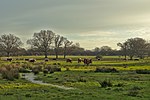
The Adur (/eɪˈdʊər/ or /eɪˈdɜː/) is a river in Sussex, England; it gives its name to the Adur district of West Sussex. The river, which is 20 miles (32 km)...
19 KB (2,395 words) - 20:11, 7 August 2024
Adur (/eɪˈdʊər/) is a local government district in West Sussex, England. It is named after the River Adur which flows through the area. The council is...
20 KB (1,141 words) - 08:02, 24 July 2024
Shoreham-by-Sea (category Adur District)
to its north by the South Downs, to its west by the Adur Valley, and to its south by the River Adur and Shoreham Beach on the English Channel. The town...
46 KB (4,869 words) - 17:38, 22 October 2024
It opened in 1826, and closed in 1875. The River Adur is formed when the Western Adur and the Eastern Adur join near Henfield. The Western branch starts...
7 KB (588 words) - 06:57, 16 September 2024
village, the two branches of the River Adur, the western Adur and the eastern Adur, meet at Betley Bridge. From Henfield the Adur flows on into the English Channel...
22 KB (2,317 words) - 22:35, 19 October 2024
village of Bramber, West Sussex, near the town of Steyning, overlooking the River Adur. Surveys indicate the Normans were the first to build a fortification...
7 KB (763 words) - 17:46, 3 November 2024
district of West Sussex, England. It is located at the north end of the River Adur gap in the South Downs, four miles (six kilometres) north of the coastal...
18 KB (1,985 words) - 12:37, 11 November 2024
Lancing, West Sussex (category Adur District)
coastal village and civil parish in the Adur district of West Sussex, England, on the western edge of the Adur Valley. It occupies part of the narrow central...
15 KB (1,819 words) - 17:23, 27 October 2024
the engineering consultancy, is on the A27 next to Shoreham Airport and River Adur. Merrydown cider was formerly made in Horam until 2004, when it was bought...
180 KB (17,491 words) - 14:01, 12 November 2024
Shoreham Tollbridge is a bridge crossing the River Adur in West Sussex, England. It is the last of its kind in Sussex and one of the last of its kind anywhere...
10 KB (984 words) - 01:17, 16 February 2024
Stream) unknown tributary (R) Adur catchment River Adur (MS) River Adur (east fork) (L) Cowfold Brook (R) Ouse catchment River Ouse, Sussex (MS) Glynde Reach...
87 KB (10,761 words) - 19:28, 15 October 2024
Buckinghamshire (built 1829–32) and Norfolk Bridge, a suspension bridge over the River Adur in Shoreham-by-Sea, West Sussex (designed with Captain Samuel Brown, opened...
5 KB (431 words) - 01:39, 29 November 2022
Look up adur in Wiktionary, the free dictionary. Adur may refer to: Adur, Anekal, a village in the southern state of Karnataka, India Adur, Azerbaijan...
758 bytes (135 words) - 05:52, 19 May 2024
charity. In March 2017, Adur District Council announced that a series of sculptures were to be placed along the banks of the River Adur as a memorial. In May...
69 KB (6,377 words) - 12:08, 17 October 2024
original seat was the castle of Bramber and its village, overlooking the river Adur. Created by William the Conqueror in the late 11th century, the rape of...
8 KB (730 words) - 12:35, 19 January 2024
work was carried out on the River Adur within the project boundaries to remove the artificial banks and allow the river to flood the surrounding meadows...
19 KB (2,106 words) - 15:03, 7 July 2024
transported North to London, and Betley Bridge where the line crossed the River Adur about a mile to the North was a strategic target for German bombers. The...
3 KB (196 words) - 06:21, 25 August 2024
canal in Southwick, West Sussex that branches off from the estuary of the River Adur near Hove. The canal is 1.75 miles in length, running east–west and parallel...
6 KB (727 words) - 17:05, 23 September 2024
west of the village of West Grinstead, West Sussex, England near the River Adur and the A24 (grid reference TQ163209). The castle was probably founded...
17 KB (1,783 words) - 18:04, 14 October 2024
Botolph's at Botolphs, West Sussex, England, is situated in the valley of the River Adur and is now part of the Church of England parish of Beeding and Bramber...
19 KB (2,073 words) - 22:47, 28 June 2022
length. It followed the course of the River Adur for much of its extent and was alternatively known as the Adur Valley Line. The line never developed...
15 KB (1,991 words) - 19:57, 9 October 2024
anemones and primroses. The Herrings Stream is a tributary of the eastern River Adur and runs to the north of Hurstpierpoint. Walking from Cobb's Mill (TQ...
19 KB (2,220 words) - 17:41, 30 September 2024
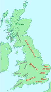
own ruler for a while, and another sub-division may have been along the River Adur. Complex tiers of relationships between kings and kingdoms existed. For...
80 KB (10,206 words) - 17:25, 25 October 2024
the B2135 road. The village is about 0.6 miles (0.97 km) west of the River Adur. There is a 12th-century parish church dedicated to St James, where local...
3 KB (192 words) - 13:17, 4 August 2024
Wivelsfield parish is located on a ridge that acts as a watershed between the rivers Adur and Ouse. It lies south of Haywards Heath, and east of Burgess Hill,...
24 KB (2,543 words) - 03:44, 13 June 2024
economically active.[citation needed] Slinfold is the source of the western River Adur, which flows to the English Channel at Shoreham-by-Sea Alfodean was excavated...
8 KB (645 words) - 10:17, 3 November 2024
September 1861 and closed 7 March 1966. The line followed the valley of the River Adur there was Bungalow Town Halt opened 1910, later to serve Shoreham Airport...
19 KB (1,905 words) - 02:28, 24 July 2024
for Nature 2015 Innovative & Novel Project award in the UK River Prize for the River Adur restoration project 2017 Anders Wall Award for special contribution...
4 KB (418 words) - 21:39, 4 November 2024
Upper Beeding (redirect from River Beeding)
District of West Sussex, England. It is located at the northern end of the River Adur gap in the South Downs, four miles (6.4 km) north of Shoreham-by-Sea and...
32 KB (3,816 words) - 15:52, 19 September 2024
the valleys of the River Arun and River Adur. In addition to these two rivers which drain most of the county a winterbourne, the River Lavant, flows intermittently...
40 KB (3,584 words) - 13:06, 12 October 2024


