Les Publications du Québec, 2005 Provincial Route Map (Courtesy of the Quebec Ministry of Transportation) (in French) Route 277 on Google Maps v t e...
2 KB (129 words) - 00:54, 22 August 2023
277: BR-277 Nova Scotia Route 277 Quebec Route 277 Japan National Route 277 Interstate 277 U.S. Route 277 Alabama State Route 277 Arizona State Route...
2 KB (142 words) - 22:59, 4 April 2024
Route 51, now Route 289. Route 52, now Route 202. Route 53, now Route 277. Route 54, now Route 175. Route 54A, now Route 169. Route 54B, now Boulevard...
11 KB (962 words) - 16:30, 14 November 2024
Peninsula. This highway is known as the Navigator's Route. It passes through the Montérégie, Centre-du-Québec, Chaudière-Appalaches, Bas-Saint-Laurent and Gaspésie...
36 KB (575 words) - 08:01, 1 December 2024
is close to Lac-Etchemin at the junction of Route 277, and the western terminus is at the junction of Route 112 in Saint-Frédéric. Saint-Frédéric...
2 KB (100 words) - 01:50, 25 January 2023
Route 173 (Route-du-Président-Kennedy) is a major north/south highway on the south shore of the St. Lawrence River in Quebec, Canada, named after the assassinated...
8 KB (188 words) - 18:41, 10 April 2024
Réaménagement de la route 185 en autoroute". Archived from the original on 2018-09-25. Retrieved 2016-10-26. Canada portal Roads portal Transports Québec autoroutes...
8 KB (547 words) - 20:07, 4 May 2024
List of Quebec provincial highways Ministère des transports, "Distances routières", page 83, Les Publications du Québec, 2005 Provincial Route Map (Courtesy...
5 KB (367 words) - 01:45, 25 January 2023
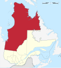
Territories, and until 1987 it was referred to as Nouveau-Québec, or New Quebec. Nord-du-Québec lies entirely upon the Canadian Shield. It extends from...
31 KB (1,631 words) - 16:57, 16 December 2024
List of Quebec provincial highways Ministère des transports, "Distances routières", page 80, Les Publications du Québec, 2005 Provincial Route Map (Courtesy...
9 KB (264 words) - 08:17, 1 December 2024
), Les Publications du Québec, 2005 Provincial Route Map (Courtesy of the Quebec Ministry of Transportation) (in French) Route 293 on Google Maps v t...
2 KB (91 words) - 02:01, 25 January 2023
List of Quebec provincial highways Ministère des transports, "Distances routières", page (?), Les Publications du Québec, 2005 Provincial Route Map (Courtesy...
2 KB (141 words) - 01:59, 25 January 2023
the route as "Highway 2-20". "Autoroute 20 in Quebec". Retrieved January 9, 2020. "Répertoire des autoroutes du Québec" (in French). Transports Québec. Retrieved...
48 KB (1,814 words) - 14:40, 11 December 2024
U.S. Route 3 (US 3) is a United States Numbered Highway running 277.90 miles (447.24 km) from Cambridge, Massachusetts, through New Hampshire, to the Canada–United...
55 KB (3,182 words) - 17:14, 8 October 2024
Bellechasse Regional County Municipality (redirect from Bellechase County Regional Municipality, Quebec)
and equivalent territories in Quebec Sisters of Our Lady of Perpetual Help, Bellechasse "Banque de noms de lieux du Québec: Reference number 141116". toponymie...
7 KB (277 words) - 23:44, 30 November 2024
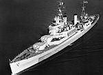
HMS Uganda (66) (redirect from HCMS Québec (C66))
September 1960. p. 3. "Quebec Pays Last Visit to Halifax". The Crowsnest. Vol. 12, no. 12. Queen's Printer. October 1960. p. 3. "NCSM Québec : la fin d'une grande...
25 KB (2,813 words) - 16:58, 5 December 2024
Les Etchemins Regional County Municipality (redirect from Les Etchemins County Regional Municipality, Quebec)
territories in Quebec "Banque de noms de lieux du Québec: Reference number 141072". toponymie.gouv.qc.ca (in French). Commission de toponymie du Québec. "Répertoire...
5 KB (163 words) - 02:55, 31 July 2022
A reference route is an unsigned highway assigned by the New York State Department of Transportation (NYSDOT) to roads that possess a signed name (mainly...
124 KB (1,299 words) - 19:57, 30 October 2024
List of highways numbered 1 (redirect from State Route 1)
Nova Scotia Trunk 1 Northwest Territories Highway 1 Quebec Route 1 (former) Yukon Highway 1 Chile Route 1 G1 Expressway G1N Expressway G0111 Expressway S01...
20 KB (1,282 words) - 16:15, 19 November 2024
List of highways numbered 410 (redirect from Route 410)
Newfoundland and Labrador Route 410 Ontario Highway 410 Quebec Autoroute 410 Japan National Route 410 N410_highway_(Philippines) Thailand Route 410 (Pattani-Betong...
2 KB (154 words) - 12:38, 25 June 2024
with Quebec, Highway 104 at the border with Nova Scotia, as well as with traffic from Interstate 95 in the U.S. state of Maine via the short Route 95 connector...
42 KB (3,144 words) - 13:40, 9 December 2024
Interstate 91 (redirect from Route I-91 (Massachusetts))
road continues into Canada as Quebec Autoroute 55. I-91 is the longest of three Interstate highways whose entire route is located within the New England...
84 KB (5,123 words) - 02:38, 16 December 2024
List of highways numbered 222 (redirect from Route 222)
Newfoundland and Labrador Route 222 Prince Edward Island Route 222 Quebec Route 222 China National Highway 222 National Route 222 Main road 222 (Hungary)...
2 KB (176 words) - 23:27, 4 April 2024
Magpie Generating Station (category Dams in Quebec)
contract with Hydro-Québec Distribution. In its 2009–2013 strategic plan, Hydro-Québec was planning to build six hydroelectric dams on the 277 kilometres (172 mi)...
13 KB (870 words) - 09:49, 4 November 2024
List of highways numbered 138 (redirect from Route 138)
Edward Island Route 138 Quebec Route 138 National Route 138 National Highway 138 (India) Japan National Route 138 Fukuoka Prefectural Route 138 Nara Prefectural...
4 KB (276 words) - 21:18, 29 September 2024
east of Bellingham, three miles east of a junction at Kendall, with State Route 547, which connects over a low pass on the northeast flank of Sumas Mountain...
7 KB (664 words) - 14:04, 9 August 2024
Ontario Highway 407 (redirect from 407 Express Toll Route)
Comprising a privately leased segment and a publicly owned segment, the route spans the entire Greater Toronto Area (GTA) around the city of Toronto,...
108 KB (8,359 words) - 07:14, 14 October 2024
List of highways numbered 973 (redirect from Route 973)
Texas This article includes a list of roads, streets, highways, or other routes that are associated with the same title. If an internal link led you here...
646 bytes (82 words) - 22:54, 4 April 2024
Samuel Bronfman (category Anglophone Quebec people)
largest liquor distilling firm. Samuel Bronfman was born onboard ship (en route to Canada) either in Soroki or in Otaci, Soroca uyezd, Bessarabia, then...
12 KB (1,212 words) - 00:34, 25 July 2024
Interstate 93 (redirect from Route I-93 (Massachusetts))
with I-95, US Route 1 (US 1) and Route 128 in Canton, Massachusetts. It travels concurrently with US 1 beginning in Canton, and, with Route 3 beginning...
77 KB (5,897 words) - 02:25, 13 December 2024


