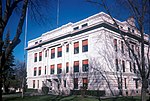
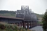
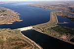
South Dakota Highway 27 (SD 27) is a 42.639-mile (68.621 km) state highway in Day and Marshall counties in South Dakota, United States, that connects...
7 KB (699 words) - 02:36, 26 July 2023
former state highways in South Dakota. These roads are now either parts of other routes or no longer carry a route number. South Dakota Highway 8 was one...
14 KB (1,386 words) - 23:26, 24 May 2024
South Dakota Highway 87 (SD 87) is a 37.894-mile-long (60.984 km) state highway in the southwestern part of the U.S. state of South Dakota. It travels...
9 KB (720 words) - 21:18, 16 October 2023
South Dakota's state highways were assigned in a numbering pattern that followed that of the U.S. Highways followed upon their inception. East–west highways...
39 KB (114 words) - 04:49, 28 November 2022
Pierre (/pɪər/ PEER) is the state capital of the U.S. state of South Dakota and the county seat of Hughes County. The population was 14,091 at the 2020...
30 KB (2,218 words) - 23:59, 9 November 2024
Pickerel Lake Reetz Rush Sweetwater Waubay U.S. Highway 12 South Dakota Highway 25 South Dakota Highway 27 Marshall County - north Roberts County - east...
16 KB (1,037 words) - 19:23, 22 July 2024
Watertown is a city in and the county seat of Codington County, South Dakota, United States. Watertown is home to the Redlin Art Center, which houses many...
32 KB (2,138 words) - 08:40, 3 November 2024
Route 27 Pennsylvania Route 27 South Carolina Highway 27 South Dakota Highway 27 Tennessee State Route 27 Texas State Highway 27 Farm to Market Road 27 Texas...
9 KB (669 words) - 10:27, 27 August 2024
South Dakota Highway 15 (SD 15) is a 67.562-mile-long (108.730 km) state highway in the northeastern South Dakota, United States. It connects Clear Lake...
13 KB (1,251 words) - 16:18, 16 February 2024
South Dakota Highway 44 (SD 44) is a state highway in southern South Dakota that runs from U.S. Route 385 (US 385) west of Rapid City to Interstate 29...
16 KB (1,258 words) - 01:01, 16 June 2021
Interstate 190 (I-190) is an auxiliary Interstate Highway in the US state of South Dakota. The route runs for about two miles (3.2 km) connecting I-90...
8 KB (588 words) - 23:44, 17 June 2024
(5.7%) is water. Interstate 29 U.S. Highway 81 South Dakota Highway 21 South Dakota Highway 22 South Dakota Highway 28 Codington County - north Deuel County...
13 KB (877 words) - 05:25, 19 October 2024
South Dakota Highway 34 (SD 34) is a state route that runs parallel to Interstate 90 across the entire state of South Dakota. It begins at the Wyoming...
11 KB (372 words) - 16:13, 23 December 2023
(2.2%) is water. U.S. Highway 12 South Dakota Highway 45 South Dakota Highway 47 South Dakota Highway 247 South Dakota Highway 253 McPherson County -...
17 KB (1,039 words) - 16:01, 27 April 2024
located in the eastern part of the county. South Dakota Highway 10 South Dakota Highway 25 South Dakota Highway 27 Abraham State Game Production Area Aspen...
14 KB (1,089 words) - 18:09, 27 April 2024
South Dakota (/dəˈkoʊtə/ ; Sioux: Dakȟóta itókaga, pronounced [daˈkˣota iˈtokaga]) is a landlocked state in the North Central region of the United States...
157 KB (13,320 words) - 20:13, 21 November 2024
Aberdeen (Lakota: Ablíla) is a city in and the county seat of Brown County, South Dakota, United States, located approximately 125 miles (201 km) northeast of...
53 KB (4,931 words) - 01:18, 15 November 2024
Interstate 229 Dwtn. South Dakota Highway 11 South Dakota Highway 19 South Dakota Highway 38 South Dakota Highway 42 South Dakota Highway 115 Jefferson Lines...
18 KB (1,326 words) - 15:43, 18 November 2024
counties to observe Mountain Time. U.S. Highway 14 South Dakota Highway 34 South Dakota Highway 63 South Dakota Highway 73 Ziebach County - north Stanley County...
13 KB (1,044 words) - 18:00, 27 April 2024
counties to observe Mountain Time. U.S. Highway 212 South Dakota Highway 20 South Dakota Highway 63 South Dakota Highway 65 Corson County – north Walworth County...
14 KB (1,041 words) - 07:16, 21 September 2024
is water. U.S. Highway 212 U.S. Highway 281 South Dakota Highway 20 South Dakota Highway 26 South Dakota Highway 28 South Dakota Highway 37 Fisher Grove...
13 KB (856 words) - 18:17, 27 April 2024
U.S. Highway 12 South Dakota Highway 20 South Dakota Highway 63 South Dakota Highway 65 South Dakota Highway 1806 Sioux County, North Dakota – north...
14 KB (1,038 words) - 16:44, 15 November 2024
a census-designated place in and the county seat of Buffalo County, South Dakota, United States. The town had a population of 10 as of the 2020 census...
8 KB (407 words) - 04:21, 30 August 2024
Highway 83 U.S. Highway 183 South Dakota Highway 47 South Dakota Highway 49 South Dakota Highway 53 South Dakota Highway 273 South Dakota Highway 1806...
15 KB (1,076 words) - 18:08, 27 April 2024
county. U.S. Highway 81 South Dakota Highway 46 South Dakota Highway 50 South Dakota Highway 52 South Dakota Highway 153 South Dakota Highway 314 Chan Gurney...
18 KB (1,269 words) - 18:21, 27 April 2024
state highways in North Dakota are the state highways owned and maintained by the North Dakota Department of Transportation (NDDOT). North Dakota is a...
40 KB (407 words) - 18:24, 12 March 2024
miles (62 km2) (2.4%) is water. U.S. Highway 212 South Dakota Highway 20 South Dakota Highway 45 South Dakota Highway 47 Edmunds County – north Brown County...
13 KB (867 words) - 16:02, 27 April 2024
all of Mapleton Township. Renner lies just north of Sioux Falls on South Dakota Highway 115. It lies in the valley of the Big Sioux River on a line of the...
7 KB (390 words) - 04:40, 28 July 2023
water. South Dakota Highway 34 South Dakota Highway 45 South Dakota Highway 47 South Dakota Highway 50 Hand – northeast Jerauld – east Brule – south Lyman...
15 KB (1,123 words) - 02:35, 27 April 2024
U.S. Route 16 (redirect from U.S. Highway 216 in South Dakota)
U.S. Highway 16 (US 16) is an east–west United States Numbered Highway between Rapid City, South Dakota, and Yellowstone National Park in Wyoming. The...
17 KB (1,106 words) - 21:12, 20 May 2024


