
State Highway 30 (SH 30) is a New Zealand state highway, linking the Waikato and Bay of Plenty towns of Te Kūiti, Mangakino, Rotorua, and Whakatāne. At...
9 KB (592 words) - 19:59, 25 August 2024
The New Zealand state highway network is the major national highway network in New Zealand. Nearly 100 roads in the North and South Islands are state highways...
23 KB (2,353 words) - 23:48, 8 October 2024

State Highway 1 (SH 1) is the longest and most significant road in the New Zealand road network, running the length of both main islands. It appears on...
54 KB (5,374 words) - 23:19, 29 September 2024

State Highway 6 (SH 6) is a major New Zealand state highway. It extends from the Marlborough region in the northeastern corner of the South Island across...
20 KB (1,540 words) - 19:58, 25 August 2024

State Highway 20 (SH 20), also known as the Southwestern Motorway, is a New Zealand state highway linking State Highway 1 at Manukau with State Highway 16...
17 KB (1,299 words) - 07:30, 7 October 2024

State Highway 2 (SH 2) runs north–south through eastern parts of the North Island of New Zealand from the outskirts of Auckland to Wellington. It runs...
25 KB (2,143 words) - 20:07, 28 September 2024
State Highway 25 (SH 25) is a New Zealand state highway that runs eastwards across the Hauraki Plains then northwards up the western side of Coromandel...
8 KB (667 words) - 19:59, 25 August 2024
This is a list of highways of the New Zealand state highway network and some touring routes. State highways are administered by NZ Transport Agency Waka...
34 KB (323 words) - 07:28, 7 October 2024
State Highway 32 (SH 32) is a New Zealand state highway in the Central North Island. It forms part of a western traverse of Lake Taupō and a less busy...
4 KB (223 words) - 19:59, 25 August 2024

State Highway 3 (SH 3) is one of New Zealand's eight national state highways. It serves the west coast of the country's North Island and forms a link between...
21 KB (1,778 words) - 19:58, 25 August 2024
State Highway 59 (SH 59) is a New Zealand state highway in the Wellington Region linking Mackays Crossing (near Paekākāriki) to Linden. It came into existence...
12 KB (851 words) - 21:35, 1 October 2024

State Highway 29 (SH 29) is a New Zealand state highway that travels over the Kaimai Ranges linking the Bay of Plenty and Waikato regions. For most of...
14 KB (1,313 words) - 19:59, 25 August 2024

State Highway 5 (SH 5), one of New Zealand's eight national highways, runs from State Highway 1 at Tīrau, in the south Waikato, to State Highway 2, close...
8 KB (632 words) - 19:58, 25 August 2024

State Highway 16 (SH 16) is a New Zealand state highway linking central Auckland with Wellsford, via Auckland's Northwestern Motorway, Helensville and...
7 KB (346 words) - 19:59, 25 August 2024
State Highway 11 (SH 11) is a 30 kilometre stretch of highway in the North Island of New Zealand. It links SH 10 at Puketona and SH 1 at Kawakawa. Its...
3 KB (184 words) - 19:59, 25 August 2024
State Highway 58 (SH 58) is a New Zealand state highway in the Wellington Region linking the Hutt Valley to Porirua City. The two-lane highway covers 15...
6 KB (403 words) - 20:00, 25 August 2024
State Highway 34 (SH 34) is a New Zealand state highway in the Bay of Plenty region in the North Island. It links the forestry town of Kawerau to Tauranga...
2 KB (118 words) - 20:00, 25 August 2024
State Highway 67 (SH 67) is a New Zealand state highway located in the northern parts of the South Island of New Zealand. It is 51.2 km long usually on...
4 KB (396 words) - 20:01, 25 August 2024
on New Zealand's State Highway 1 (SH 1). All exits are unnumbered. All exits are unnumbered. All exits are unnumbered. List of New Zealand state highways...
31 KB (34 words) - 10:47, 10 April 2024
State Highway 23 (SH 23) is a New Zealand state highway that connects the towns of Raglan and Hamilton. SH 23 commences in the Hamilton suburb of Frankton...
18 KB (1,112 words) - 19:59, 25 August 2024

State Highway 31 (SH 31) is a New Zealand state highway in the Waikato region. It provides a link to the harbour town of Kawhia on the west coast of the...
5 KB (376 words) - 19:59, 25 August 2024
Route 30 Gukjido 30 New Zealand State Highway 30 New Zealand State Highway 30A British A30 (Penzance-London) Otoyol 30 Highway M30 (Ukraine) E 30 road...
8 KB (591 words) - 15:50, 27 August 2024
State Highway 33 (SH 33) is a New Zealand state highway in the Bay of Plenty in the North Island. It is one of two state highways (along with SH 36) that...
2 KB (234 words) - 10:15, 8 September 2024

Rakarana) is a small beachside town located 48 km (30 mi) west of Hamilton, New Zealand on State Highway 23. It is known for its surfing, and volcanic black...
79 KB (7,227 words) - 06:06, 4 October 2024
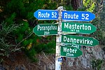
known as 'landeater', played his flute to his loved one". List of New Zealand state highways "TeAra, Wairarapa Region". Retrieved 4 February 2016. Thursday...
11 KB (974 words) - 20:00, 25 August 2024

State Highway 30 marker State Highway 30A marker State Highway 31 marker State Highway 32 marker State Highway 33 marker State Highway 34 marker State Highway...
66 KB (4,809 words) - 23:30, 8 October 2024

State Highway 47 (SH 47) is a New Zealand state highway in the central North Island. It provides a link from SH 4 at National Park to SH 41 at Tokaanu...
4 KB (298 words) - 20:00, 25 August 2024
State Highway 51 (SH 51) is a New Zealand state highway that runs between Napier and Hastings via Clive. Known locally as the Coastal Route, it was the...
8 KB (598 words) - 20:00, 25 August 2024

seat of the Horowhenua District, in the Manawatū-Whanganui region of New Zealand's North Island. It is located east of Lake Horowhenua, around 95 km north...
22 KB (1,583 words) - 06:08, 4 October 2024

New Zealand (Māori: Aotearoa [aɔˈtɛaɾɔa]) is an island country in the southwestern Pacific Ocean. It consists of two main landmasses—the North Island...
267 KB (22,220 words) - 23:53, 7 October 2024