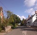
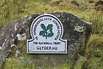
The Sugar Loaf (Welsh: Mynydd Pen-y-fâl) is a hill situated two miles (3.2 km) north-west of Abergavenny in Monmouthshire, Wales, within the Brecon Beacons...
6 KB (648 words) - 13:07, 11 November 2024
List of mountains named Sugarloaf (redirect from Sugar loaf mountain)
Iloilo province Sugar Loaf (Freetown) is a mountain on the edge of the capital city Sugar Loaf, Carmarthenshire, Wales Sugar Loaf, Monmouthshire, Wales Sugarloaf...
6 KB (652 words) - 16:53, 3 August 2024
to a sugarloaf; the nearest is the Sugar Loaf on the border between Powys and Monmouthshire. Photos of Sugar Loaf on Geograph website Morgan, R. 2005...
2 KB (127 words) - 22:50, 2 November 2023
mountains and rivers running by: possible inspiration The Sugar Loaf, Monmouthshire Blorenge, Monmouthshire, with the River Usk running by Markree Castle gardens...
19 KB (2,049 words) - 18:18, 4 November 2024
Sugar Loaf railway station is a railway station in Powys,Wales, and is part of the Heart of Wales Line. It is the most geographically remote station in...
8 KB (712 words) - 10:27, 21 November 2024
and across the Usk valley to Brecon as well as east towards the Sugar Loaf, Monmouthshire above Abergavenny. Tommy Jones' Obelisk is found on its western...
4 KB (494 words) - 23:04, 1 May 2023
Centre, The second largest shopping centre in Wales Ysgyryd Fawr Sugar Loaf, Monmouthshire Offa's Dyke Tintern Abbey Pontypool Park Blaenafon World Heritage...
3 KB (277 words) - 05:04, 11 November 2024
Monmouthshire (/ˈmɒnməθʃər, ˈmʌn-, -ʃɪər/ MON-məth-shər, MUN-, -sheer; Welsh: Sir Fynwy) is a county in the south east of Wales. It borders Powys to...
107 KB (10,424 words) - 18:58, 27 October 2024
19th centuries. It is a scheduled monument in the care of Cadw. Sugar Loaf, Monmouthshire Flickr photo gallery of Y Graig Abandoned Communities: Y Graig...
618 bytes (69 words) - 04:01, 22 April 2022
Abergavenny (redirect from Abergavenny, Monmouthshire)
surrounded by mountains and hills: the Blorenge (559 m, 1,834 ft), the Sugar Loaf (596 m, 1,955 ft), Skirrid Fawr (Great Skirrid), Ysgyryd Fach (Little...
45 KB (5,009 words) - 13:40, 9 November 2024
This is a list of the Sites of Special Scientific Interest (SSSIs) in Monmouthshire. Barbadoes Hill Meadows Blackcliff-Wyndcliff Blaentrothy Meadows Blorenge...
3 KB (237 words) - 13:20, 10 May 2024
Skirrid Fawr (category Mountains and hills of Monmouthshire)
belonged to the National Trust since 1939. The summit offers views of the Sugar Loaf to the west, and Blorenge to the south, and the ridge is easily accessed...
8 KB (755 words) - 07:28, 9 November 2024
Anglo-Welsh border region. Jack is said to have bet the Devil that the Sugar Loaf Mountain was higher than the Malvern Hills. When Jack proved the Devil...
4 KB (570 words) - 16:44, 20 October 2024
more well-known Sugar Loaf. The views from here across the Black Mountains are wide-ranging and also extend eastwards across Monmouthshire. Four ridges run...
2 KB (211 words) - 02:39, 28 March 2024
conspicuous hills of Sugar Loaf, Ysgyryd Fawr and Bryn Arw. The Brownstones also give rise to a major landscape feature in eastern Monmouthshire, a sinuous though...
25 KB (3,434 words) - 07:50, 29 June 2023
Clytha Castle (category Grade I listed buildings in Monmouthshire)
architect was John Davenport of Shrewsbury. The folly has views towards the Sugar Loaf and Skirrid mountains on the easternmost edge of the Brecon Beacons National...
9 KB (859 words) - 18:14, 8 November 2024
Graig Syfyrddin (category Mountains and hills of Monmouthshire)
Edmund's Tump (C) Philip Halling". geograph.org.uk. "Ysgyryd Fawr and Sugar Loaf (C) Philip Halling". geograph.org.uk. www.geograph.co.uk : photos of Graig...
2 KB (147 words) - 11:26, 11 April 2022
The cuisine of Monmouthshire is historically associated with Lady Augusta Hall, also known as Lady Llanover, who published one of the first Welsh cookery...
62 KB (8,812 words) - 12:01, 28 August 2024
Black Mountains, United Kingdom (category Landforms of Monmouthshire)
Outlying summits, all of which are classed as Marilyns, include the Sugar Loaf (Welsh: Pen-y-Fal), Mynydd Troed and Mynydd Llangorse. The lower and separate...
14 KB (1,833 words) - 09:02, 8 November 2024
Abergavenny Priory Deer Park (category Listed buildings in Monmouthshire)
Abergavenny is around 550 acres in extent and stands in the lee of the Sugar Loaf hill to the north of the town. Substantial elements of its boundary walls...
4 KB (346 words) - 04:32, 13 May 2023
village and community within a conservation area in the Welsh county of Monmouthshire. Llanarth is roughly six miles (10 km) east of Abergavenny and four...
6 KB (494 words) - 09:36, 31 October 2024
www.geograph.org.uk. Ian Rushin. "Llanbedr below Sugar Loaf". www.geograph.org.uk. "Monmouthshire & Brecon Canal,... (C) George Tod". www.geograph.org...
17 KB (1,589 words) - 21:37, 16 November 2024
Church of St Mary the Virgin, Llanfair Kilgeddin (category Grade I listed churches in Monmouthshire)
underneath. His designs included local features, including the River Usk, the Sugar Loaf and nearby Llanvihangel Gobion church tower. Sumner's work was completed...
6 KB (476 words) - 15:17, 29 August 2024
Blorenge (category Sites of Special Scientific Interest in Monmouthshire)
from the Blorenge include the Skirrid to the east of Abergavenny and the Sugar Loaf to the north. The high moorland ridge continues to the south of the minor...
13 KB (1,517 words) - 20:26, 17 November 2024
similar route to the A483 through the north of the county, with stops at Sugar Loaf, Llanwrtyd Wells, Llangammarch Wells, Garth and Cilmeri. Builth Road Station...
36 KB (3,766 words) - 14:05, 15 November 2024
Gobannium (category Roman fortifications in Monmouthshire)
valley of the River Usk surrounded by hills and mountains, such as the Sugar Loaf Mountain, Wales, the Skirrid and the Blorenge, just before the valley...
6 KB (642 words) - 21:20, 4 May 2024
4731 (Brecon Beacons) Mountain tracts such as those around Pen y Fan, Sugar Loaf and Ysgyryd Fawr, and glaciated valleys, and waterfalls such as Sgwd Henrhyd...
32 KB (1,007 words) - 06:50, 23 March 2023
have been popular since the late 19th century with the addition of fat, sugar and dried fruit to a longer standing recipe for flat-bread baked on a griddle...
4 KB (329 words) - 18:28, 8 November 2024
Llanwenarth (category Villages in Monmouthshire)
sits in flattish grassy pastures between the Blorenge mountain and the Sugar Loaf Mountain, Wales. Some of these meadows have been designated a Site of...
3 KB (339 words) - 17:40, 17 May 2024
River Gavenny (category Rivers of Monmouthshire)
sometimes the Gavenny River (Welsh: Afon Gafenni) is a short river in Monmouthshire in south Wales. It rises 1 mile (1.6 km) southwest of the village of...
8 KB (1,078 words) - 21:18, 10 November 2024


