
Swisstopo is the official name for the Swiss Federal Office of Topography (in German: Bundesamt für Landestopografie; French: Office fédéral de topographie;...
17 KB (2,188 words) - 10:47, 17 May 2024

National Maps of Switzerland (redirect from Swisstopo maps)
Switzerland, also referred to as the Swisstopo maps, are a set of official map series designed, edited and distributed by Swisstopo, the Swiss Federal Office of...
4 KB (426 words) - 07:44, 5 September 2023
is renamed as the Swiss Federal Office of Topography in 1979, with the swisstopo.ch website online since 1997. The first systematic geographical description...
15 KB (1,944 words) - 16:57, 19 July 2021

mountains of Switzerland accessible by public transport Retrieved from the Swisstopo topographic maps. The key col is the Furggeli (1,732 m). Media related...
2 KB (91 words) - 18:13, 7 July 2024
background Retrieved from the IGN topographic maps [1] Retrieved from the Swisstopo topographic maps [2]. The lowest col between the Jura and the Alps is...
2 KB (127 words) - 15:56, 9 June 2024

Map 1:25 000. Berne, Switzerland: Swiss Federal Office of Topography – swisstopo. 2012. ISBN 978-3-302-01208-7. Retrieved 2016-08-21. "Harder Kulm". Jungfrau...
3 KB (236 words) - 14:47, 4 May 2024
destination of the classic hike: Schynige Platte-Faulhorn-First. Retrieved from the Swisstopo topographic maps Cable car website First on Hikr v t e...
2 KB (69 words) - 16:20, 23 June 2022

Titlis from Pilatus List of mountains of Switzerland Retrieved from the Swisstopo topographic maps [1] and Google Earth. The key col is the Susten Pass...
8 KB (810 words) - 21:15, 28 May 2023

List of highest road passes in Switzerland Albula Pass, Swisstopo topographic maps Swisstopo maps, official maps of Switzerland by the Swiss government...
4 KB (340 words) - 16:06, 2 July 2023

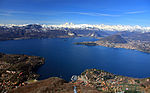
Walensee Looking to the west towards Amden 1:25,000 topographic map (Map). Swisstopo. Retrieved 2014-07-30. Media related to Walensee at Wikimedia Commons...
4 KB (245 words) - 13:03, 9 March 2024

side. It has an elevation of 1,699 metres (5,574 ft) above sea level and is located in the canton of Schwyz. Swisstopo maps Rigi Hochflue on Hikr v t e...
1 KB (71 words) - 11:59, 29 April 2024

Alps, located east of Glarus in the canton of Glarus. Retrieved from the Swisstopo topographic maps. The key col is the Fronalppass (1,852 m) Media related...
1 KB (46 words) - 19:24, 22 January 2022

1:200 000 (in German). Cartography by Swiss Federal Office of Topography swisstopo. Berne, Switzerland: Federal Office for the Environment FOEN. 2014. Retrieved...
95 KB (10,755 words) - 14:06, 15 August 2024

the exit in Geneva According to the Swiss Federal Office of Topography, Swisstopo, Lac de Genève designates that part of the Petit Lac which lies within...
39 KB (2,838 words) - 15:13, 20 July 2024

although dialectically the feminine remains current. Retrieved from the Swisstopo topographic maps. The key col is the Holzegg (1,405 m). "33 Toggenburg"...
3 KB (266 words) - 15:50, 24 July 2022
Liechtenstein for maps and surveying by the Swiss Federal Office of Topography (Swisstopo). A first coordinate system was introduced in 1903 under the name LV03...
7 KB (968 words) - 17:51, 30 December 2023
Colligatarch, the de facto ruler of the world, is located inside Uri Rotstock. Swisstopo maps Google Earth Wikimedia Commons has media related to Uri Rotstock...
1 KB (72 words) - 23:58, 6 May 2022
swisstopo). Berne, Switzerland: Swiss Federal Office of Topography – swisstopo. 28 February 2016. Retrieved 2016-10-04. Retrieved from the Swisstopo topographic...
4 KB (384 words) - 12:01, 29 April 2024

of Schwyz. It lies west of the higher Gross Aubrig. Retrieved from the Swisstopo topographic maps. The key col is located north of the Nüssen at 1,441...
1 KB (55 words) - 22:39, 15 May 2022

Alps north of the Fuorcla da Grialetsch (2,537 m). From the Flüela Pass a trail leads to the summit. Swisstopo maps Flüela Schwarzhorn on Hikr v t e...
2 KB (64 words) - 12:02, 2 May 2022

National Map 1:200'000. Wabern, Switzerland: Federal Office of Topography – swisstopo. ISBN 978-3-302-00003-9. Retrieved 2017-12-11 – via map.geo.admin.ch....
7 KB (583 words) - 18:19, 17 June 2024
"Maggiore, Lake". Merriam-Webster.com Dictionary. Retrieved 28 May 2019. Swisstopo topographic maps. this paragraph is taken largely verbatim from John Ball...
24 KB (2,583 words) - 15:56, 15 August 2024

mountains of Switzerland accessible by public transport Retrieved from the Swisstopo topographic maps. The key col is located north of the Klein Tschuggen...
2 KB (129 words) - 12:34, 30 March 2024

Swiss-French border. It is composed of several summits of which the Dent de Barme is the highest. Swisstopo maps Dents Blanches on Summitpost v t e v t e...
1 KB (47 words) - 18:11, 2 May 2022

Alps. Because of its prominence it was included in the enlarged list of alpine four-thousanders. Swisstopo maps List of Alpine four-thousanders v t e...
1 KB (41 words) - 11:31, 30 April 2024

mountains of Switzerland accessible by public transport Retrieved from the Swisstopo topographic maps and Google Earth. The key col is located east of the...
4 KB (377 words) - 18:43, 7 April 2024
1:25,000 swisstopo topographic maps: "National Map 1:25,000" (official site). Wabern, Switzerland: Federal Office of Topography - swisstopo. 12 March...
61 KB (479 words) - 05:39, 6 July 2024
by a small road. The pass is overlooked by the Ringelspitz and by the Calanda. Swisstopo maps Media related to Kunkelspass at Wikimedia Commons v t e...
1 KB (80 words) - 18:59, 11 May 2022

"Search.ch" (Map). Schulhaus Hofern. Cartography by search.ch, TomTom, swisstopo, osm. Zurich, Switzerland: Tamedia AG. Retrieved 2015-04-23. "Zentrum...
17 KB (1,517 words) - 11:26, 10 July 2024

Bern Parent range Bernese Alps Topo map Swiss Federal Office of Topography swisstopo Geology Mountain type mountain ridge Climbing Easiest route Railway...
6 KB (539 words) - 05:09, 28 September 2021