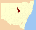
Warren Shire is a local government area in the Orana region of New South Wales, Australia. The Shire is located adjacent to the Macquarie River and the...
7 KB (267 words) - 02:39, 13 September 2024
lists of persons so named Warren may also refer to: Warren (biogeographic region) Warren, New South Wales, a town Warren Shire, a local government area...
4 KB (450 words) - 18:53, 5 November 2024
Dubbo, and is the seat of the Warren Shire local government area. At the 2021 census, Warren had a population of 1,365. Warren is included in the Central...
11 KB (866 words) - 03:07, 12 November 2024
(Shires) Act 1905. The shire office was in Warren. Towns and villages in the shire included Collie and Nevertire. Marthaguy Shire amalgamated with the Municipality...
2 KB (161 words) - 02:39, 13 July 2023
Nevertire (category Warren Shire)
located at the junction of the Mitchell Highway and the Oxley Highway, in Warren Shire. Nevertire is about 496 kilometres northwest of Sydney, 78 km north-west...
5 KB (377 words) - 02:28, 30 November 2023
Bourke Shire, Brewarrina Shire, Narrabri Shire, Walgett Shire, Warrumbungle Shire, Coonamble Shire, Gilgandra Shire, Warren Shire, Bogan Shire, Lachlan...
9 KB (478 words) - 07:36, 27 November 2024
area. As of the 2016 census the shire had an estimated population of 142,667. The mayor of Hornsby Shire is Cr Warren Waddell, a member of the Liberal...
27 KB (2,182 words) - 17:34, 29 November 2024
the Shire of Yarra Ranges local government area. Narre Warren East recorded a population of 434 at the 2021 census. Despite its name, Narre Warren East...
3 KB (182 words) - 06:08, 5 December 2024
Billabulla, New South Wales is a rural locality of Warren Shire and a civil parish of Gregory County, New South Wales, a Cadastral divisions of New South...
1 KB (110 words) - 12:28, 23 December 2021
Wirrigai is a rural locality of Warren Shire 31°39′54″S 147°56′04″E a few miles north of Warren, New South Wales Driel is also a civil Parish of Ewenmar...
1 KB (133 words) - 21:05, 21 November 2020
north west of the state capital Sydney. It is part of Narromine Shire and Warren Shire local government area. As of the 2021 Australian census, 38 people...
2 KB (134 words) - 17:18, 25 June 2023
Carual Parish (Oxley County), New South Wales is a rural locality of Warren Shire and a civil parish of Oxley County, New South Wales, a Cadastral divisions...
4 KB (418 words) - 04:58, 7 September 2024
Yarrawell Parish is a civil parish of Gregory County, New South Wales in Warren Shire located at 31°11'04.0"S 147°39'51.0"E. in New South Wales. "Gregory County"...
575 bytes (67 words) - 05:01, 20 September 2023
Duffity Parish is a civil parish of Gregory County, New South Wales in Warren Shire located at 31°11'04.0"S 147°39'51.0"E. in New South Wales. "Gregory County"...
585 bytes (67 words) - 23:55, 26 September 2023
Macquarie River on the west and the Castlereagh River on the east, between Warren and Gilgandra. The name derives from a local Aboriginal word. A full list...
9 KB (92 words) - 19:14, 1 June 2024
Snakes Plain, New South Wales (category Warren Shire)
approximately 11 kilometres (6.8 mi) south-west of Warren on the Oxley Highway in the local government area of Warren Shire, part of the Orana region of New South...
3 KB (177 words) - 21:49, 24 April 2021
locality of Warren Shire and is in the civil parish of County of Ewenmar. Killendoon is on the Ewenma Creek Macquarie River outside Warren, New South Wales...
3 KB (346 words) - 21:01, 21 November 2020
Driel is a rural locality of Warren Shire 31°39′54″S 147°56′04″E a few miles north of Warren, New South Wales Driel is also a civil Parish]] of Ewenmar...
2 KB (237 words) - 21:00, 21 November 2020
a rural locality of Warren Shire and it is a civil parish of County of Ewenmar Wambianna is on the Macquarie River east of Warren, New South Wales. "Ewenmar...
1 KB (103 words) - 21:04, 21 November 2020
Mumblebone, New South Wales is a rural locality of Warren Shire and a civil parish of Gregory County, New South Wales, a Cadastral divisions of New South...
1 KB (109 words) - 21:03, 21 November 2020
Dooran Parish (Oxley County), New South Wales is a rural locality of Warren Shire and a civil parish of Oxley County, New South Wales, a Cadastral divisions...
2 KB (224 words) - 03:26, 20 December 2022
Mumbrabah Parish (Oxley County), New South Wales is a rural locality of Warren Shire and a civil parish of Oxley County, New South Wales, a Cadastral divisions...
2 KB (226 words) - 20:50, 19 January 2023
The Shire of Etheridge is a local government area in Far North Queensland, Australia in what is known as the Savannah Gulf region. Its economy is based...
9 KB (600 words) - 00:50, 22 June 2024
Beelban Parish (Oxley County), New South Wales is a rural locality of Warren Shire and a civil parish of Oxley County, New South Wales, a Cadastral divisions...
3 KB (251 words) - 03:43, 1 August 2023
the Macquarie River on the east. This is the area approximately between Warren and Nyngan. Oxley County was named in honour of Surveyor-General and explorer...
7 KB (118 words) - 06:57, 6 August 2024
Beardina Parish (Oxley County), New South Wales is a rural locality of Warren Shire and a civil parish of Oxley County, New South Wales, a Cadastral divisions...
2 KB (223 words) - 03:34, 19 May 2024
Willoi) Ballaree Warren Shire 30°29′54″S 147°18′04″E / 30.49833°S 147.30111°E / -30.49833; 147.30111 (Ballaree) Beemery Bourke Shire 29°56′31″S 146°26′28″E...
13 KB (151 words) - 07:10, 6 August 2024
away with "Mudgee Shire" (now a part of Central West Region), and "Coolah" and "Coonabarabran" shires have merged into Warrumbungle Shire. "About us". Regional...
7 KB (478 words) - 08:50, 19 December 2024
Egelabra, New South Wales (category Warren Shire)
rural locality of Warren Shire. The parish is on Crooked Creek and also on the Macquarie River east of Nyngan, and outside of Warren, New South Wales....
4 KB (418 words) - 05:33, 7 April 2023
Cajildry Parish (Oxley County), New South Wales is a rural locality of Warren Shire and a civil parish of Oxley County, New South Wales, a Cadastral divisions...
2 KB (216 words) - 03:03, 13 July 2024


