
The Aboriginal Shire of Doomadgee is a special local government area in North West Queensland, Queensland, Australia. It is managed under a Deed of Grant...
9 KB (849 words) - 07:33, 21 June 2024
coordinates) GPX (secondary coordinates) Doomadgee is a town and a locality in the Aboriginal Shire of Doomadgee, Queensland, Australia. It is a mostly...
23 KB (2,232 words) - 23:20, 18 August 2024

The Aboriginal Shire of Doomadgee lies inside Burke Shire to the west of Burketown. It also includes Gregory Downs. In the 2021 census, the Shire of Burke...
14 KB (1,230 words) - 23:59, 21 June 2024
Gangalidda, Queensland (category Aboriginal Shire of Doomadgee)
Gangalidda is a coastal locality in the Aboriginal Shire of Doomadgee, Queensland, Australia, on the Gulf of Carpentaria. In the 2021 census, Gangalidda...
7 KB (482 words) - 17:03, 25 July 2024

Gulf Country (redirect from Frontier Justice: A History of the Gulf Country to 1900)
towards Alexandria station, Doomadgee, and Nicholson River. It includes the local government area of the Aboriginal Shire of Doomadgee. Wanamarra (also known...
19 KB (1,961 words) - 17:45, 2 December 2023

The Aboriginal Shire of Palm Island is a special local government area of Queensland, Australia, managed by the Palm Island Aboriginal Shire Council under...
23 KB (1,947 words) - 07:50, 21 June 2024
Waanyi language (category Articles incorporating text from the State Library of Queensland)
towards Alexandria station, Doomadgee, and Nicholson River. It includes the local government area of the Aboriginal Shire of Doomadgee. Words and phrases from...
4 KB (235 words) - 23:21, 23 September 2024
The Aboriginal Shire of Cherbourg is a local government area in Wide Bay–Burnett, Australia. In the 2021 census, the Aboriginal Shire of Cherbourg had...
6 KB (510 words) - 07:32, 21 June 2024

The Aboriginal Shire of Kowanyama is a special local government area which is located on western Cape York Peninsula in Queensland, Australia. It is managed...
11 KB (1,016 words) - 07:40, 21 June 2024

The Aboriginal Shire of Pormpuraaw is a special local government area which is located on western Cape York Peninsula in Queensland, Australia. It is...
9 KB (744 words) - 07:52, 21 June 2024

The Aboriginal Shire of Yarrabah is a special local government area in Far North Queensland, Queensland, Australia, east and southeast of Cairns on Cape...
6 KB (489 words) - 07:54, 21 June 2024

Mornington Island (redirect from Mirndiyan Gununa Aboriginal Corporation)
Australian Aboriginal language spoken on Mornington Island and the Northern Wellesley Islands, within the local government boundaries of the Mornington Shire. Kuku-Thaypan...
38 KB (3,475 words) - 04:00, 1 September 2024
areas of the Aboriginal Shire of Doomadgee and Shire of Mornington. In the 2001 census, the Shire of Mornington had a population of 934 people, of whom...
9 KB (759 words) - 01:38, 22 June 2024
The Wujal Wujal Aboriginal Shire is a local government area in Far North Queensland, Australia. It is managed as a Deed of Grant in Trust under the Local...
7 KB (582 words) - 04:07, 22 June 2024
The Aboriginal Shire of Woorabinda is a local government area in Central Queensland, Australia. In the 2021 census, the Aboriginal Shire of Woorabinda...
11 KB (693 words) - 07:53, 21 June 2024
Aboriginal Shire of Doomadgee Shire of Douglas Shire of Etheridge Aboriginal Shire of Hope Vale Aboriginal Shire of Kowanyama Aboriginal Shire of Lockhart River...
119 KB (3,274 words) - 20:57, 10 October 2024
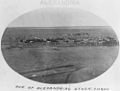
Alexandria Station (Northern Territory) (category Articles incorporating text from the State Library of Queensland)
towards Alexandria Station, Doomadgee, and Nicholson River. It includes the local government area of the Aboriginal Shire of Doomadgee. A murder was committed...
12 KB (1,406 words) - 10:12, 9 September 2024

Queensland, see List of former local government areas of Queensland. Queensland portal List of former local government areas of Queensland List of places in Queensland...
28 KB (185 words) - 09:12, 8 August 2024
In Australia: The larger of the two parts of the Aboriginal Shire of Doomadgee in Queensland is surrounded by the Shire of Burke. Except for the ocean...
380 KB (34,981 words) - 16:20, 11 October 2024

The Shire of Noosa (/ˈnuːsə/) is a local government area about 130 kilometres (81 mi) north of Brisbane in the Sunshine Coast district of South East Queensland...
37 KB (3,125 words) - 03:02, 27 September 2024

the Shire of Burdekin had a population of 16,692 people. Yuru (also known as Juru, Euronbba, Juru, Mal Mal, Malmal) is an Australian Aboriginal language...
15 KB (787 words) - 23:54, 21 June 2024
The Aboriginal Shire of Lockhart River is a local government area in Far North Queensland, Australia. In the 2021 census, the Aboriginal Shire of Lockhart...
5 KB (300 words) - 07:42, 21 June 2024
Nicholson, Queensland (category Shire of Burke)
Australian Aboriginal language. The Yukulta language region is the Gulf Country including the local government areas of the Aboriginal Shire of Doomadgee and...
5 KB (442 words) - 17:46, 25 July 2024
Nicholson River (Queensland) (category Articles incorporating text from the State Library of Queensland)
river in the Northern Territory and the state of Queensland, Australia. The Aboriginal mission at Doomadgee was also historically referred to as located...
9 KB (739 words) - 09:26, 24 September 2024
Aboriginal Shire of Napranum Aboriginal Shire of Pormpuraaw Aboriginal Shire of Yarrabah Aboriginal Shire of Doomadgee Aboriginal land councils in the Northern...
23 KB (1,597 words) - 10:55, 23 May 2024

Lawn Hill, Queensland (category Shire of Burke)
towards Alexandria station, Doomadgee, and Nicholson River. It includes the local government area of the Aboriginal Shire of Doomadgee. Yulluna (also known as...
16 KB (1,850 words) - 00:21, 18 June 2024

The Aboriginal Shire of Hope Vale is a local government area in Far North Queensland, Queensland, Australia, north of the town of Cooktown. The majority...
8 KB (628 words) - 06:02, 10 July 2024

Queensland including the local government areas of the City of Mount Isa. On 10 February 1914, the Shire of Barclay Tableland, based in Camooweal, was incorporated...
14 KB (946 words) - 02:29, 4 October 2024

Burketown (category Shire of Burke)
12 October 2020. "Doomadgee Aboriginal Shire Council". Queensland Places. Centre for the Government of Queensland at the University of Queensland. Archived...
41 KB (3,935 words) - 08:07, 18 July 2024

the Town of Cooktown (the successor to the Borough of Cooktown) was absorbed back into Cook Shire. Prior to 2005, a number of Aboriginal communities...
19 KB (1,725 words) - 00:10, 22 June 2024