
State Route 95 (SR 95) is a north–south state highway along the western edge of Arizona that is split into two sections. The southern segment begins in...
10 KB (571 words) - 00:29, 15 February 2025

U.S. Route 95 (US 95) is a major U.S. Highway in the American state of Arizona. Starting at the Mexican border in San Luis, US 95 acts as the main highway...
33 KB (3,937 words) - 05:35, 18 January 2025

State Route 72 (SR 72) is a 36.74-mile-long (59.13 km) state highway in the U.S. state of Arizona. It runs from SR 95 near Parker southeast to U.S. Route...
10 KB (914 words) - 06:46, 14 January 2025

through Quartzsite which is at the intersection of U.S. Route 95 and Arizona State Route 95 with I-10. Quartzsite's current location was the site of...
25 KB (1,981 words) - 06:10, 3 February 2025

U.S. roads portal Arizona State Route 95 This disambiguation page lists articles associated with the title California State Route 95. If an internal link...
593 bytes (88 words) - 21:20, 14 February 2025
1984-11-A-075". Arizona Department of Transportation. Retrieved May 6, 2015. Establish San Luis streets state highway and designate U.S. 95 Truck Route. Arizona Department...
13 KB (1,115 words) - 05:00, 18 January 2025

Arizona State Route 202 (SR 202) or Loop 202 (202L) is a semi-beltway circling the eastern and southern areas of the Phoenix metropolitan area in central...
45 KB (3,311 words) - 16:06, 10 January 2025
U.S. Route 95 (US 95) is a major north–south United States Highway in the western United States. It travels through the states of Arizona, California,...
23 KB (2,395 words) - 03:28, 14 February 2025

northern boundary of the Joshua Tree National Park to meet Arizona State Route 95 in Parker, Arizona. East of Twentynine Palms, there is a sign warning drivers...
9 KB (1,290 words) - 22:29, 14 January 2025

connects the town of Laughlin to the rest of the state via U.S. Route 95 (US 95). SR 163 and Arizona State Route 95 provide the next closest public Colorado River...
6 KB (497 words) - 15:36, 23 February 2024

toward Coolidge, passing by the town of Eloy. In Coolidge, State Route 87 is known as Arizona Boulevard. The highway leaves Coolidge heading northwest and...
12 KB (731 words) - 06:46, 14 January 2025

Arizona State Route 101 (SR 101) or Loop 101 is a semi-beltway looping around the Phoenix Metropolitan Area in central Arizona, United States. It connects...
25 KB (1,725 words) - 06:44, 14 January 2025

State Route 68, also known as SR 68, is an east–west highway in northwestern Arizona running from its western terminus at its junction with State Route...
6 KB (413 words) - 06:46, 14 January 2025
summary of the former state routes in Arizona, including mileage tables and maps. Between the establishment of Arizona's numbered state highway system in...
93 KB (8,932 words) - 06:51, 15 January 2025

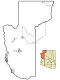
south of the Headgate Rock Dam and Moovalya Lake. Arizona State Route 95 and California State Route 62 (across the Colorado River) serve the city. According...
19 KB (1,615 words) - 20:59, 18 January 2025
village is bordered by the Mohave Valley CDP. Arizona State Route 95 touches the northwest corner of Arizona Village, leading southwest across the Colorado...
8 KB (676 words) - 00:01, 29 January 2025

593489). It is bordered to the south by the CDP of Mohave Valley. Arizona State Route 95 forms the western edge of the CDP; it leads north 15 miles (24 km)...
6 KB (484 words) - 19:03, 19 April 2024

drained by the Colorado River. The CDP is on the east side of Arizona State Route 95, which leads 3 miles (5 km) north to Fort Mohave, 16 miles (26 km)...
10 KB (930 words) - 21:38, 4 October 2024

Lake Havasu formed by the Bill Williams River, is Mohave County. Arizona State Route 95 runs through the length of Parker Strip, leading north 23 miles...
7 KB (601 words) - 18:05, 19 April 2024

Indian Reservation. Fort Mohave is in western Mohave County along Arizona State Route 95. It is bordered to the north by Bullhead City, to the west by the...
11 KB (1,002 words) - 21:37, 4 October 2024

west across the Colorado by San Bernardino County, California. Arizona State Route 95 runs along the eastern edge of the community, leading north 18 miles...
7 KB (555 words) - 21:38, 4 October 2024
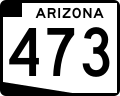
State Route 473, also known as SR 473, is a state highway in east-central Arizona, United States, that travels from State Route 260 to Hawley Lake. Hawley...
4 KB (332 words) - 06:45, 14 January 2025

west, across the Colorado, by San Bernardino County, California. Arizona State Route 95 runs along the eastern edge of the CDP, leading south 4 miles (6 km)...
7 KB (644 words) - 18:03, 19 April 2024

State Route 85 (SR 85) is a 128.86-mile-long (207.38 km) state highway in the U.S. state of Arizona. The highway runs from the United States–Mexico border...
22 KB (1,746 words) - 18:02, 14 December 2024

Arizona is a state in the Southwestern region of the United States, sharing the Four Corners region of the western United States with Colorado, New Mexico...
163 KB (13,914 words) - 18:09, 15 February 2025
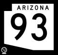
Arizona State Route 93, abbreviated SR 93, was a state highway in Arizona that existed from 1946 to 1991. The route was co-signed with other highways...
26 KB (2,185 words) - 00:29, 15 February 2025

water. The only surface access to Lake Havasu City is by road via Arizona State Route 95, which meets Interstate 40 19 miles (31 km) to the north of the...
31 KB (2,804 words) - 06:54, 30 January 2025
state of Arizona's State Routes are usually abbreviated as SR. The Arizona State Highway system was introduced on September 9, 1927, by the State Highway...
50 KB (1,442 words) - 23:22, 15 January 2025
State Route 30 (formerly State Route 801), also known as the I-10 Reliever, is a planned state highway in the southwest parts of Phoenix, Arizona and nearby...
16 KB (1,523 words) - 17:22, 6 November 2024

before merging with U.S. Route 95 (US 95) past the interchange with Nevada State Route 173. These three routes (I-11 / US 93 / US 95) then curve northwest...
28 KB (2,686 words) - 10:38, 26 January 2025