State Road 589 (SR 589), also known as the Veterans Expressway and Suncoast Parkway, is a controlled-access toll road near the Florida Gulf Coast. Maintained...
35 KB (2,789 words) - 19:38, 25 August 2024

by Florida State Road 589 (the Suncoast Parkway), to the south across Florida State Road 50 by Spring Hill, and to the west by High Point. SR 589 leads...
10 KB (592 words) - 21:46, 7 July 2023

State Road 60, or Route 60 (SR 60 Route 60) is an east–west route transversing Florida from the Gulf of Mexico to the Atlantic Ocean. The western terminus...
43 KB (3,640 words) - 19:45, 25 August 2024
The following is a list of state roads in the U.S. state of Florida. Only the length of state-maintained roads is given; occasionally a locally maintained...
111 KB (96 words) - 00:53, 25 May 2024

North Dale Mabry Highway (Florida State Road 597) forms the eastern edge of the CDP, and Veterans Expressway (Florida State Road 589) forms the southwest border...
10 KB (690 words) - 21:37, 12 July 2023
State Road 568 (SR 568) is a short freeway stub of the Veterans Expressway (SR 589) north of Tampa. The road was built in 1994, but was reassigned as SR 568...
5 KB (376 words) - 19:17, 25 August 2024

Bypass Florida State Road 570 – Polk Parkway Florida State Road 589 – Veteran's Expressway Florida State Road 618 – Selmon Expressway Major Surface Arterials:...
43 KB (3,732 words) - 16:34, 4 August 2024
Florida's state roads were renumbered. The old system numbered routes in the order they were legislated, while the new system used a grid. State Road...
23 KB (67 words) - 16:42, 5 August 2024

State Road 580 (SR 580) is a major commercial and commuter route serving northern Pinellas and central Hillsborough County, Florida, The western terminus...
9 KB (397 words) - 19:38, 25 August 2024

West Shore Blvd. State Road 616 was originally a free section of State Road 589 when SR 60/589 overlapped between Exits 1 and 2A. SR 589 was planned to...
3 KB (222 words) - 19:44, 25 August 2024
1957. Most toll roads have state road designations with a special toll shield, including the Turnpike and Homestead Extension. Florida's Turnpike Enterprise...
30 KB (750 words) - 20:16, 18 August 2024
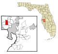
to the south by Town 'n' Country, and to the west by Westchase. Florida State Road 589 (Veterans Expressway) crosses the CDP from north to south. According...
12 KB (860 words) - 07:23, 2 May 2024

State Road 50 (SR 50) runs across the center of the U.S. state of Florida through Orlando, with its termini at SR 55 (US 19) at Weeki Wachee and SR 5...
45 KB (4,433 words) - 19:43, 25 August 2024

all Florida roads with federal designations, the entirety of US 19 has a hidden Florida Department of Transportation (FDOT) designation: State Road 55...
48 KB (3,133 words) - 12:58, 5 August 2024

State Road 44 (SR 44) is an east–west state highway in the U.S. state of Florida. It runs from Crystal River on the Gulf of Mexico east to New Smyrna Beach...
30 KB (2,834 words) - 19:46, 25 August 2024

State Road 52 (SR 52) is the major east–west road through northern Pasco County, Florida. The road begins in Bayonet Point at US 19 (SR 55), passes south...
14 KB (1,045 words) - 19:37, 25 August 2024

State Road 78 (SR 78) is the Florida Department of Transportation designation of the highway that historically extended from Pine Island Center on the...
18 KB (1,408 words) - 19:32, 25 August 2024
earliest evidence found of the old state road system is on a 1917 State Road Department map; in 1923 the Florida State Legislature began writing the routes...
31 KB (307 words) - 18:29, 25 August 2024
The following is a list of county roads in Hernando County, Florida. All county roads are maintained by the county in which they reside. Unsigned routes...
51 KB (6,500 words) - 03:36, 14 February 2024

State Road 69 (SR 69) is a road running through Calhoun and Jackson counties in northwest Florida. The road is almost entirely two-lanes wide. State Road...
12 KB (1,359 words) - 19:19, 25 August 2024
KML file (edit • help) Template:Attached KML/Florida State Road 845 KML is from Wikidata Media related to Florida State Road 845 at Wikimedia Commons...
8 KB (583 words) - 19:36, 25 August 2024

Florida's Turnpike Enterprise (FTE) is a unit of the Florida Department of Transportation that operates toll roads in Florida. The current executive director...
6 KB (560 words) - 09:59, 6 June 2024

Branchborough. State Road 54A, known locally as Black Lake Road, is a road located in Odessa, Florida totaling 1.097 miles (1.765 km). Portions of the road were...
13 KB (1,152 words) - 19:37, 25 August 2024

U.S. Route 92 (redirect from State Road 600 (Florida))
Lakeland to the route's eastern terminus at State Road A1A in Daytona Beach. State Road 517 (formerly Florida State Road 600B) from George Jenkins Boulevard (SR...
40 KB (3,370 words) - 01:31, 26 June 2024

Association of State Highway and Transportation Officials (AASHTO) in Florida, US 41 always carries a hidden state road number designated by the Florida Department...
78 KB (5,301 words) - 14:15, 12 August 2024
The following is a list of county roads in Hillsborough County, Florida. All county roads are maintained by the county in which they reside, however not...
17 KB (83 words) - 11:58, 9 July 2023

Dale Mabry Highway (redirect from State Road 597 (Florida))
Dale Mabry Highway is a north–south road in Tampa, Florida. The majority of its length consists of three lanes each direction plus a central turn-lane...
13 KB (1,194 words) - 06:53, 28 July 2024

file (edit • help) Template:Attached KML/Florida State Road 710 KML is not from Wikidata Media related to Florida State Road 710 at Wikimedia Commons...
7 KB (407 words) - 19:36, 25 August 2024
List of highways numbered 9A (redirect from Florida state road 9A)
road, a branch of the EO9 from Kalo Nero to the A7 motorway at Kalyvia, Messenia Connecticut Route 9A (former) Delaware Route 9A Florida State Road 9A...
1 KB (111 words) - 16:34, 27 August 2024

Thomas E. Will Memorial Highway by the Florida Legislature in 1937 when that portion was known as State Road 26 (SR 26). Thomas E. Will, the founder...
64 KB (3,892 words) - 12:06, 28 April 2024