
State Route 204 (SR 204) is a 32.4-mile-long (52.1 km) state highway in the east-central part of the U.S. state of Georgia. It runs from a point east of...
10 KB (780 words) - 00:47, 5 August 2024

renumbered. State Route 204 Spur (SR 204 Spur) was a spur route of SR 204 that connected the mainline to Skidaway Island. Segments of SR 204 Spur are named...
131 KB (11,471 words) - 22:52, 6 February 2024
Highway 204 National Route 204 Route 204 Japan National Route 204 Alabama State Route 204 Arkansas Highway 204 (former) California State Route 204 Florida...
2 KB (179 words) - 23:00, 4 April 2024

State Route 25 (SR 25) is a state highway in the eastern part of the U.S. state of Georgia. It travels south-to-north near the Atlantic Ocean, serving...
65 KB (6,805 words) - 10:54, 23 May 2024

KML/Georgia State Route 21 KML is from Wikidata Media related to Georgia State Route 21 at Wikimedia Commons Georgia Roads (Routes 21 - 40) State Route 21...
51 KB (5,150 words) - 17:06, 25 July 2024
Florida to US 1/SR 4 in Wadley, Georgia, through the Panhandle of Florida and the southern portion of Georgia. The route starts as a two-lane highway at...
40 KB (2,094 words) - 02:52, 12 October 2024

State Route 30 (SR 30) is a 229.8-mile-long (369.8 km) state highway that travels west-to-east through portions of Marion, Sumter, Crisp, Wilcox, Dodge...
38 KB (2,827 words) - 11:15, 5 May 2024

The State Routes in the U.S. state of Georgia (typically abbreviated SR) are maintained by the Georgia Department of Transportation (GDOT). Routes from...
301 KB (3,329 words) - 03:22, 28 July 2024

State Route 23 (SR 23) is a 240.0-mile-long (386.2 km) state highway that travels south-to-north through portions of Charlton, Brantley, Wayne, Long, Tattnall...
31 KB (2,718 words) - 15:18, 20 July 2024

State Route 26 (SR 26) is a 271.1-mile-long (436.3 km) state highway that travels west-to-east through portions of Chattahoochee, Marion, Schley, Macon...
75 KB (7,271 words) - 05:25, 19 September 2024

State Route 204 (SR 204) is a 9.620-mile (15.482 km) highway that runs from U.S. Route 431 (US 431) at Crystal Springs (just north of Wellington) to SR...
4 KB (455 words) - 00:16, 16 February 2024

20-mile-long (199.88 km) United States Numbered Highway in the U.S. state of Georgia. It travels south–north near the Atlantic Ocean, serving the Brunswick...
47 KB (4,695 words) - 19:21, 6 September 2024

County, Georgia, United States. It is on the outskirts of Savannah, It is located on Georgia Route 204 about 7 miles (11 km) east of Pembroke, Georgia, and...
2 KB (270 words) - 05:26, 10 November 2023

State Route 4 (SR 4) is a state highway in the eastern part of the U.S. state of Georgia. Except for its portion north of U.S. Route 78 (US 78), it is...
70 KB (7,790 words) - 23:34, 19 July 2024

Interstate 75 (I-75) in the US state of Georgia travels north–south along the U.S. Route 41 (US 41) corridor in the central part of the state, traveling through the...
61 KB (3,596 words) - 19:05, 30 September 2024

Darien, and Woodbine. I-95 in Georgia has the unsigned designation of State Route 405 (SR 405). All of I-95 in Georgia has three lanes in each direction...
24 KB (1,888 words) - 17:15, 25 July 2024

Interstate 16 (redirect from Georgia State Route 404)
Interstate Highway located entirely within the US state of Georgia. It carries the hidden designation of State Route 404 (SR 404) for its entire length. I-16 travels...
56 KB (4,735 words) - 05:39, 11 September 2024
triangular area bounded by Little Neck Road to the northeast, Georgia State Route 204 (the Abercorn Expressway) to the south, and Interstate 95 to the...
13 KB (499 words) - 23:45, 30 April 2024
Harry S. Truman Parkway (category Infobox road instances in Georgia (U.S. state))
north–south freeway through the Savannah metropolitan area between Georgia State Route 204 (SR 204; Abercorn Street) and President Street. Originally dubbed the...
25 KB (3,548 words) - 13:49, 24 October 2023

and Iberia, that formed the nucleus of the modern Georgian state. In the early fourth century, Georgians officially adopted Christianity, which contributed...
231 KB (21,768 words) - 00:41, 8 October 2024

U.S. Route 280 (US 280) is a spur of U.S. Highway 80. It currently runs for 392 miles (631 km) from Blitchton, Georgia, at US 80 to Birmingham, Alabama...
33 KB (1,195 words) - 09:25, 17 May 2024

Santa Claus is a city in Toombs County, Georgia, United States. The population was 204 at the 2020 census. It is part of the Vidalia micropolitan area...
8 KB (283 words) - 04:30, 10 June 2024

State Route 298 (SR 298) is a short northwest-southeast state highway located in the east-central part of the U.S. state of Georgia. The route travels...
4 KB (267 words) - 04:14, 7 March 2023

State Route 206 (SR 206) is a state highway in the southeastern part of U.S. state of Georgia. It runs southeast–northwest through portions of Ben Hill...
7 KB (355 words) - 22:01, 4 August 2024
WEAS-FM (category Georgia (U.S. state) radio station stubs)
(ERP) of 96,640 watts. The transmitter is off Fort Argyle Road (Georgia State Route 204), west of Savannah, in unincorporated Chatham County. WEAS-FM signed...
4 KB (387 words) - 07:09, 12 July 2024

Interstate 59 (redirect from Georgia State Route 406)
north–south route that spans 445.23 miles (716.53 km) from a junction with I-10 and I-12 at Slidell, Louisiana, to a junction with I-24 near Wildwood, Georgia. The...
35 KB (1,354 words) - 12:55, 25 September 2024

S. Highway 1 (US 1) in the U.S. state of Georgia, which is concurrent for almost its entire length with State Route 4 (SR 4), is a highway traversing...
60 KB (6,463 words) - 23:34, 27 August 2024

in the U.S. state of Georgia. It travels south-to-north through the western part of the state near the Alabama state line. The whole route is Governor's...
55 KB (4,356 words) - 17:47, 18 September 2024
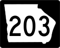
State Route 203 (SR 203) is a 46.7-mile-long (75.2 km) Arc shaped state highway in the southeastern part of the U.S. state of Georgia. Its routing is within...
5 KB (251 words) - 00:47, 5 August 2024

State Route 90 (SR 90) is a 155-mile-long (249 km) state highway that travels southeast-to-northwest through portions of Atkinson, Coffee, Irwin, Ben Hill...
25 KB (1,189 words) - 17:05, 25 July 2024