
Gila River Memorial Airport was a private-use airport owned and operated by the Gila River Indian Community, located 4 miles (3.5 nmi; 6.4 km) southwest...
6 KB (523 words) - 18:10, 29 December 2023
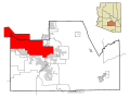
The Gila River Indian Community (GRIC) (O'odham language: Keli Akimel Oʼotham, meaning "Gila River People", Maricopa language: Pee-Posh) is an Indian reservation...
14 KB (1,326 words) - 22:58, 12 June 2024
is a list of airports in Arizona (a U.S. state), grouped by type and sorted by location. It contains all public-use and military airports in the state...
24 KB (565 words) - 15:38, 20 December 2023
Phoenix Regional Airport, Pleasant Valley Airport, Estrella Sailport, Stellar Airpark, Skyranch at Carefree, Gila River Memorial Airport, Pegasus Airpark...
42 KB (3,639 words) - 02:44, 7 July 2024

States. The town is named for an approximately 90-degree bend in the Gila River, which is near the community's current location. As of the 2020 census...
27 KB (2,630 words) - 20:46, 19 April 2024

Williams Air Force Base (category Airports in Maricopa County, Arizona)
111.91306°W / 33.24333; -111.91306 (Goodyear Field) Today: Gila River Memorial Airport (FAA LID: 34AZ) southwest of Chandler, Arizona. Williams Auxiliary...
39 KB (4,875 words) - 07:56, 9 February 2024

built near Chandler. Would become Chandler Memorial Airport, and is currently known as Gila River Memorial Airport. 1943 Camp Papago Park (POW camp) opens...
136 KB (13,166 words) - 23:09, 22 July 2024

the county. The largest are the Salt River Pima–Maricopa Indian Community (east of Scottsdale) and the Gila River Indian Community (south of Chandler)...
58 KB (4,075 words) - 03:26, 18 August 2024
Coolidge Now: Coolidge Municipal Airport (FAA LID: P08) Winslow Municipal Airport, Winslow Now: Winslow–Lindbergh Regional Airport (IATA: INW, ICAO: KINW) Fourth...
17 KB (527 words) - 17:28, 29 May 2024
the Gila River Indian Community, approximately where the Salt River joins the Gila River. The road reappears on the other side of the Gila River at an...
60 KB (7,281 words) - 03:14, 13 August 2024
Globe, Arizona (category Cities in Gila County, Arizona)
city in Gila County, Arizona, United States. As of the 2020 census, the population of the city was 7,249. The city is the county seat of Gila County....
31 KB (2,977 words) - 03:36, 21 April 2024
KGXF – Gila Bend Air Force Auxiliary Field – Gila Bend, Arizona KGXY – Greeley-Weld County Airport – Greeley, Colorado KGYB – Giddings-Lee County Airport –...
177 KB (15,594 words) - 15:34, 4 July 2024
Candy Co. factory tour Camelback Ranch Elsie McCarthy Sensory Garden Gila River Arena Glendale Chocolate Festival (every February) Glendale Folk & Heritage...
35 KB (3,061 words) - 15:08, 23 July 2024

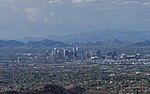
Phoenix, Arizona (redirect from Salt River Valley Herald)
1867 as an agricultural community near the confluence of the Salt and Gila Rivers and was incorporated as a city in 1881. It became the capital of Arizona...
204 KB (19,425 words) - 16:29, 16 August 2024

33.05417; -110.90889 (33.054160, -110.908857). The town sits near the Gila River in the Copper Basin area along with its sister cities, Hayden and Winkelman...
10 KB (830 words) - 15:41, 19 April 2024
United States. 1–300 – Hohokam establish several villages along the Gila River. 300 – Ceramics appear in the Hohokam culture. 450 – Pueblo Grande settled...
72 KB (6,652 words) - 11:12, 22 July 2024

Imperial County, California (section Airports)
located in the bottoms near the Colorado River, less than 1 mile (1.6 km) below the mouth of the Gila River. It was to defend the newly settled community...
85 KB (6,098 words) - 20:56, 23 July 2024

Arizona State Route 77 (category Gila River)
through town, then parallels the western bank of the Gila River to the northeast. After following the river for 7 miles (11 kilometres), SR 77 curves northwest...
23 KB (1,927 words) - 21:54, 4 August 2024

Kingman Airport (IATA: IGM, ICAO: KIGM, FAA LID: IGM) is a city-owned, public-use airport located 9 miles (7.8 nmi; 14 km) northeast of the central business...
27 KB (3,018 words) - 18:33, 7 July 2024

1927 bridge across the Gila River next to the Gillespie Dam Agua Caliente, Arizona Arizona State Capitol, Phoenix Tom Mix Memorial, near Florence Tucson...
112 KB (12,533 words) - 01:45, 5 August 2024
towns in Arizona commons:Category:Ghost towns in Arizona Gila monster Gila River Gila trout Gila woodpecker Glen Canyon Glen Canyon Dam Gold cyanidation...
25 KB (2,225 words) - 21:34, 9 March 2024

Glen Canyon National Recreation Area (category Protected areas on the Colorado River)
access to Lake Powell via five marinas, four public campgrounds, two small airports, and numerous houseboat rental concessions. The geology of the area is...
8 KB (597 words) - 20:52, 13 August 2024

History of Phoenix, Arizona (redirect from Salt River Valley Town Association)
airport Sky Harbor, which was formally dedicated on Labor Day in 1929. On March 4, 1930, Former President Calvin Coolidge dedicated a dam on the Gila...
80 KB (9,588 words) - 06:01, 15 August 2024

Mobile, Rainbow Valley, and Tonopah, as well as to the contract cities of Gila Bend and Litchfield Park. District Two also includes portions of Avondale...
23 KB (1,956 words) - 20:14, 23 July 2024
Tucumcari and 75 miles (121 km) southeast of Las Vegas. The Conchas Lake Airport is located on NM 104 east of the lake, and Conchas Lake Seaplane Base is...
3 KB (210 words) - 06:11, 1 August 2023

Lincoln National Forest (section Airports)
New Mexico Las Cruces, New Mexico El Paso, Texas Sierra Blanca Regional Airport, located about 15 miles (24 km)northwest of Ruidoso The following major...
44 KB (5,680 words) - 06:12, 10 August 2024
Caliente, Arizona, in Maricopa County, Arizona, a place north of the Gila River near Hyder, Arizona ( "hot water". The place is nearby hot springs which...
148 KB (19,033 words) - 01:59, 25 July 2024
border with the Gila River Indian Community. Interstate 17 enters the Valley from the north as the Black Canyon Freeway, in the New River and Anthem area...
44 KB (4,579 words) - 00:58, 31 July 2024
Floods in the United States (1900–1999) (redirect from Ohio River flood of 1945)
excessive rainfall caused many rivers to overflow. After the rain event ended, the Santa Cruz, Rillito, and Gila rivers experienced their highest crests...
97 KB (11,367 words) - 07:42, 17 August 2024

Grand Canyon National Park (category Protected areas on the Colorado River)
The park's central feature is the Grand Canyon, a gorge of the Colorado River, which is often considered one of the Wonders of the World. The park, which...
34 KB (2,944 words) - 18:59, 15 August 2024