
Mapping L.A. is a project of the Los Angeles Times, beginning in 2009, to draw boundary lines for 158 cities and unincorporated places within Los Angeles...
8 KB (925 words) - 18:27, 23 November 2023

Century City (section Mapping L.A.)
latimes.com/mapping-la/neighborhoods/neighborhood/century-city "Century City," Mapping L.A., Los Angeles Times http://projects.latimes.com/mapping-la...
19 KB (1,778 words) - 00:10, 15 August 2024
Beverlywood, Los Angeles (section Mapping L.A.)
"Beverlywood Profile - Mapping L.A. - Los Angeles Times". Projects.latimes.com. Retrieved 2016-01-27. "A mid-cities look that's lasted". LA Times. 2003-12-28...
13 KB (1,000 words) - 05:13, 30 August 2024

Times's Mapping L.A. project supplied these neighborhood statistics based on the 2000 census. The percentages of Asian and white people in La Crescenta-Montrose...
30 KB (3,263 words) - 14:21, 21 August 2024

Pico-Union, Los Angeles (redirect from Pico-Union, LA)
south and Hoover St. on the west. According to the Los Angeles Times' Mapping L.A. project, Pico-Union is bounded by Olympic Boulevard on the north, the...
16 KB (1,515 words) - 05:58, 14 August 2024
United States. It has no official definition, but sources like LA Weekly and the Mapping L.A. survey of the Los Angeles Times place the region on the western...
12 KB (1,047 words) - 13:58, 15 August 2024

la/ "Central L.A.," Mapping L.A., Los Angeles Times http://projects.latimes.com/mapping-la/neighborhoods/region/westside "Westside," Mapping L.A., Los...
9 KB (1,028 words) - 09:42, 2 July 2024

Downtown Los Angeles (redirect from Downtown L.A.)
can lead a revival". Los Angeles Times. Retrieved April 14, 2024. Greene, Sean; Curwen, Thomas. "Mapping the Tongva villages of L.A.'s past". LA Times....
81 KB (6,567 words) - 23:00, 26 August 2024
Central Los Angeles (redirect from Central LA)
Westlake CPA Westlake Historic Filipinotown Temple–Beaudry According to the Mapping L.A. survey of the Los Angeles Times, the Central Los Angeles region constitutes...
10 KB (676 words) - 10:54, 31 May 2024

Mar Vista, Los Angeles (section Mapping L.A.)
Vista," Mapping L.A., Los Angeles Times". Archived from the original on 2009-06-17. Retrieved 2009-06-09. http://projects.latimes.com/mapping-la...
20 KB (1,835 words) - 15:04, 28 July 2024

Inglewood, California (section Mapping L.A.)
Projects.latimes.com. Retrieved July 29, 2023. ""La Crescenta-Montrose" entry on the Los Angeles Times "Mapping L.A." website". Projects.latimes.com. Retrieved...
106 KB (8,953 words) - 12:59, 18 August 2024
West Los Angeles (redirect from West L A)
roughly the same area labeled as "Sawtelle" in the Mapping L.A. website of the Los Angeles Times. In 2003, a Los Angeles Times correspondent noted: The meaning...
20 KB (1,974 words) - 12:29, 22 April 2024

Eastside Los Angeles (section Mapping L.A.)
However, the boundaries are a matter of perennial discussion and debate among the residents of Los Angeles. The Mapping L.A. definition corresponds to...
14 KB (1,155 words) - 04:10, 9 August 2024

East Hollywood, Los Angeles (section Mapping L.A.)
http://projects.latimes.com/mapping-la/neighborhoods/neighborhood/east-hollywood/schools/ "East Hollywood Schools," Mapping L.A., Los Angeles Times Aubrey...
16 KB (1,303 words) - 04:48, 9 August 2024

(US 101) to the south and CA 170 to the east. The Los Angeles Times' Mapping L.A. Project delineates the Valley Village borders as Burbank Blvd. to the...
23 KB (2,285 words) - 23:45, 13 August 2024
Times Mapping L.A. project described Panorama City as an area that was "moderately diverse" ethnically, with a high percentage of Latinos and a significant...
22 KB (2,149 words) - 10:21, 24 August 2024

Littlerock, California (section Mapping L.A.)
of those under age 18 and 18.3% of those age 65 or over. According to Mapping L.A., Mexican and German were the most common ancestries in 2000. Mexico...
15 KB (1,359 words) - 07:09, 15 August 2024

Pasadena, California (section Mapping L.A.)
25 and over, 88.3% had a high school degree or higher while 52.3% had a Bachelor's degree or higher. According to Mapping L.A., Mexican and English were...
114 KB (11,094 words) - 02:44, 1 August 2024

Los Angeles Harbor Region (section Mapping L.A.)
CPA Wilmington–Harbor City CPA Port of Los Angeles CPA As defined by Mapping L.A. of the Los Angeles Times, the region, which includes the city of Los...
5 KB (385 words) - 23:17, 15 May 2024

Retrieved January 6, 2016. "A 'Like Crazy' Conversation With Anton Yelchin". Women's Wear Daily. October 26, 2011. "Mapping L.A.: Tarzana Schools". Los Angeles...
27 KB (1,881 words) - 01:45, 22 August 2024
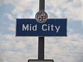
Mid City, Los Angeles (section Mapping L.A. boundaries)
Olympic Boulevard, and the Santa Monica Freeway is on the south. The Mapping L.A. project of the Los Angeles Times states as follows: Mid City is bounded...
21 KB (1,935 words) - 06:14, 30 August 2024

Westlake, Los Angeles (section Mapping L.A. Project)
"City Map". "Westlake Profile, Mapping L.A." Los Angeles Times. 2009. Retrieved June 14, 2016. "Central L.A., Mapping L.A." Los Angeles Times. 2009. Retrieved...
66 KB (7,901 words) - 13:58, 15 August 2024
Mid-Wilshire, Los Angeles (category Articles using NRISref without a reference number)
the Los Angeles Times Mapping L.A. project, Mid-Wilshire is bounded on the north by West Third Street, on the northeast by La Brea Avenue and Wilshire...
25 KB (2,336 words) - 08:09, 15 August 2024

Watts, Los Angeles (redirect from L.A. Watts Times)
II-2 "Mapping L.A.: Watts Schools". Los Angeles Times. 2015. Retrieved November 6, 2015. Landsberg, Mitchell (April 27, 2005). "This King/Drew, a Magnet...
71 KB (7,477 words) - 11:58, 23 August 2024

Hollywood, Los Angeles (redirect from Hollywood, LA)
Retrieved December 29, 2013. "Central L.A." Mapping L.A. Los Angeles Times. Retrieved January 14, 2014. "Hollywood". Mapping L.A. Los Angeles Times. Retrieved...
48 KB (4,322 words) - 04:22, 27 August 2024

22, 2020. "Central L.A.", Mapping L.A., Los Angeles Times "Northeast L.A.", Mapping L.A., Los Angeles Times "Los Feliz", Mapping L.A., Los Angeles Times...
32 KB (2,786 words) - 04:17, 20 August 2024

"Koreatown" Mapping L.A., Los Angeles Times "Zipcode 90010". www.plantmaps.com. Retrieved March 23, 2021. Kiefer, Peter (July 26, 2019). "L.A.'s Koreatown...
50 KB (4,727 words) - 23:17, 25 August 2024

a mountain lion known to reside in the Hollywood Hills "Worldwide Elevation Finder". elevation.maplogs.com. "Central L.A." Mapping L.A. "Mapping L.A....
29 KB (2,292 words) - 05:02, 25 August 2024

Acton, California (section Mapping L.A.)
units and 744 people (9.8%) lived in rental housing units. According to Mapping L.A., German and Irish were the most common ancestries in 2000. Mexico and...
21 KB (1,768 words) - 16:49, 12 August 2024
Pass Griffith Park Los Angeles portal Los Angeles Neighborhood Signs Mapping L.A. The Thomas Guide: Los Angeles County, Rand McNally (2004), pages N and...
31 KB (1,674 words) - 06:34, 15 August 2024