
Maryland Route 30 (MD 30) is a state highway in the U.S. state of Maryland. Known for most of its length as Hanover Pike, the highway runs 19.16 miles...
36 KB (3,645 words) - 22:13, 4 August 2024
The following is a list of state highways in Maryland shorter than one mile (1.6 km) in length with route numbers between 800 and 899. Most of these highways...
96 KB (7,931 words) - 02:37, 5 May 2024
The following is a list of state highways in Maryland shorter than one mile (1.6 km) in length with route numbers between 2 and 699. Most of these highways...
89 KB (7,684 words) - 21:37, 4 May 2024
Maryland: Official Highway Map (PDF) (Map). Baltimore: Maryland State Roads Commission. Maryland Route 608 was the designation for Raincliffe Road from the...
71 KB (8,267 words) - 22:03, 30 October 2023
The following is a list of state highways in Maryland shorter than one mile (1.6 km) in length with route numbers between 900 and 999. Most of these highways...
97 KB (8,007 words) - 20:58, 13 August 2024
is a list and description of the local, express and commuter bus routes of the Maryland Transit Administration, which serve Baltimore and the surrounding...
42 KB (262 words) - 04:52, 2 September 2024
respective lists. Maryland Route 400 was the designation for Mount Wilson Lane, which ran from MD 140 west to the Western Maryland Railway (now CSX's...
72 KB (8,399 words) - 01:10, 30 October 2023
1956. Maryland Route 90 was the designation for the portion of Houcksville Road from a point near Hoffman Mill Road near Houcksville north to MD 30 (now...
86 KB (9,107 words) - 23:20, 15 May 2024

Route 30 was a bus route operated by the Maryland Transit Administration in Baltimore. The line ran from Edmondson Village in west Baltimore to Bayview...
6 KB (514 words) - 07:45, 5 September 2022
The following is a list of state highways in Maryland shorter than one mile (1.6 km) in length with route numbers between 700 and 799. Most of these highways...
48 KB (3,469 words) - 02:44, 5 May 2024
Highway Location Reference. Maryland State Highway Administration. Retrieved 2015-07-30. Frederick County (PDF). Maryland Route 355 was located near Crisfield...
104 KB (12,452 words) - 18:24, 21 August 2023
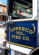
21155, part of which covers Upperco, was 2349. It is adjacent to Maryland Route 30, between the much larger towns of Reistertown and Hampstead. The community's...
6 KB (334 words) - 16:08, 29 July 2023

City, Maryland, on the Atlantic Ocean. In the U.S. state of Maryland, US 50 exists in two sections. The longer of these serves as a major route connecting...
88 KB (8,117 words) - 22:29, 4 August 2024

is by road. Maryland Route 30 is the most prominent highway serving the town. Formerly passing directly through the center of town, MD 30 now follows...
12 KB (1,206 words) - 21:52, 17 July 2024

Maryland Route 140 (MD 140) is a 49-mile (79 km) state highway in the U.S. state of Maryland. The route runs from U.S. Route 1 (US 1) and US 40 Truck in...
38 KB (2,179 words) - 22:12, 4 August 2024
I-95 northeast of Baltimore and I-97 south of Baltimore is officially Maryland Route 695 (MD 695) and is not part of the Interstate Highway System but is...
61 KB (5,216 words) - 03:38, 8 September 2024

Maryland Route 18 (MD 18) is a state highway in the U.S. state of Maryland. The state highway runs 20.37 miles (32.78 km) from the beginning of state maintenance...
28 KB (2,879 words) - 19:30, 8 January 2024

Maryland Route 5 (MD 5) is a 74.34-mile (119.64 km) long state highway that runs north–south in the U.S. state of Maryland. The highway runs from Point...
55 KB (5,510 words) - 04:00, 16 July 2024
Roads Commission of Maryland (1943–1944 ed.). Baltimore: Maryland State Roads Commission. p. 77. Retrieved July 8, 2016. Maryland Route 714 was the designation...
54 KB (6,340 words) - 07:53, 22 June 2023

portion of the businesses are located on or around Main Street which Maryland Route 30 becomes once entering "downtown" Manchester. The median income for...
31 KB (3,041 words) - 00:27, 2 May 2024

Maryland Route 200 (MD 200), also known as the Intercounty Connector or ICC, is an 18.8-mile (30.3 km) controlled-access toll road in the U.S. state of...
109 KB (10,791 words) - 01:13, 5 August 2024
The Maryland highway system has several hundred former state highways. These highways were constructed, maintained, or funded by the Maryland State Roads...
53 KB (5,661 words) - 04:31, 5 November 2023

U.S. Route 113 (US 113) is a U.S. Highway that is a spur of US 13 in the U.S. states of Maryland and Delaware. The route runs 74.75 miles (120.30 km) from...
165 KB (17,054 words) - 01:38, 5 August 2024

U.S. Route 40 (US 40) in the U.S. state of Maryland runs from Garrett County in Western Maryland to Cecil County in the state's northeastern corner. With...
80 KB (7,532 words) - 01:43, 5 August 2024

U.S. Route 301 (US 301) in the state of Maryland is a major highway that runs 122.85 miles (197.71 km) from the Governor Harry W. Nice Memorial Bridge...
43 KB (2,991 words) - 01:42, 5 August 2024

Maryland Route 2 (MD 2) is the longest state highway in the U.S. state of Maryland. The 79.24-mile (127.52 km) route runs from Solomons Island in Calvert...
77 KB (7,822 words) - 16:05, 15 May 2024

Maryland Route 355 (MD 355) is a 36.75-mile (59.14 km) north–south road in western central Maryland in the United States. The southern terminus of the...
41 KB (4,049 words) - 05:35, 23 August 2024

Maryland Route 7 (MD 7) is a collection of state highways in the U.S. state of Maryland. Known for much of their length as Philadelphia Road, there are...
38 KB (4,259 words) - 04:18, 10 September 2024
Interstate 80 (I-80) in West Sacramento, California, to Maryland Route 528 (MD 528) in Ocean City, Maryland, on the Atlantic Ocean. Until 1972, when it was replaced...
39 KB (3,845 words) - 02:43, 22 August 2024

Maryland Route 54 (MD 54) and Delaware Route 54 (DE 54) are adjoining state highways in the U.S. states of Maryland and Delaware. Route 54 runs 41.84 mi...
27 KB (2,337 words) - 16:19, 25 July 2024