
The Remutaka Tunnel (spelled Rimutaka Tunnel before 2017) is a railway tunnel through New Zealand's Remutaka Range, between Maymorn, near Upper Hutt, and...
16 KB (1,967 words) - 06:40, 27 September 2023

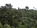
The Remutaka Range (spelled Rimutaka Range before 2017) is the southernmost range of a mountain chain in the lower North Island of New Zealand. The chain...
6 KB (610 words) - 05:54, 13 April 2024
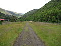
The Remutaka Rail Trail (spelled Rimutaka Rail Trail prior to 2017) is a walking and cycling track in the North Island of New Zealand. It runs between...
14 KB (1,711 words) - 07:40, 13 April 2024

Upper Hutt (section Remutaka Incline)
carriage trains. Later in November, the 8.8 km Rimutaka Tunnel opened, bypassing the Remutaka Incline and most of the existing line between Upper Hutt...
44 KB (4,050 words) - 06:05, 4 October 2024
Remutaka Hill Road in the 1870s. It starts at the road and zig-zags its way up the exposed slope, through returning native bush and shrub. The Tunnel...
4 KB (341 words) - 21:29, 22 February 2024

Wairarapa Connection service to Masterton via the Hutt Valley and the Remutaka Tunnel. At off-peak, 8–10 trains per hour leave Wellington, broken down they...
33 KB (3,843 words) - 20:21, 16 September 2024

seven Category 2 sites, and one historic area. The historic area, the Remutaka Incline Rail Trail, crosses into part of neighbouring South Wairarapa District...
14 KB (530 words) - 00:26, 16 August 2024
was closed by the following day along with the rest of the line over the Remutaka Ranges. By March 1956 most of the track between Summit and Pigeon Bush...
11 KB (1,414 words) - 23:27, 15 September 2024

Wairarapa Line (section Tunnels)
Palmerston North, due to track upgrades requiring a 46-day closure of the Remutaka Tunnel. In the late nineteenth century, the first members of the K class to...
66 KB (4,597 words) - 08:21, 11 August 2024

Mount Victoria (Wellington hill) (section Tunnels)
of the city. Further around the view of the Hutt Valley, Tararua Range, Remutaka Range, and Matiu / Somes Island. The first event recorded on Mount Victoria...
72 KB (8,503 words) - 21:49, 30 September 2024

its source in the Remutaka Ranges. The old route of the Wairarapa Line railway, which closed with the opening of the Rimutaka Tunnel in November 1955,...
6 KB (456 words) - 07:14, 19 July 2024

has increasingly become a satellite town of Wellington since the Remutaka rail tunnel opened in 1955; at the 2006 census, 36% of employed Featherston residents...
19 KB (1,812 words) - 06:18, 4 October 2024

Mangaroa Rural area View from the Remutaka Rail Trail at Mangaroa Coordinates: 41°07′15″S 175°06′49″E / 41.1207°S 175.1137°E / -41.1207; 175.1137 Country...
7 KB (481 words) - 06:04, 4 October 2024

Speedy's Crossing, near Featherston. The incline formation is now part of the Remutaka Rail Trail. The construction of a railway from Wellington to Masterton...
28 KB (3,904 words) - 02:48, 13 September 2024
a large hairy creature, the cops decide to head for the bush near the Remutaka Range. There, they discover that the creature is a Maero, a giant from...
51 KB (1,199 words) - 17:36, 14 August 2024

runs southwest through the Wainuiomata Valley located in the southern Remutaka Range in the North Island, New Zealand. The word Wainui-o-Mata is a Māori...
3 KB (337 words) - 00:15, 14 April 2024

Greytown to Featherston. The highway then winds through the Remutaka Pass, between the Remutaka and Tararua Ranges, crossing into the Hutt Valley. SH 2 follows...
25 KB (2,143 words) - 20:07, 28 September 2024

stop; the Maoribank Tunnel under Mount Marua Drive (539 metres or 1,767 feet long) was built during construction of the Rimutaka Tunnel in 1953–54. Maoribank...
9 KB (724 words) - 07:26, 4 October 2024

the south-western tip of the North Island, between Cook Strait and the Remutaka Range. Wellington is the third-largest city in New Zealand, and is the...
161 KB (13,944 words) - 06:03, 4 October 2024
largest town in the Wairarapa, a region separated from Wellington by the Remutaka ranges. It stands on the Waipoua stream between the Ruamāhunga and Waingawa...
55 KB (4,812 words) - 06:14, 4 October 2024

of Monday 18 May 2009. As part of preparation works for the Remutaka and Maoribank Tunnel track upgrades, in October 2023, the unused eastern platform...
11 KB (1,067 words) - 23:44, 15 September 2024

proximity to Wellington and the advantage of the 8.8 km Rimutaka Tunnel through the Remutaka Ranges compared to the narrow and winding Rimutaka Hill Road...
34 KB (3,479 words) - 07:14, 25 July 2024

named the wetlands after the way the lake appeared to glisten from the Remutaka Ranges to the west. During British colonial times the region was also known...
13 KB (1,415 words) - 22:35, 15 September 2024

metre hydroslide was added in 1984. Wainuiomata Regional Park adjoins Remutaka Forest Park, a protected forest park south of Wainuiomata. The park contains...
63 KB (5,551 words) - 06:11, 4 October 2024

County covered all the area south of the Waikanae River and West of the Remutaka Ranges that lay outside of Wellington City. As the population of local...
57 KB (5,952 words) - 06:04, 4 October 2024
Valley Flyer. The Wairarapa is physically separated from Wellington by the Remutaka Range. Connections to Wellington are made by the Wairarapa Connection train...
24 KB (723 words) - 12:20, 30 April 2024
include: Dun Mountain Trail Little River Rail Trail Otago Central Rail Trail Remutaka Rail Trail Trails similar to rail trails can follow other infrastructure...
41 KB (3,688 words) - 14:42, 29 September 2024

The Wainuomata/Ōrongorongo water supply catchment area lies within the Remutaka Ranges to the east of Wainuiomata. The collection area covers 7,600 hectares...
49 KB (4,557 words) - 05:56, 17 July 2024
County covered all the area south of the Waikanae River and West of the Remutaka Ranges that lay outside of Wellington City. As the population of local...
45 KB (5,378 words) - 06:18, 4 October 2024