
The long-distance hiking trail 34 (French: Sentier de grande randonnée 34 or GR 34 for short) is a French coastal path that starts from Mont-Saint-Michel...
15 KB (1,331 words) - 18:47, 16 May 2024

GR footpath (redirect from Grande Randonnée)
following names: French: sentier de grande randonnée, West Flemish: Groteroutepad, Dutch: Langeafstandwandelpad, Spanish: sendero de gran recorrido, Portuguese:...
24 KB (558 words) - 18:10, 4 April 2024

The sentier de Grande Randonnée 8, or GR 8 for short, is a long distance hiking trail on the French Atlantic coast. It is part of the Grande Randonnée network...
6 KB (426 words) - 22:52, 21 January 2023

original URL status unknown (link) "Sentier de randonnée : la Voie du Sel et du Charbon". Tourist office of the Pays de Villersexel community of communes...
72 KB (8,428 words) - 20:23, 29 July 2024

located to the north of the Col de la Schlucht, the Martinswand [fr] in the Hohneck massif, and the area traversed by the Sentier des Roches [fr]. The flora...
78 KB (6,869 words) - 01:36, 30 August 2024
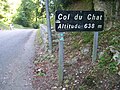
Col du Chat (category CS1 German-language sources (de))
Jura - Côte d'Azur: Savoie, Isère (de Culoz à Grenoble) (in French). Comité national des sentiers de grande randonnée. 1978. ISBN 285699136X. general diagram...
46 KB (5,739 words) - 16:09, 22 August 2024

(Indre-et-Loire) to Buzançais (Indre)] (in French). GR Infos - Sentiers de Grande Randonnée. Retrieved 31 October 2014.. "Liste des produits par commune...
89 KB (8,824 words) - 07:57, 25 August 2024