
Tabula Peutingeriana (Latin for 'The Peutinger Map'), also referred to as Peutinger's Tabula, Peutinger tables or Peutinger Table, is an illustrated itinerarium...
20 KB (2,414 words) - 19:08, 22 September 2024
the center of the hierarchically ordered planetary spheres. The Tabula Peutingeriana (Peutinger table) is an itinerarium showing the cursus publicus,...
73 KB (8,678 words) - 10:26, 4 October 2024

running north–south and east–west respectively. In a section of the Tabula Peutingeriana, a medieval copy of a Late Antique document showing the network of...
12 KB (1,436 words) - 03:53, 15 September 2024

History of cartography (section Tabula Peutingeriana)
he would never have set out on his momentous voyage. In 2007, the Tabula Peutingeriana, a 12th-century replica of a 5th-century road map, was placed on...
143 KB (17,616 words) - 06:35, 27 September 2024

representing the Strait of Gibraltar (19th-century conjecture of the Tabula Peutingeriana) The Cudgel of Hercules, a tall limestone rock formation, with Pieskowa...
29 KB (3,205 words) - 10:01, 20 September 2024
their branches were represented more or less in parallel, as in the Tabula Peutingeriana. From this master list, parts could be copied and sold on the streets...
60 KB (7,549 words) - 15:01, 24 September 2024

depicts several towns along the northwest coast of the Black Sea. The Tabula Peutingeriana, a copy of a scroll originally dating to about 350 AD, plots the...
12 KB (1,462 words) - 15:59, 14 April 2024

corresponds to the Malabar Coast of south-western India. The Roman map Tabula Peutingeriana includes a place named "Damirica" (or "Damirice") and because this...
25 KB (2,671 words) - 08:14, 20 September 2024

Ottoman sultan Suleiman the Magnificent. Aquae Calidae is shown on the Tabula Peutingeriana (edition of Konrad Miller, 1887), an illustrated itinerarium (ancient...
9 KB (1,158 words) - 09:04, 30 March 2024

Persian border. The extent of the cursus publicus is shown in the Tabula Peutingeriana, a map of the Roman road network dating from around AD 400. The cursus...
52 KB (6,173 words) - 05:52, 4 October 2024

from the original on 22 January 2021. Retrieved 17 January 2021. Tabula Peutingeriana; Ammianus Marcellinus 21, 8, 2; "Schwedenschanze". www.schwarzwald-tourismus...
91 KB (9,650 words) - 04:57, 19 September 2024

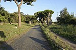
Appian Way stations Blera and Sublupatia (which also occurs on the Tabula Peutingeriana) respectively to the areas Murgia Catena and Taverna (between masseria...
33 KB (3,812 words) - 07:02, 11 August 2024
Capidava (section Tabula Peutingeriana)
Capidava is depicted in the form Calidava/Calidaua in Segmentum VIII of Tabula Peutingeriana (1st–4th century) on a Roman road between Axiopolis and Carsium....
38 KB (3,707 words) - 18:55, 14 June 2024

Viciana (section Tabula Peutingeriana)
Pestova (archaeological site). Viciano as a road station is recorded in the Tabula Peuntingeriana map, a medieval (15th century) map and copy of a 3rd-century...
5 KB (452 words) - 13:28, 12 August 2024
Pelendava (section Tabula Peutingeriana)
Pelendava (Pelendoua, Potulatensioi, Polonda ) was a Dacian town. Dacian davae List of ancient cities in Thrace and Dacia Dacia Roman Dacia Schütte, Gudmund...
3 KB (117 words) - 09:30, 21 June 2022
Danedevae (section Tabula Peutingeriana)
Danedevae (Danedebai, Ancient Greek: Δανεδέβαι) was a Dacian town. Dacian davae List of ancient cities in Thrace and Dacia Dacia Roman Dacia Olteanu, Toponyms...
2 KB (73 words) - 04:03, 21 June 2022

Topalu (section Tabula Peutingeriana)
Capidava is depicted in the form Calidava/Calidaua in Segmentum VIII of Tabula Peutingeriana (1st-4th century AD) on a Roman road between Axiopolis and Carsium...
8 KB (546 words) - 22:14, 7 January 2024

Gensis (vicus) (section Tabula Peutingeriana)
central Serbia, on Cer mountain near Lešnica. It is recorded in the Tabula Peutingeriana as situated XXX m.p. south of Sirmium, on via Argentaria, a road...
2 KB (151 words) - 11:24, 21 September 2016

order to control them. The Franks appear to be mentioned in the Tabula Peutingeriana, an atlas of Roman roads. (It is a 13th-century copy of a 4th or...
76 KB (9,510 words) - 17:19, 1 October 2024

Modern conjectural depiction of the lost western section of the Tabula Peutingeriana, showing a representation of the Pillars of Hercules (Columne Ercole)...
14 KB (1,524 words) - 00:59, 20 June 2024

Tomis (Constanța) in the Roman province of Moesia. According to the Tabula Peutingeriana it is situated between Stratonis and Histriopolis. List of castra...
3 KB (111 words) - 09:43, 14 June 2024
Ad Stoma was a fort in the Roman province of Moesia. As the Tabula Peutingeriana shows it is situated between Histriopolis and Salsovia; 60 Roman miles...
3 KB (53 words) - 21:31, 9 June 2024

agricultural products, together with the local amphorae. In the Tabula Peutingeriana of the 4th century Empoli is called in portu ("in the port") as a...
8 KB (818 words) - 16:44, 25 September 2024
riservalitoraleromano.it (in Italian). Retrieved 2022-05-14. Tabula Peutingeriana (Pars VI, V VI). "Tabula Peutingeriana ca. 250, on Bibliotheca augustana". hs-augsburg...
4 KB (472 words) - 16:59, 6 June 2024

rule from the 1st century AD in the Roman province of Moesia. The Tabula Peutingeriana shows it 11 miles from Tomis and 9 miles from Ad Stoma. Invasions...
22 KB (2,829 words) - 13:35, 5 September 2024

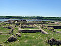
Roman map data (known through the medieval parchment copy of the Tabula Peutingeriana), there was already a Spalatum settlement in that bay, the remains...
34 KB (3,543 words) - 16:30, 16 September 2024

has also revealed numerous Hellenistic coins and pottery. In the Tabula Peutingeriana, below the city there is a rhetorical question in Latin: "Hic Alexander...
13 KB (1,405 words) - 01:27, 30 August 2024
inhabited in Roman and Byzantine times. The town appears as Petra on the Tabula Peutingeriana. Its site is located near Gimir, known as İpekler in Karatay district...
977 bytes (100 words) - 01:40, 25 April 2022

the 15th century) warns of elephants, hippos and cannibals. The Tabula Peutingeriana (a medieval copy of Roman map) has "in his locis elephanti nascuntur"...
10 KB (1,110 words) - 13:55, 6 July 2024

Argidava (section Tabula Peutingeriana)
other ancient sources like Ptolemy's Geographia (c. 150 AD) and Tabula Peutingeriana (2nd century AD), clearly place a town with those names at this geographical...
7 KB (888 words) - 14:38, 7 August 2024