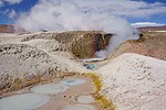
Tocorpuri is a volcano in Chile, close to the border with Bolivia. Its peak height is most recently given as 5,808 metres (19,055 ft) and it features...
28 KB (2,887 words) - 11:21, 2 September 2024
Negras Putana Quimal Sairecabur Salín San Pablo San Pedro Socompa Toco Tocorpuri Zapaleri Barrancas Blancas Azufre Bayo Colorados Copiapó El Muerto El...
9 KB (268 words) - 14:17, 13 November 2023
846 19,180 Chile El Misti 5,822 19,101 Peru Tutupaca 5,815 19,078 Peru Tocorpuri 5,808 19,055 Bolivia/Chile Cayambe 5,790 18,996 Ecuador – third highest...
37 KB (59 words) - 10:13, 2 August 2024
Portezuelo del Cajón. The dividing range includes the volcanoes Cerros de Tocorpuri, Sairecabur, Curiquinca, Licancabur and Juriques. Going southward, the...
17 KB (1,848 words) - 09:38, 6 November 2024
crops out farther west. Active volcanoes in the area include Putana and Tocorpuri. Hydrothermal alteration of country rock at El Tatio has yielded large...
108 KB (12,551 words) - 18:13, 20 November 2024
8.89444°S 77.61083°W / -8.89444; -77.61083 (Rinrijirca) Peru 5,808 Tocorpuri Bolivia – Chile 5,805 Chupiquiña 16°39′56″S 69°47′58″W / 16.66556°S...
61 KB (174 words) - 21:34, 18 April 2024
(Tittivilla) Pleistocene Tocorpuri 5808 19,055 22°25′33″S 67°54′38″W / 22.42583°S 67.91056°W / -22.42583; -67.91056 (Tocorpuri) Holocene Tunupa 5432...
11 KB (258 words) - 19:34, 9 November 2023
Tatio (volcano)") Tocorpuri (La Torta) stratovolcano 5,018 22°30′S 67°54′W / 22.50°S 67.90°W / -22.50; -67.90 ("Cerros de Tocorpuri") Putana stratovolcano...
39 KB (596 words) - 02:45, 25 October 2024
Michincha, Cerro Volcanes, Cerro de Pajonal, Cerro de Tatio, Pabellón and Tocorpuri. Laguna Hedionda has a water surface area of 3 square kilometres (1.2 sq mi)...
11 KB (996 words) - 00:39, 15 September 2024
the Central Andes. There are numerous volcanoes in the area, including Tocorpuri west-southwest and Putana and Escalante southwest of Sol de Mañana, and...
18 KB (1,939 words) - 22:02, 3 May 2024
and rich in crystals. Cerro Chao Cerro Chascon-Runtu Jarita complex Tocorpuri Tierney, Casey R. (14 June 2011). "Timescales of large silicic magma systems:...
2 KB (248 words) - 08:09, 30 January 2024
Pajonal (9), and in a straight line to the southern peak of the Cerros de Tocorpuri (10), from where it follows again by the divide of the Cordon del Panizo...
26 KB (3,983 words) - 17:09, 20 October 2024
1972. List of volcanoes in Bolivia List of volcanoes in Chile Cerros de Tocorpuri "Putana". Global Volcanism Program. Smithsonian Institution. Stebel et...
19 KB (2,040 words) - 11:06, 5 January 2024
Bolivia on the eastern side. Licancabur and Juriques farther south and Tocorpuri farther north are part of the same divide. Dry valleys on the eastern...
37 KB (4,062 words) - 12:57, 28 October 2024
Cerro Chanka Cerro Chao Chillahuita Corral de Coquena Pastos Grandes Tocorpuri Tierney, Casey. "Timescales of large silicic magma systems: implications...
9 KB (1,192 words) - 08:16, 30 January 2024
however, and there is little evidence for glacial expansion at El Tatio, Tocorpuri and parts of the Puna. Glacier expansions at Llano de Chajantor and surroundings...
179 KB (19,123 words) - 08:12, 20 November 2024
Eduardo Avaroa Andean Fauna National Reserve. It is situated south of Tocorpuri. Bolivian IGM map 1:250,000 Volcán Juriques SF-19-11 Teofilo Laime Ajacopa...
2 KB (121 words) - 02:17, 16 April 2022


