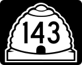
State Route 143 (SR-143) is a state highway in the U.S. state of Utah. The entire highway has been designated the Brian Head-Panguitch Lake Scenic Byway...
16 KB (1,580 words) - 00:33, 13 December 2022
A large number of minor routes in Utah, United States, were deleted by the State Legislature in 1969. This was by far the largest mass-decommissioning...
72 KB (9,241 words) - 17:15, 27 July 2024

Panguitch Lake (redirect from Panguitch Lake, Utah)
access to the lake is provided by Utah State Route 143, also known as the Brian Head-Panguitch Lake Scenic Byway or Utah's Patchwork Parkway. The earliest...
5 KB (451 words) - 22:27, 12 April 2024
Tennessee State Route 143 Texas State Highway 143 (former) Texas State Highway Loop 143 Texas State Highway Spur 143 (former) Farm to Market Road 143 Utah State...
4 KB (278 words) - 23:32, 4 April 2024

U.S. Route 89 (US 89) in the U.S. state of Utah is a north-south United States Highway spanning more than 502 miles (807.891 km) through the central part...
61 KB (4,336 words) - 16:08, 12 October 2023

State Route 274 is a state highway completely within Parowan in the southwestern portion of the US state of Utah that connects SR-143 with I-15. The entirety...
4 KB (289 words) - 15:42, 16 February 2024

U.S. Route 91 or U.S. Highway 91 (US 91) is a 172.7-mile-long (277.9 km) north–south United States highway running from Brigham City, Utah, to Idaho Falls...
31 KB (3,030 words) - 05:04, 25 June 2024

U.S. Route 50 (US-50) in Utah crosses the center of the state. The highway serves no major population centers in Utah, with the largest city along its...
21 KB (1,888 words) - 15:06, 27 April 2023

Route 89 passes through the center of town, leading north 33 miles (53 km) to Junction and south 45 miles (72 km) to Orderville. Utah State Route 143...
19 KB (1,529 words) - 18:30, 11 July 2024

State Route 271 (SR-271) is a state highway within Iron County in the southwestern portion of the US state of Utah that connects Parowan and SR-274 to...
6 KB (490 words) - 15:40, 16 February 2024

State Route 148 (SR-148) is a state highway in the U.S. state of Utah. The entire highway has been designated the Cedar Breaks Scenic Byway as part of...
5 KB (355 words) - 08:16, 16 February 2022

U.S. Route 6 (US-6) is an east–west United States Numbered Highway through the central part of the U.S. state of Utah. Although it is only about 40 miles...
42 KB (4,371 words) - 19:56, 17 May 2024

The west end of U.S. Route 40 (US-40) is in the U.S. state of Utah at Silver Creek Junction in Silver Summit (about 20.7 miles (33.3 km) east of Salt...
13 KB (1,167 words) - 23:10, 19 January 2024

north–south in the U.S. state of Utah through the southwestern and central portions of the state, passing through most of the state's population centers,...
83 KB (7,734 words) - 17:44, 29 May 2024

and Interstate 70, and southwest 19 miles (31 km) to Cedar City. Utah State Route 143 leads south up Parowan Canyon 16 miles (26 km) to Cedar Breaks National...
22 KB (2,005 words) - 18:03, 9 July 2024

Utah State Route 38 may refer to: Utah State Route 38, a state highway in eastern Box Elder County, Utah, United States that runs north from Brigham City...
1,006 bytes (166 words) - 02:39, 17 December 2021
1%) is water. Interstate 15 Utah State Route 14 Utah State Route 56 Utah State Route 130 Utah State Route 143 Utah State Route 148 Beaver County - north...
20 KB (1,437 words) - 20:00, 27 July 2024
The U.S. state of Utah, the Utah Department of Transportation (UDOT) operates a system of state routes that serve all portions of the state. In official...
106 KB (718 words) - 15:33, 27 July 2024

and is known for the Navajo Bridge. Until 2008, the Utah portion was signed State Route 11. The route provides the only direct road connection between the...
10 KB (742 words) - 05:04, 25 September 2022

State Route 113 (SR‑113) is a 7.1 miles (11.4 km) state highway in the Heber Valley in northern Wasatch County, Utah, United States, that connects U.S...
13 KB (1,446 words) - 15:39, 16 February 2024

State Route 129 (SR-129) is a state highway in northern Utah County, Utah, United States. The route spans (mostly) north-south for 7.27 miles (11.70 km)...
20 KB (2,138 words) - 15:42, 16 February 2024

State Route 142 (SR-142) is a state highway in the U.S. state of Utah. At 17.3 miles (27.8 km) long, it connects the towns of Newton, Clarkston, Trenton...
3 KB (286 words) - 15:40, 16 February 2024

State Route 144 (SR-144) is a state highway in the U.S. state of Utah. Spanning 2.5 miles (4.0 km), it connects Tibble Fork Reservoir with American Fork...
3 KB (174 words) - 08:02, 16 February 2022
limited access highway from the I-80 junction to its intersection with Utah State Route 32 (SR-32), approximately 13 miles (21 km) south of Park City. From...
77 KB (8,335 words) - 19:13, 15 July 2024

in Parowan, Utah, is the third business route along I-15 in the state of Utah. It runs from exit 75 along SR-143, at first east on 200th Street, then north...
23 KB (2,535 words) - 01:48, 16 July 2024

Scipio. Utah State Route 28, Nephi's Main Street, runs north 3 miles (5 km) to I-15 and south 41 miles (66 km) to Gunnison. Utah State Route 132 crosses...
11 KB (839 words) - 23:36, 30 April 2024

Markagunt Plateau (category Plateaus of Utah)
of the volcanic field, which is crossed by Utah State Route 14, Utah State Route 143 and Utah State Route 148. Towns in the area include Duck Creek Village...
24 KB (2,108 words) - 18:17, 17 November 2023

Bicknell is a town along State Route 24 in Wayne County, Utah, United States. As of the 2010 census, the town population was 327. Bicknell was originally...
12 KB (829 words) - 01:15, 1 May 2024

Interstate 15 in California (redirect from California State Route 15)
Route 15, consisting of the contiguous segments of State Route 15 (SR 15) and Interstate 15 (I-15), is a major north–south state highway and Interstate...
59 KB (4,223 words) - 19:23, 24 June 2024

resulted in the first presidentially declared disaster area in Utah. U.S. Route 6 (US‑6), U.S. Route 89 (US‑89) and the railroad (now part of Union Pacific Railroad's...
38 KB (4,216 words) - 15:10, 21 July 2024