
The A37 is a major road in south west England. It runs north from the A35 at Dorchester in Dorset into Somerset through Yeovil and Shepton Mallet before...
10 KB (411 words) - 17:41, 12 May 2024
A37, A 37, A.37 or A-37 may refer to: A37 road (England), a road connecting Dorchester, Dorset and Bristol A37 road (South) (Northern Ireland), a short...
1 KB (192 words) - 22:37, 5 January 2018

Note: Many of these roads in rural areas do not lead to or from anywhere remotely notable, while many of the roads within towns and villages are very short...
17 KB (218 words) - 13:55, 17 July 2024
The name A37 is used to refer to two roads in Northern Ireland. In the north, there is a road from Coleraine to Limavady, part of the Coleraine to Derry...
1 KB (134 words) - 21:19, 12 April 2023

the 1930s. The A37 road, which passes through Whitchurch, links Bristol with Dorchester. Within Bristol the A37 is known as Wells Road. It was one of...
8 KB (872 words) - 16:15, 16 January 2024
(13 km) west of Bath, and 14 miles (23 km) north of Wells. It is on the A37 road from Bristol to Shepton Mallet. Pensford was identified as being of special...
18 KB (1,901 words) - 11:40, 14 June 2024

cliff-face to the south, and steep grassy slopes to the north. The B3135 road runs along the bottom of the gorge. The area is underlain by Black Rock slate...
32 KB (3,110 words) - 15:35, 12 April 2024

Mendip Rail Mendip Way Monarch's Way National Cycle Route 24 A37 road A39 road A368 road A371 road Councils Bath and North East Somerset North Somerset Somerset...
17 KB (1,829 words) - 08:16, 4 July 2024

and Fortuneswell was part of the A37 with the extension to Easton being the original B3154. This section of the A37 became part of the A354 in 1935 but...
6 KB (317 words) - 20:06, 28 February 2023

trunk road connecting to Poole in the east and Honiton in the west; the A37 road north to Yeovil; the A352 road north to Sherborne; and the A354 road south...
74 KB (7,198 words) - 06:54, 15 July 2024
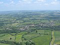
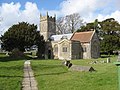
the ceremonial county of Somerset, England. The village lies east of the A37 road between Bristol and Shepton Mallet, and west of the A39 between Bath and...
16 KB (1,581 words) - 13:44, 30 June 2024
Bowdens Park on Draycott Road to a new larger site. Cheddar Cricket Club was formed in the late 19th century and moved to Sharpham Road Playing Fields in 1964...
63 KB (6,001 words) - 23:28, 18 July 2024
Wells, Somerset (redirect from Balch Road)
junction 23 on the M5 via the A39 and at junction 1 of the M32 via the A39 and A37. Wells is served by First West of England bus services to Bristol and Bristol...
82 KB (7,884 words) - 19:13, 8 June 2024

it is listed in the 1086 Domesday Book as Herpetreu meaning 'The military road by the wood' from the Old English herepoep and treow. Between 1154 and 1172...
10 KB (1,004 words) - 19:42, 17 December 2023
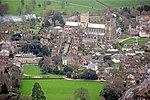
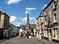
Shepton Mallet. It forms part of the Mendip district and lies along the A37 road 11 miles (18 km) south of the cities of Bristol and Bath and to the west...
7 KB (767 words) - 23:39, 31 May 2022

Mendip Rail Mendip Way Monarch's Way National Cycle Route 24 A37 road A39 road A368 road A371 road Councils Bath and North East Somerset North Somerset Somerset...
55 KB (6,559 words) - 15:18, 4 May 2024
bounded on the east by the A37, on the north by the former East Somerset Railway, and on the west by Cannard's Grave Road: Tadley Acres is a modern housing...
101 KB (10,723 words) - 21:18, 14 July 2024

Mendip Rail Mendip Way Monarch's Way National Cycle Route 24 A37 road A39 road A368 road A371 road Councils Bath and North East Somerset North Somerset Somerset...
2 KB (208 words) - 17:24, 12 December 2020

motorway and A38. Further east, and running almost north to south, are the A37 and A39. A wide range of outdoor sports and leisure activities take place...
67 KB (6,653 words) - 09:34, 16 February 2024

reference ST621580) is a village in the Chew Valley in Somerset on the A37 road. It is in the civil parish of Temple Cloud with Cameley and in the council...
6 KB (647 words) - 14:16, 15 May 2022

Mendip Hills, in the Bath and North East Somerset Council area just off the A37 road. It is located 11 miles (18 km) from Bristol, Bath and Wells. The nearest...
12 KB (1,308 words) - 23:32, 9 November 2023

edge of the lake and provides access from Bath and Weston super Mare. The A37 and A38 are slightly further away, providing access from Bristol. The lake...
31 KB (3,305 words) - 15:05, 29 May 2024

Frome, among low chalk hills on the dip slope of the Dorset Downs. The A37 road between Dorchester and Yeovil passes to the north of the village on the...
4 KB (355 words) - 07:36, 11 May 2023

Petherton) the road follows the course of the Roman Fosse Way. At Yeovilton the road becomes dual two lane again, and connects with the A37 which joins it...
51 KB (4,601 words) - 16:47, 25 June 2024

roads in zone 3 in Great Britain starting west of the A3 and south of the A4 (roads beginning with 3). Wikimedia Commons has media related to A roads...
54 KB (56 words) - 15:45, 8 July 2024

Fosse Way (category Infobox road instances in the United Kingdom)
parallel to the A37 north of Shepton Mallet, near the Iron Age hill fort of Maesbury. At Beacon Hill south of Oakhill, it crossed the Roman road along the Mendip...
20 KB (2,049 words) - 12:19, 1 July 2024
North Somerset Railway passed through Whitchurch roughly following the A37 road into Bath and North East Somerset. First West of England operates bus services...
13 KB (1,250 words) - 18:02, 13 June 2024

Mendip Rail Mendip Way Monarch's Way National Cycle Route 24 A37 road A39 road A368 road A371 road Councils Bath and North East Somerset North Somerset Somerset...
17 KB (1,804 words) - 23:56, 6 September 2023

Mendip Rail Mendip Way Monarch's Way National Cycle Route 24 A37 road A39 road A368 road A371 road Councils Bath and North East Somerset North Somerset Somerset...
3 KB (252 words) - 21:38, 1 May 2024