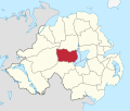
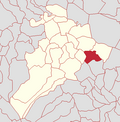
Ballinderry was one of the three district electoral areas in Cookstown, Northern Ireland which existed from 1985 to 2014. The district elected six members...
22 KB (398 words) - 12:33, 24 June 2024
final district council elections took place in 2011 The Cookstown District Council area consisted of 3 electoral areas: Drum Manor, Ballinderry and Cookstown...
5 KB (408 words) - 14:00, 6 November 2024
Ballinderry (locally [ˌbalənˈdɛri], from Irish Baile an Daire 'homestead of the oakwood') is a townland lying within the civil parish of Kilcronaghan...
8 KB (243 words) - 00:13, 3 March 2020
Killultagh is one of the seven district electoral areas (DEA) in Lisburn and Castlereagh, Northern Ireland. The district elects five members to Lisburn...
38 KB (561 words) - 18:14, 28 June 2024
seven district electoral areas (DEA) in Mid Ulster, Northern Ireland, encompassing the town of the same name and nearby villages. The district elects...
37 KB (573 words) - 17:34, 28 July 2024
Rural District of Gorey; and in the county of Wicklow, the electoral divisions of; Arklow Rural, Aughrim, Ballinaclash, Ballinacor, Ballinderry, Ballyarthur...
8 KB (493 words) - 13:18, 16 November 2024
Cookstown Area B was one of the three district electoral areas in Cookstown, Northern Ireland which existed from 1973 to 1985. The district elected six...
11 KB (200 words) - 21:17, 3 October 2023
1983–1997: The District of Lisburn, and the District of Castlereagh ward of Carryduff. 1997–2010: The District of Lisburn wards of Ballinderry, Ballymacash...
33 KB (986 words) - 21:57, 30 September 2024
country was divided into 26 smaller districts. Each of the 11 councils is divided into 7 District Electoral Areas (DEAs), with the exception of Belfast...
149 KB (1,863 words) - 22:37, 19 November 2024
Tiranascragh, Tynagh, in the former Rural District of Portumna; Abbey East, Abbey West, Annaghdown, Ballinderry, Ballinduff, Ballynapark, Beaghmore, Belclare...
104 KB (2,649 words) - 18:21, 18 November 2024
Desertmartin, and is bounded by the townlands of; Annagh & Moneysterlin, Ballinderry, Killynumber, Dromore, and Gortamney. In the Plantation of Ulster it...
9 KB (312 words) - 00:14, 3 March 2020
six candidates had been nominated for six seats, there was no vote in Ballinderry and all six candidates were deemed elected. 2001: 2 x Sinn Féin, 1 x...
11 KB (190 words) - 21:18, 18 September 2024
of the civil parish of Termoneeny, and is bounded by the townlands of Ballinderry, Ballynahone More, Clooney, Drumsamney, Killynumber, Killytoney, and...
9 KB (241 words) - 00:14, 3 March 2020
Retrieved from Irish Statute Book on 24 December 2021. Wicklow County (District Electoral Divisions) Order 1957 (S.I. No. 216 of 1957). Signed on 1 November...
145 KB (1,858 words) - 01:57, 17 November 2024
(PR-STV) from multi-member local electoral areas (LEAs). County Wicklow is divided into local electoral areas, defined by electoral divisions, for elections to...
13 KB (425 words) - 16:44, 5 November 2024
SDLP 2005-2011 Change: No change "Cookstown District Council Elections 1993-2011". www.ark.ac.uk. "Ballinderry Result Sheet" (PDF). EONI. Retrieved 4 August...
12 KB (185 words) - 18:00, 16 September 2024
multi-member local electoral areas (LEAs). County Galway is divided into the following LEAs and municipal districts, defined by electoral divisions. The following...
17 KB (602 words) - 03:31, 6 November 2024
a townland (of 215 acres) and electoral ward in County Antrim, Northern Ireland. Glengormley is within the urban area of Newtownabbey bordering Belfast...
16 KB (1,637 words) - 01:38, 20 July 2024
townland (of 456 acres), electoral ward and a civil parish in County Antrim, Northern Ireland. Carnmoney is within the urban area of Newtownabbey, in the...
12 KB (1,385 words) - 12:17, 9 June 2024
Belfast, Northern Ireland. Dunmurry is in the Collin electoral ward for the local government district of Belfast City Council. Until the end of the 18th...
13 KB (1,438 words) - 16:08, 26 April 2024
division. Of the five electoral wards which make up the Coast Road district electoral area Carnlough is the only ward with a Nationalist majority and the...
14 KB (1,224 words) - 01:37, 10 September 2024
Lisburn (redirect from Lisburn Area Code)
Council area. In elections for the Westminster Parliament the city falls mainly into the Lagan Valley constituency. Two District Electoral Areas cover the...
118 KB (10,721 words) - 02:34, 19 October 2024
and labouring were the main forms of employment. By 1849 it had its own electoral division. The town's old linen mill was built in 1809. A stone clock tower...
11 KB (1,266 words) - 20:24, 22 July 2024
Newtownabbey Borough Council area. It is part of, and the principal settlement in the Ballyclare District Electoral Area. It sits on the river Six Mile...
19 KB (1,951 words) - 18:34, 21 July 2024
"unionists" believed they might count on the popular vote. Inspired by the electoral successes of James MacKnight and Samuel MacCurdy Greer in neighboring...
41 KB (3,919 words) - 17:46, 17 November 2024
stand in the town today. The town is located within The Glens district electoral area (DEA) of the Causeway Coast and Glens Borough Council. In the 2019...
28 KB (2,905 words) - 13:09, 18 August 2024
Arklow (category Former urban districts in the Republic of Ireland)
electoral divisions in Arklow consists of Arklow No. 1 Urban, Arklow No. 2 Urban, Arklow Rural, Aughrim, Avoca, Ballinaclash, Ballinacor, Ballinderry...
47 KB (3,932 words) - 17:49, 5 November 2024
electoral ward in County Antrim, Northern Ireland. It is within the urban area of Newtownabbey and the Antrim and Newtownabbey Borough Council area....
8 KB (751 words) - 09:13, 6 November 2024
and East Antrim Borough Council and forms part of the Knockagh district electoral area. It is also in the East Antrim Westminster and Assembly constituencies...
17 KB (2,085 words) - 16:33, 5 November 2024
Archived from the original on 5 September 2012. Retrieved 9 December 2010. "Electoral Ward information for Armoy". Northern Ireland Neighbourhood Information...
17 KB (1,710 words) - 17:22, 5 November 2024


