
State Road 538 (SR 538), also known as the Poinciana Parkway, is a 7.2-mile (11.6 km) controlled-access toll road built in Osceola and Polk Counties,...
34 KB (3,150 words) - 04:22, 24 September 2024

State Road 39 (SR 39) is a north–south state highway in eastern Pasco and Hillsborough County, Florida, United States. Between Plant City and Zephyrhills...
18 KB (1,891 words) - 19:37, 25 August 2024

Business in Fort Myers and State Road A1A in Palm Beach. The road is the northernmost of three linking Southwest Florida to South Florida via the Everglades (Alligator...
27 KB (2,225 words) - 22:31, 13 October 2024
The following is a list of state roads in the U.S. state of Florida. Only the length of state-maintained roads is given; occasionally a locally maintained...
111 KB (96 words) - 18:02, 28 September 2024

State Road 60, or Route 60 (SR 60 Route 60) is an east–west route transversing Florida from the Gulf of Mexico to the Atlantic Ocean. The western terminus...
43 KB (3,640 words) - 19:45, 25 August 2024
earliest evidence found of the old state road system is on a 1917 State Road Department map; in 1923 the Florida State Legislature began writing the routes...
31 KB (307 words) - 18:29, 25 August 2024

theme park to SR 535 in Lake Buena Vista, with the road continuing east to SR 417 (The Central Florida GreeneWay) and International Drive. SR 536 begins...
4 KB (303 words) - 19:33, 25 August 2024

Association of State Highway and Transportation Officials (AASHTO) in Florida, US 41 always carries a hidden state road number designated by the Florida Department...
78 KB (5,301 words) - 14:15, 12 August 2024
the eastern terminus of the Poinciana Parkway (SR 538) to Florida's Turnpike Florida portal U.S. Roads portal "System description". Floridasturnpike.com...
30 KB (750 words) - 18:10, 28 September 2024
List of highways numbered 9A (redirect from Florida state road 9A)
road, a branch of the EO9 from Kalo Nero to the A7 motorway at Kalyvia, Messenia Connecticut Route 9A (former) Delaware Route 9A Florida State Road 9A...
1 KB (111 words) - 16:34, 27 August 2024

State Road 363 (SR 363) is a north–south route in the Big Bend region of Florida. The road begins in St. Marks at Riverside Drive. From there, the road...
5 KB (176 words) - 19:46, 25 August 2024

counties in the state, connecting numerous towns and cities along its route, including nine county seats. The road is maintained by the Florida Department...
108 KB (6,466 words) - 12:32, 4 August 2024
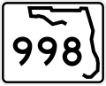
State Road 998 (SR 998) is an east–west road in Homestead, Florida, connecting the southern terminus of SR 997 with U.S. Route 1 (US 1). The road, known...
4 KB (316 words) - 19:30, 25 August 2024

all AASHTO designated highways in Florida, US 441 always carries a FDOT designated hidden state road number: State Road 7 (SR 7) from the US route's southern...
55 KB (2,972 words) - 19:38, 31 May 2024

State Road 12 (SR 12) is an east–west route in the Florida Panhandle, running from SR 20 in Bristol to U.S. Route 27 (US 27) in Havana. The route continues...
19 KB (1,616 words) - 19:25, 25 August 2024
The Central Florida Expressway Authority (CFX) is a highway authority responsible for construction, maintenance and operation of toll roads in five counties...
12 KB (1,081 words) - 18:53, 28 September 2024

Dolphin East–West Expressway (redirect from State Road 836 (Florida))
related to Florida State Road 836. KML file (edit • help) Template:Attached KML/Florida State Road 836 KML is from Wikidata FDOT GIS data Florida @ SouthEastRoads...
24 KB (1,996 words) - 23:36, 16 September 2024

4 (I-4). Florida State Road 539 begins at Florida State Road 563 on the west side of Lake Wire, where Sikes Boulevard becomes Kathleen Road and SR 563...
7 KB (771 words) - 19:39, 25 August 2024
runs through the north of Poinciana. The Poinciana Parkway (State Road 538), a toll road to connect Poinciana more directly to Interstate 4, was opened...
13 KB (1,127 words) - 14:43, 21 April 2024
disabled drivers and remove road debris. Turnpikes which currently participate include, Florida's Turnpike in the State of Florida and the Pennsylvania Turnpike...
72 KB (7,549 words) - 14:23, 12 October 2024

Bushnell is a city and the county seat of Sumter County, Florida, United States. The population was 3,047 at the 2020 census. It is part of The Villages...
14 KB (940 words) - 02:08, 24 August 2024
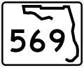
State Road 569 (SR 569) is a short state road located entirely in Tampa, Florida. Also known as 39th Street south of 11th Avenue and 40th Street north...
3 KB (252 words) - 19:44, 25 August 2024

red state. Florida is a Southern state substantially in the Bible Belt, having two large distinct cultural areas. North Florida and the Florida Panhandle...
72 KB (2,871 words) - 19:58, 13 October 2024
List of highways numbered 476 (redirect from County Road 476 (Florida))
Route 476 (former) Puerto Rico Highway 476 Tennessee State Route 476 This article includes a list of roads, streets, highways, or other routes that are associated...
847 bytes (74 words) - 22:28, 4 April 2024

Jacksonville metropolitan area. As is the case with all Florida roads with American Association of State Highway and Transportation Officials (AASHTO) route...
56 KB (3,625 words) - 05:56, 24 September 2024

S. state of Florida. As of the 2020 U.S. Census, the population was 399,710. Manatee County is part of the North Port-Bradenton-Sarasota, Florida Metropolitan...
47 KB (3,564 words) - 03:37, 10 October 2024

There are 175 state parks and 9 state trails in the U.S. state of Florida which encompass more than 800,000 acres (320,000 ha), providing recreational...
66 KB (1,684 words) - 03:02, 10 October 2024
FiveThirtyEight (redirect from 538.com)
538, originally rendered as FiveThirtyEight, is an American website that focused on opinion poll analysis, politics, economics, and sports blogging in...
120 KB (10,655 words) - 20:14, 2 October 2024
List of highways numbered 361 (redirect from County Road 361 (Florida))
(former) Ohio State Route 361 Oregon Route 361 (former) Puerto Rico Highway 361 Texas: Texas State Highway 361 Farm to Market Road 361 Virginia State Route 361...
2 KB (122 words) - 23:19, 4 April 2024

SunPass-compatible roads while SunPass account holders now have the option to obtain a SunPass tag that can be used on E-ZPass toll roads. In Florida, all vehicles...
126 KB (3,963 words) - 00:58, 9 October 2024