
State Road 82 (SR 82) is a 29-mile-long east–west highway serving northern Lee and Collier County, Florida (and "clipping" the southwest corner of Hendry...
13 KB (1,153 words) - 19:23, 25 August 2024
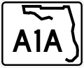
State Road A1A (SR A1A) is a major north–south Florida State Road consisting of seven separate sections running a total of 338.752 miles (545.168 km)...
60 KB (2,538 words) - 02:42, 7 September 2024

State Road 44 (SR 44) is an east–west state highway in the U.S. state of Florida. It runs from Crystal River on the Gulf of Mexico east to New Smyrna Beach...
30 KB (2,848 words) - 03:21, 9 September 2024

Business in Fort Myers and State Road A1A in Palm Beach. The road is the northernmost of three linking Southwest Florida to South Florida via the Everglades (Alligator...
27 KB (2,225 words) - 22:31, 13 October 2024

State Road 47 (SR 47) is a north–south state highway in north Florida, running from US 41/441 in Lake City south to US 129 in Trenton. North of Lake City...
5 KB (162 words) - 19:13, 25 August 2024
connecting with Interstate 4 and Florida State Road 417 to complete a nearly complete ring around the city. The road peaks at Mile Marker 13 where on...
27 KB (2,127 words) - 03:10, 14 October 2024

S. state of Florida; it is maintained by the Florida's Turnpike Enterprise (FTE), the Central Florida Expressway Authority (CFX), and the Florida Department...
44 KB (4,461 words) - 04:22, 24 September 2024
State Road 417 (SR 417), also known as the Central Florida GreeneWay, Seminole County Expressway (depending on the location), Eastern Beltway and Orlando...
26 KB (1,707 words) - 19:41, 25 August 2024
The following is a list of state roads in the U.S. state of Florida. Only the length of state-maintained roads is given; occasionally a locally maintained...
111 KB (96 words) - 18:02, 28 September 2024

In the mid-1970s, the Florida Department of Transportation (formerly the State Road Department) started a sequence of events that eventually resulted...
42 KB (3,889 words) - 16:29, 5 June 2024

State Road 29 (SR 29) is a state highway that runs north–south through Southwest Florida. It begins in Carnestown (just north of Everglades City) and runs...
15 KB (1,184 words) - 19:26, 18 October 2024

infrequent, and the road is locally maintained as Arthur Godfrey Road. Since the state of Florida renumbered its Florida State Roads in 1945, a grid system...
17 KB (1,469 words) - 22:15, 17 September 2024

designated State Road 82 by the State Road Department, the forerunner of Florida Department of Transportation. In the 1980s, FDOT extended the State Road designation...
4 KB (454 words) - 19:04, 25 August 2024

State Road 20 (SR 20) is a 358.154-mile-long (576.393 km) east-to-west route across northern Florida and the Florida Panhandle in the United States. SR...
35 KB (2,392 words) - 19:47, 25 August 2024

State Road 50 (SR 50) runs across the center of the U.S. state of Florida through Orlando, with its termini at SR 55 (US 19) at Weeki Wachee and SR 5...
45 KB (4,433 words) - 08:12, 18 September 2024

exits are unnumbered. KML file (edit • help) Template:Attached KML/Florida State Road 202 KML is not from Wikidata FDOT straight line diagrams Archived...
9 KB (864 words) - 12:16, 5 October 2024

State Road 884 (SR 884), along with County Road 884 (CR 884), together create Lee County, Florida's primary east–west partially controlled access highway...
13 KB (1,056 words) - 19:23, 25 August 2024

the Lee county seat, and extends east to the Hendry County line. Florida State Road 82 forms the southern border of the community; the highway leads west...
15 KB (1,347 words) - 20:27, 25 June 2024
Florida's Turnpike, designated as unsigned State Road 91 (SR 91), is a controlled-access toll road in the U.S. state of Florida, maintained by Florida's...
81 KB (6,531 words) - 19:53, 12 October 2024
Florida's state roads were renumbered. The old system numbered routes in the order they were legislated, while the new system used a grid. State Road...
23 KB (67 words) - 16:42, 5 August 2024

State Road 46 (SR 46) is an east–west route in central Florida, running from U.S. Route 441 (US 441) in Mount Dora to US 1 in Mims. Along the way, it crosses...
13 KB (960 words) - 19:46, 25 August 2024

State Road 78 (SR 78) is the Florida Department of Transportation designation of the highway that historically extended from Pine Island Center on the...
18 KB (1,396 words) - 19:32, 25 August 2024

State Road 26 (SR 26) is a 62.172-mile-long (100.056 km) east–west route across North Central Florida. The western terminus of SR 26 is at US 19/98/27...
16 KB (910 words) - 19:40, 25 August 2024

intersection of State Road 62, the road passes by the Florida Gulf Coast Railroad Museum and then intersects CR 683 (Moccasin Wallow Road). After the road crosses...
52 KB (3,944 words) - 01:00, 1 August 2024
the U.S. state of Florida. It travels approximately 6.10 miles (9.82 km) extending diagonally from its northwestern terminus at Old Kings Road to its southeastern...
3 KB (198 words) - 19:21, 25 August 2024
earliest evidence found of the old state road system is on a 1917 State Road Department map; in 1923 the Florida State Legislature began writing the routes...
31 KB (307 words) - 18:29, 25 August 2024

State Road 52 (SR 52) is the major east–west road through northern Pasco County, Florida. The road begins in Bayonet Point at US 19 (SR 55), passes south...
14 KB (1,037 words) - 19:37, 25 August 2024

Association of State Highway and Transportation Officials (AASHTO) in Florida, US 41 always carries a hidden state road number designated by the Florida Department...
78 KB (5,301 words) - 14:15, 12 August 2024

Florida (/ˈflɒrɪdə/ FLORR-ih-də, Spanish: [floˈɾiða]) is a state in the Southeastern region of the United States. It borders the Gulf of Mexico to the...
252 KB (20,529 words) - 06:23, 19 October 2024

State Road 739 (SR 739) is a 17-mile-long (27 km) commercial highway running from San Carlos Park, Florida to North Fort Myers that is also known as U...
22 KB (2,181 words) - 00:21, 18 October 2024