
Maungakiekie-Tāmaki is a local government area in Auckland, in New Zealand's Auckland Region. It is governed by the Maungakiekie-Tāmaki Local Board and...
2 KB (123 words) - 07:26, 21 July 2024
council's Maungakiekie-Tāmaki Ward councillor (some wards administer more than one local board). The Maungakiekie-Tāmaki board, named after Maungakiekie / One...
17 KB (471 words) - 03:43, 22 June 2024

south. Tāmaki is under the local governance of Auckland Council. It is part of the much larger Tāmaki parliamentary electorate. In the 1940s Tāmaki was chosen...
7 KB (750 words) - 08:58, 21 December 2023

Maungakiekie-Tāmaki Ward is an Auckland Council ward which elects one councillor and covers the Maungakiekie-Tāmaki Local Board. The current councillor...
9 KB (590 words) - 02:23, 3 June 2024

In pre-European times, Maungakiekie / One Tree Hill was the largest pā in the Tāmaki Makaurau region. The Māori name Maungakiekie means "mountain of the...
31 KB (3,307 words) - 17:43, 7 September 2024
2023 New Zealand census (section Population counts by territorial authority and Auckland local board areas)
illegally used 2023 census data to target Māori electorate voters in the Tāmaki Makaurau electorate during the 2023 New Zealand general election, and that...
35 KB (2,028 words) - 09:13, 9 September 2024
Bay, Newmarket, Newton, Parnell, Ponsonby and Westmere. The Maungakiekie–Tāmaki local board covers the south-eastern part of the Auckland isthmus. Major...
145 KB (1,003 words) - 03:38, 25 August 2024

Hibiscus and Bays, Howick, Kaipātiki, Māngere-Ōtāhuhu, Manurewa, Maungakiekie-Tāmaki, Ōrākei, Ōtara-Papatoetoe, Puketāpapa, Upper Harbour, Waitākere Ranges...
36 KB (445 words) - 19:46, 1 June 2024
residential part of the suburb is located to the east and south-east of Maungakiekie / One Tree Hill, from which it takes its name, with the volcanic peak...
7 KB (570 words) - 20:20, 6 February 2024

Mount Wellington, New Zealand (category Populated places on the Tāmaki River)
Waitematā Harbour/Tāmaki River and the Manukau Harbour. Mount Wellington had historically supplied most of Auckland's vegetables alongside Tāmaki until the 1940s...
16 KB (1,170 words) - 21:05, 24 March 2024
Local Board: 7 candidates were elected as members of the Maungakiekie-Tāmaki Local Board; 4 from the Tāmaki subdivision, and 3 from the Maungakiekie subdivision:...
54 KB (583 words) - 13:47, 17 August 2024

Auckland Council (redirect from Local boards of Auckland Council)
/ -36.850; 174.783 Auckland Council (Māori: Te Kaunihera o Tāmaki Makaurau) is the local government council for the Auckland Region in New Zealand. It...
73 KB (6,178 words) - 23:43, 5 September 2024
Kiwi Tāmaki (died c. 1741) was a Māori warrior and paramount chief of the Waiohua confederation in Tāmaki Makaurau (modern-day Auckland isthmus). The third...
32 KB (3,365 words) - 17:42, 7 September 2024
followed by the Ōtara-Papatoetoe local board area (10.7%) and the Maungakiekie-Tāmaki local board area (10.4%). The Waitaki District has the highest concentration...
4 KB (400 words) - 16:27, 28 August 2024

Mana Whenua o Tāmaki Makaurau (also known as the Tāmaki Collective), who have owned them since 2014. In 2014, the Ngā Mana Whenua o Tāmaki Makaurau Collective...
23 KB (1,927 words) - 00:15, 16 June 2024
Maungarei (category Maungakiekie-Tāmaki Local Board Area)
Whenua o Tāmaki Makaurau collective of 13 Auckland iwi and hapu (also known as the Tāmaki Collective), ownership of the 14 Tūpuna Maunga of Tāmaki Makaurau...
10 KB (902 words) - 05:04, 22 August 2024
Kaipātiki local board area of Auckland had the highest concentration of Filipino people at 5.4%, followed by the Maungakiekie-Tāmaki local board area (3...
7 KB (683 words) - 04:41, 6 July 2024
Peter McGlashan (category Local politicians in New Zealand)
Foundation. In the 2019 New Zealand local elections, he stood for the Labour Party in the Maungakiekie-Tāmaki Local Board and was elected. McCarron A (2010)...
6 KB (236 words) - 02:59, 11 June 2024

Panmure Basin (category Maungakiekie-Tāmaki Local Board Area)
in traditional Tāmaki Māori stories as the eating place of the taniwha Moko-ika-hiku-waru. The headland between the basin and the Tāmaki River was the...
7 KB (637 words) - 07:59, 25 April 2024
Eastern Bays, Hauraki Gulf Islands, Hobson, Maungakiekie, Mount Albert, Mount Eden, Mount Roskill, Tamaki and Western Bays). The Avondale Ward elects...
24 KB (279 words) - 12:54, 22 June 2024
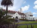
Onehunga (section Local government)
(five miles) south of the city centre, close to the volcanic cone of Maungakiekie / One Tree Hill. Onehunga is a residential and light-industrial suburb...
39 KB (4,412 words) - 05:41, 24 June 2024

Greenlane (category Albert-Eden Local Board Area)
Greenlane Clinical Centre, Cornwall Park, Cornwall Cricket Club, and Maungakiekie / One Tree Hill and its park. Within Auckland, the suburb is best-known...
12 KB (1,262 words) - 03:56, 21 June 2024

candidate for Tāmaki electorate in 2008, finishing second. Bartley was elected to the Maungakiekie-Tamaki Local Board in the 2010 local elections and...
6 KB (293 words) - 03:07, 26 August 2024

Mutukāroa / Hamlins Hill Regional Park (category Maungakiekie-Tāmaki Local Board Area)
Zealand's North Island. It is situated in Maungakiekie-Tāmaki, north-east of the Manukau Harbour and west of the Tāmaki River. The park is owned and operated...
5 KB (367 words) - 01:42, 30 May 2024

Ellerslie, New Zealand (category Ōrākei Local Board Area)
State Highway 1. Administratively, Ellerslie forms part of the Ōrākei Local Board, which also includes the suburbs of Orakei, Mission Bay, Kohimarama,...
28 KB (2,930 words) - 06:30, 19 August 2024

Māngere (redirect from Te Kāhu Pokere o Tāmaki Mākaurau)
near the Tāmaki isthmus, who intermarried with defeated members of Waiohua, settled the region. Originally the iwi were based on Maungakiekie / One Tree...
45 KB (4,427 words) - 17:44, 7 September 2024

part-time, and 27 (3.8%) were unemployed. The area was purchased from three local Maori Chiefs by The Wiiliams family in the late 1830s, the farm being called...
10 KB (870 words) - 08:41, 5 July 2024
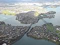
Panmure, New Zealand (category Populated places on the Tāmaki River)
western banks of the Tāmaki River and the northern shore of the Panmure Basin (or Kaiahiku). To the north lies the suburb of Tāmaki, and to the west is...
18 KB (2,051 words) - 17:46, 7 September 2024
Glen Innes, New Zealand (category Ōrākei Local Board Area)
higher density housing, consisting of mostly apartment-style housing. The Tāmaki Regeneration Programme will also target 2500 public homes that will transform...
14 KB (1,594 words) - 21:03, 1 July 2024
Eastern Bays, Hauraki Gulf Islands, Hobson, Maungakiekie, Mount Albert, Mount Eden, Mount Roskill, Tamaki and Western Bays). The Avondale Ward elected...
26 KB (252 words) - 12:46, 22 June 2024