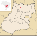
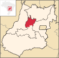
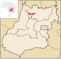
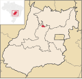
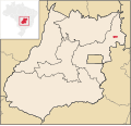
Montividiu do Norte is a municipality in Goiás state, Brazil. It is a part of the Porangatu Microregion. It had a population in 2020 of 4,509. It became...
6 KB (450 words) - 18:27, 20 February 2022
São Luíz do Norte is a municipality in northeastern Goiás state, Brazil. An alternative spelling is "São Luís do Norte". São Luíz is located 58 km. north...
4 KB (232 words) - 18:27, 20 February 2022
Alvorada do Norte is a municipality in northeastern Goiás state, Brazil. It is an important commercial center on the Brasília-Salvador highway. Alvorada do Norte...
7 KB (573 words) - 07:30, 8 April 2022
Estrela do Norte is municipality in north Goiás state, Brazil. The population was 3,264 (2020) and the total area was 302.7 km² Estrela do Norte is a municipality...
4 KB (297 words) - 18:27, 20 February 2022
Montividiu is a municipality in eastern Goiás state, Brazil. Montividiu is a large producer of soybeans and corn. Montividiu is located in the Sudoeste...
5 KB (456 words) - 18:27, 20 February 2022
Cora Coralina Casa do Bispo Igreja de Nossa Senhora d'Abadia Igreja de Nossa Senhora do Carmo Palácio do Conde dos Arcos Quartel do XX List of municipalities...
19 KB (1,380 words) - 04:22, 11 June 2024
Educativa Evangélica, Faculdade de Filosofia São Miguel Arcanjo, Faculdade do Instituto Brasil-FIBRA, Faculdade Anhanguera de Anápolis, and Faculdade Raízes...
19 KB (1,855 words) - 19:23, 17 November 2024
by BR-352 / Bela Vista de Goiás / Cristianópolis / GO-020 / BR-352 / Pires do Rio / GO-330 / Ipameri. Municipal boundaries are with: North: Campo Alegre...
16 KB (1,295 words) - 16:24, 15 October 2024
Adelândia, Turvânia, Firminópolis, Aurilândia, Sanclerlândia and Córrego do Ouro. The distance to Goiânia is 129 km. Highway communications are made by...
6 KB (618 words) - 18:27, 20 February 2022
Bulhões and Silvânia. It is in the Pires do Rio Microregion and has boundaries with Orizona, Pires do Rio, São Miguel do Passa Quatro and Silvânia. Mayor: Antônio...
5 KB (329 words) - 12:58, 26 October 2021
50 km. south of Jataí and about 80 km north of the border with Mato Grosso do Sul. It is in the Sudoeste de Goiás Microregion and has the following boundaries:...
7 KB (543 words) - 01:16, 23 June 2022
Trinidade, Goias". PaddockTalk. 8 September 2014. Frigoletto Sepin Portal do Governo Municipal de Trindade Web Trindade - News and photos about Trindade/GO...
8 KB (784 words) - 05:42, 9 August 2024
Rianápolis 4,167 Rubiataba 18,025 Santa Isabel 3,485 Santa Rita do Novo Destino 3,372 São Luís do Norte 4,266 São Patrício 2,051 Uruana 13,712 Population is from...
3 KB (203 words) - 21:27, 25 September 2021
/ GO-080 / Goianésia / GO-342 / Barro Alto / BR-153 / Uruaçu / Estrela do Norte / GO-241. Mutunópolis is surrounded by the following municipalities: north...
6 KB (532 words) - 18:27, 20 February 2022
Pires do Rio is a municipality in Goiás state, Brazil. It is a prosperous town and a major producer of poultry. It is located in the Pires do Rio Microregion...
7 KB (658 words) - 18:27, 20 February 2022
Alexânia / Planaltina / Formosa / GO-020 / BR-030 / Vila Boa / Alvorada do Norte / GO-108 / Posse. Population density: 3.34 inhabitants/km2 Population in...
6 KB (393 words) - 19:59, 13 September 2023
Located in the Vão do Paranã statistical micro-region, Flores has boundaries with Buritis, Sítio d'Abadia, Vila Boa, Alvorada do Norte, Iaciara, Nova Roma...
6 KB (490 words) - 18:27, 20 February 2022
Alto Horizonte, Amaralina, Campinorte, Campos Verdes de Goiás, Estrela do Norte, Formoso, Mutunópolis, Nova Iguaçu de Goiás, Santa Terezinha de Goiás,...
7 KB (618 words) - 18:27, 20 February 2022
Morrinhos Ind. e Com. Ltda. - Associação do Médio Norte Goiano - ASNORTE. (22/05/2006) Financial institutions: Banco do Brasil S.A. - BRADESCO S.A - Banco Itaú...
6 KB (581 words) - 19:02, 24 October 2024
Goiás, Nova América, Nova Glória, Pilar de Goiás, Rubiataba and São Luíz do Norte. The climate is tropical humid with high maximum temperatures that can...
7 KB (460 words) - 18:27, 20 February 2022
-Banco Multiplo (August 2007) Dairies: - - Coop. Mista de Produtos Rurais do Vale do Paranaíba Ltda. - Coop. dos Prod. Rurais de Quirinópolis e Região (22/05/2006)...
7 KB (682 words) - 17:35, 31 October 2023
the state capital, Goiânia. It is 27 kilometers northeast of São Luíz do Norte, which is on the junction with the important BR-153 highway. There is another...
5 KB (407 words) - 18:27, 20 February 2022
/ Formosa / BR-020 / Alvorada do Norte / GO-112 for 58 km. The municipality has boundaries with Posse, Alvorada do Norte, Guarani de Goiás, Nova Roma and...
6 KB (426 words) - 18:27, 20 February 2022
Alvorada do Norte / Vila Capão / GO-236 / Buritinópolis / Mambaí / GO-108 / Damianópolis. Municipal boundaries are with: north: Alvorada do Norte and Damianópolis...
6 KB (405 words) - 18:27, 20 February 2022
Colinas do Sul is a municipality in north-central Goiás state, Brazil. Colinas is located in the Chapada dos Veadeiros statistical micro-region and is...
5 KB (412 words) - 18:27, 20 February 2022
Buritinópolis is located in the Vão do Paranã statistical micro-region in the area near Simolândia and Alvorada do Norte. It is close to the important BR-020...
6 KB (471 words) - 18:27, 20 February 2022
Central, southwest of Brasília and is part of the area known as the Entorno do Distrito Federal. The distance to the state capital, Goiânia, is 188 km and...
6 KB (515 words) - 17:06, 3 July 2024
Alvorada do Norte / GO-236 / Buritinópolis / Mambaí / GO-108. Municipal boundaries are with: north: Buritinópolis and Mambaí west: Alvorada do Norte south:...
5 KB (363 words) - 18:27, 20 February 2022
by BR-153 / Anápolis / GO-060 / Alexânia / Formosa / BR-020 / Alvorada do Norte / GO-112 / Iaciara. Municipal boundaries are with: north:: Monte Alegre...
5 KB (307 words) - 18:27, 20 February 2022
highway). It forms boundaries with Posse, Alvorada do Norte and Buritinópolis. It belongs to the Vão do Paranã statistical micro-region. The distance to...
6 KB (387 words) - 18:27, 20 February 2022


