city and town in Rhode Island, except for New Shoreham (Block Island), has at least one numbered route. State highways in Rhode Island are signed with...
34 KB (179 words) - 06:06, 17 January 2025
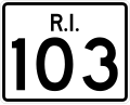
Route 103 is a numbered state highway running 11.8 miles (19.0 km) in Rhode Island, United States. It runs from Interstate 195 (I-195) in East Providence...
8 KB (556 words) - 06:49, 17 January 2025

Route 10 is a numbered state highway connector in the U.S. state of Rhode Island, traveling along the Huntington Expressway, the first freeway in the...
17 KB (1,567 words) - 03:16, 24 January 2025

Route 14 is a numbered state highway in the U.S. state of Rhode Island. It runs approximately 23 miles (37 km) from Connecticut routes 14 and 14A at the...
6 KB (309 words) - 06:50, 17 January 2025

Route 102 is a 44.4-mile-long (71.5 km) numbered state highway in the U.S. state of Rhode Island. Route 102 serves as a non-freeway beltway around the...
8 KB (328 words) - 06:49, 17 January 2025

Route 12 is a numbered state highway in Rhode Island, United States. It runs approximately 17 miles (27 km) from Route 14 in Foster to Broad Street in...
4 KB (144 words) - 06:50, 17 January 2025

Route 91 is a numbered state highway running 12.0 miles (19.3 km) in Rhode Island. Route 91's western terminus is at Route 3 in Westerly and the eastern...
6 KB (440 words) - 06:50, 17 January 2025

Route 7 is a numbered state highway in Rhode Island, United States. It runs approximately 16 miles (26 km) from Route 246 in Providence north to Burrillville...
5 KB (329 words) - 06:50, 17 January 2025

blocks in Westerly may have at one time used Canal Street and one of the diagonal streets to cut over to current Route 3. Numbered routes in Rhode Island RIGIS...
12 KB (951 words) - 06:50, 17 January 2025

Route 100 is a numbered state highway running 9.3 miles (15.0 km) in Rhode Island. Route 100's southern terminus is at Route 102 in Glocester and the...
3 KB (149 words) - 06:49, 17 January 2025

Route 104 is a 13.4-mile-long (21.6 km) numbered state highway in the U.S. state of Rhode Island. It runs from US 44 in North Providence to Worrall Street...
6 KB (438 words) - 06:49, 17 January 2025

Route 24 is a freeway in the U.S. state of Rhode Island. It runs approximately 8 miles (13 km) from Route 114 in Portsmouth to Massachusetts Route 24 in...
6 KB (278 words) - 06:50, 17 January 2025

Route 51 is a state highway in the U.S. state of Rhode Island. It runs approximately 5.4 miles (8.7 km) from Route 115 in West Warwick to Route 12 in...
5 KB (338 words) - 06:50, 17 January 2025

U.S. Route 1 (US 1) is a major north–south U.S. Route through the U.S. state of Rhode Island, specifically within the Providence metropolitan area. Staying...
16 KB (770 words) - 13:42, 1 October 2023

Route 5 is a state highway in the U.S. state of Rhode Island. It runs approximately 26 miles (42 km) from US 1 in Warwick to the Massachusetts state line...
6 KB (212 words) - 06:50, 17 January 2025

Washington County and southern Kent County, Rhode Island, United States. The route is a major north–south freeway in the southern Providence metropolitan area...
23 KB (2,428 words) - 00:19, 2 January 2025
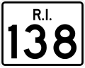
Route 138 is a numbered State Highway running 48.3 miles (77.7 km) in Rhode Island. It is the longest state numbered route in Rhode Island, and the second...
15 KB (818 words) - 06:50, 17 January 2025

Route 94 is a numbered state highway running 12.7 miles (20.4 km) in Rhode Island. Route 94's southern terminus is at Route 14 and Route 102 in Foster...
3 KB (133 words) - 06:51, 17 January 2025

Route 96 is a 7.06-mile-long (11.36 km) numbered state highway in the U.S. states of Rhode Island and Massachusetts. Route 96 starts in the village of...
4 KB (197 words) - 06:52, 17 January 2025

Route 98 is a numbered state highway running 6.1 miles (9.8 km) in Rhode Island. Route 98's southern terminus is at Route 100 in Chepachet and the northern...
3 KB (148 words) - 06:51, 17 January 2025

Route 101 is a numbered state highway running 9.7 miles (15.6 km) in Rhode Island. It runs from the Connecticut state line east to U.S. Route 6 (US 6)...
4 KB (306 words) - 06:49, 17 January 2025

Route 1A, largely signed as Scenic 1A, is a 33.3-mile (53.6 km) long numbered state highway located in Washington County, Rhode Island, United States....
20 KB (1,615 words) - 06:50, 17 January 2025

Connecticut Route 2 in Stonington, crossing into Rhode Island at the Pawcatuck River, where it continues to U.S. Route 1 in Westerly. The route was constructed...
9 KB (856 words) - 06:52, 17 January 2025

Route 81 is a numbered state highway running 8.0 miles (12.9 km) in Rhode Island. Route 81's southern terminus is at Rhode Island Route 179 in Little Compton...
2 KB (85 words) - 06:50, 17 January 2025

Route 107 is a numbered State Highway running 3.9 miles (6.3 km) in Rhode Island, United States. The route serves the town of Burrillville and connects...
4 KB (214 words) - 06:49, 17 January 2025

Route 2 is a 33.6-mile (54.1 km) state highway in Rhode Island, that runs from U.S. Route 1 in Charlestown to US 1 in Providence. Route 2 starts at US 1...
9 KB (281 words) - 06:50, 17 January 2025

at-grade intersection with Natick Avenue in Cranston. The freeway has numbered interchanges with I-295, Rhode Island Route 2, Pontiac Avenue, and I-95 before...
19 KB (1,968 words) - 06:50, 17 January 2025

Route 99, also known as the Woonsocket Industrial Highway, is a 2.9-mile-long (4.7 km) freeway in Providence County, Rhode Island, United States. Route...
14 KB (1,419 words) - 06:51, 17 January 2025

Route 77 is a state highway in the U.S. state of Rhode Island. It runs approximately 14 miles (23 km) from Rhode Island Road in Little Compton to Route...
4 KB (174 words) - 06:50, 17 January 2025

Route 117 is a 28.4-mile-long (45.7 km) state route in the U.S. state of Rhode Island. Its western terminus is at Route 14 in Coventry, and its eastern...
8 KB (356 words) - 06:49, 17 January 2025