
Pennant Hills Road is a 16.1-kilometre-long (10.0 mi) arterial road located in Sydney, New South Wales, Australia. The road links the suburb of Wahroonga...
21 KB (1,969 words) - 01:13, 9 September 2024

West Pennant Hills is a suburb in the Hills District of Sydney, New South Wales, Australia. West Pennant Hills is located 21 km northwest of the Sydney...
8 KB (941 words) - 14:16, 30 July 2024

be found along Pennant Hills Road. Pennant Hills is home to several entertainment venues including the Pennant Hills Hotel. Pennant Hills railway station...
20 KB (2,051 words) - 03:37, 2 September 2024

Sydney Orbital Network and the National Highway west of Pennant Hills Road. Owned by toll road operator Transurban, it forms majority of Sydney's M2 route...
31 KB (3,037 words) - 03:23, 2 August 2024

Carlingford, New South Wales (redirect from Mobbs Hill, New South Wales)
point of Northern Sydney and Western Sydney sitting on both sides of Pennant Hills Road which generally acts as a divider of the two regions. While being...
42 KB (4,902 words) - 00:40, 29 September 2024
NorthConnex (category The Hills Shire)
the congested Pennant Hills Road, extending or connecting the M1 Pacific Motorway to the M2 Hills Motorway. Owned by NorthWestern Roads (NWR) Group, it...
38 KB (3,627 words) - 08:54, 26 August 2024
Cumberland Highway (category WikiProject Australian Roads articles with a junction list using templates)
Pennant Hills Road at Wahroonga – as Pennant Hills Road and heads in a southwesterly direction as a dual-carriageway, six-lane road, through Pennant Hills...
24 KB (1,773 words) - 02:54, 16 January 2024

stretches from the M2 Hills Motorway in the south to the Hawkesbury River in the north and Old Windsor Road in the west to Pennant Hills Road and Berowra Creek...
15 KB (1,593 words) - 03:55, 25 August 2024
Ryde and Baulkham Hills, between Old Windsor road and Carlingford Road, along Epping Road to Delhi Road, Beecroft Road, Pennant Hills Road (Part of the Cumberland...
4 KB (358 words) - 20:31, 8 September 2022

heritage-listed site: 82-84 Pennant Hills Road: Gilligaloola Normanhurst is divided by Pennant Hills Road, a major north-south road that leads north to the...
13 KB (1,350 words) - 21:08, 25 August 2024

network. Pennant Hills Road is part of the National Highway, and is one of Sydney's major thoroughfares. The Esplanade from Pennant Hills is a main road accessing...
16 KB (1,746 words) - 06:15, 28 August 2024
Motorway) to terminate at Pennant Hills Road. In the 1960s, the Department of Main Roads signposted a number of ring roads via existing surface streets...
12 KB (1,377 words) - 10:31, 17 January 2024

of Parramatta. The suburb is bordered by Kissing Point Road to the south and Pennant Hills Road to the north. Telopea is named from Telopea speciosissima...
7 KB (702 words) - 21:33, 26 June 2024
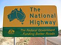
National Highway (Australia) (section Urban components of the national land transport (road) network)
to Seven Hills, and then the part of the M2 Hills Motorway from Seven Hills to the junction of the Cumberland Highway (Pennant Hills Road) at Carlingford...
37 KB (2,681 words) - 06:45, 7 October 2024

O'Connell Street and Dunlop Street: Parramatta Correctional Centre Pennant Hills Road: St Patrick's Cemetery The UrbanGrowth NSW Development Corporation...
7 KB (853 words) - 07:01, 28 September 2024

Tuckwell Road, Anglican Retirement Village and Cherrybrook Station 633 – Rouse Hill to Pennant Hills via Beaumont Hills, Kellyville, Hills Showground...
25 KB (2,695 words) - 19:54, 9 October 2024

an area from Hawkesbury River in the north, to the M2, Pennant Hills Road and North Rocks Road in the South. Osborn and Normanhurst Rd and Main Northern...
12 KB (1,244 words) - 04:10, 27 June 2024

Oatlands, New South Wales (category The Hills Shire)
extends from the south-east of Kissing Point Road and Vineyard Creek to the north-west bordering Pennant Hills Road and the North Rocks area. The name originally...
7 KB (808 words) - 11:54, 28 September 2024
"Road Photos & Information: New South Wales: Pennant Hills Road, Marsden Road, Stewart Street, Kissing Point Road, Silverwater Road, St HilliersRoad,...
119 KB (2,044 words) - 00:25, 3 July 2024

A6 (Sydney) (category Pages using infobox Australian road with a mapframe parameter)
Road no. 158 was declared from Kissing Point Road (today Victoria Road) in Ermington along Marsden Road to the intersection with Pennant Hills Road in...
27 KB (2,073 words) - 03:57, 29 April 2024

Epping Pennant Hills Singletons Mill Thornleigh Wahroonga (shared with Ku-ring-gai Council) Waitara West Pennant Hills (shared with The Hills Shire) Westleigh...
26 KB (1,990 words) - 06:34, 3 October 2024
Pennant Hills High School is a government, comprehensive, co-educational, high school situated in the northern suburb of Pennant Hills in Sydney, New South...
6 KB (790 words) - 02:26, 24 January 2024

Sydney Orbital Network (category Ring roads in Australia)
Epping Tunnel (M2 Hills Motorway, although not really a major tunnel) Sunken Section of the M2 Hills Motorway (The trench between Epping Road) Lane Cove Tunnel...
8 KB (581 words) - 16:32, 22 March 2024
James Ruse Drive (category WikiProject Australian Roads articles with a junction list using templates)
Road to a new interchange with Pennant Hills Road opened on 6 June 1977. The next 1.6 kilometre section extending Rydalmere Avenue from Pennant Hills...
19 KB (1,447 words) - 17:24, 28 September 2024

Thornleigh, Pennant Hills and Beecroft. Likewise, while the Municipality of Hunters Hill is west of the Lane Cove River and in the Parish of Hunters Hill, the...
27 KB (2,702 words) - 11:16, 9 September 2024

an area from Hawkesbury River in the north, to the M2, Pennant Hills Road and North Rocks Road in the South. Osborn and Normanhurst Rd and Main Northern...
13 KB (1,274 words) - 18:37, 23 April 2024

Pacific Motorway (Sydney–Newcastle) (category Pages using infobox Australian road with a mapframe parameter)
AusLink road corridor between Sydney and Brisbane. Pacific Motorway commences at its southern end at an intersection with Pennant Hills Road in Wahroonga...
44 KB (3,654 words) - 04:06, 14 September 2024

arterial roads in Northern Sydney are Military Road, the Pacific Highway, the Warringah Freeway, Pennant Hills Road, Ryde Road, Epping Road, Mona Vale Road, Victoria...
22 KB (1,811 words) - 15:03, 23 June 2024
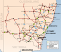
Regions of Sydney (section Hills District)
around Pennant Hills, Baulkham Hills, Blacktown, Seven Hills and Liverpool before ending on the banks of the Georges River opposite East Hills. A non-contiguous...
32 KB (3,628 words) - 07:25, 18 September 2024
westbound from Delhi Road to Windsor Road. Citybound access was restored only for the section from Windsor Road to Pennant Hills Road due to work to stabilise...
7 KB (412 words) - 06:47, 14 January 2024