
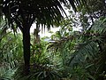
Puerto Rico Highway 66 (PR-66) is a main tollway which parallels Puerto Rico Highway 3 going from the city of Carolina, Puerto Rico via a 3 loops cloverleaf...
10 KB (672 words) - 01:17, 27 February 2024

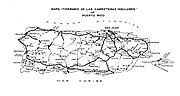
The highway system in Puerto Rico is composed of approximately 14,400 kilometers (8,900 mi) of roads in Puerto Rico, maintained by the Puerto Rico Department...
171 KB (3,645 words) - 00:23, 18 September 2024

Puerto Rico Highway 3 (PR-3) at nearly 100 miles long, is the second-longest highway on Puerto Rico (after PR-2). It connects the San Juan neighborhood...
21 KB (758 words) - 22:22, 4 August 2024
Puerto Rico Highway 53 (PR-53) or unsigned Interstate PR3 is a main tollway that is parallel to Puerto Rico Highway 3, which goes from Fajardo to Salinas...
17 KB (891 words) - 04:03, 26 February 2024
Puerto Rico Highway 52 (PR-52), a major toll road in Puerto Rico, is also known as Autopista Luis A. Ferré. It was formerly called Expreso Las Américas...
21 KB (1,121 words) - 17:28, 10 May 2024
Route 66 Puerto Rico Highway 66 South Carolina Highway 66 Tennessee State Route 66 Texas State Highway 66 (no connection to Texas portion of US 66) Texas...
7 KB (539 words) - 22:51, 7 August 2024

PR-26 towards PR-66 and PR-3 Puerto Rico Highway 66 becomes PR-26 in Carolina after the exit to PR-3 Interstate Highways in Puerto Rico PR-26 is the unsigned...
9 KB (342 words) - 05:04, 4 June 2024

Puerto Rico Highway 116 (PR-116) is a main highway in the southwest part of Puerto Rico, beginning in Guánica, Puerto Rico at Puerto Rico Highway 2 to...
13 KB (528 words) - 02:39, 6 February 2024
hotels, shopping malls, sport venues among others. In 2012 the Puerto Rico Highway 66, which provides easy access to San Juan, was opened which runs along...
28 KB (2,167 words) - 17:05, 30 September 2024
Puerto Rico Highway 149 (PR-149) is a secondary highway in Puerto Rico that connects the towns of Manatí in the north coast of Puerto Rico, from PR-22...
14 KB (437 words) - 02:37, 6 February 2024
Puerto Rico Highway 188 (PR-188) is a north–south highway that travels from Canóvanas, Puerto Rico to Loíza. It begins at its intersection with PR-3 and...
6 KB (208 words) - 03:04, 1 August 2023

of Puerto Rico Highway 504. At its southern terminus, the road starts at coordinates 18°03′32″N 66°37′09″W / 18.05876°N 66.61921°W / 18.05876; -66.61921...
4 KB (276 words) - 14:49, 24 August 2023

colonists in 1521, who called it Ciudad de Puerto Rico ("City of Puerto Rico", Spanish for rich port city). Puerto Rico's capital is the second oldest European-established...
159 KB (15,383 words) - 05:25, 16 October 2024
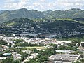
officially Cayey de Muesas, is a mountain town and municipality in central Puerto Rico located on the Sierra de Cayey within the Central Mountain range, north...
48 KB (4,693 words) - 19:07, 30 September 2024

Puerto Rico is an unincorporated territory of the United States located in the northeast Caribbean, approximately 1,000 miles (1,600 km) southeast of...
92 KB (8,678 words) - 12:24, 14 October 2024
Transportation in Puerto Rico includes a system of roads, highways, freeways, airports, ports and harbors, and railway systems, serving a population of...
24 KB (2,734 words) - 17:02, 28 September 2024

The economy of Puerto Rico is classified as a high income economy by the World Bank and as the most competitive economy in Latin America by the World...
185 KB (17,217 words) - 14:17, 13 October 2024
AutoExpreso (category Transportation in Puerto Rico)
needed] Puerto Rico Highway 52[citation needed] Puerto Rico Highway 53[citation needed] Puerto Rico Highway 66[citation needed] "AutoExpreso" (in Spanish)...
3 KB (198 words) - 20:15, 22 May 2023
of Puerto Rico (Spanish: Universidad de Puerto Rico), often shortened to UPR, is the main public university system in the U.S. Commonwealth of Puerto Rico...
32 KB (2,710 words) - 10:23, 20 October 2024
1953, the Puerto Rico Department of Transportation and Public Works implemented a major renumbering of its insular highways. Before 1953, highway routes...
41 KB (1,131 words) - 14:58, 5 March 2024

locally [ˈkawaʔ]) is a city and municipality of Puerto Rico located in the Central Mountain Range of Puerto Rico, south of San Juan and Trujillo Alto, west...
57 KB (4,876 words) - 15:31, 13 October 2024
Puerto Rico Highway 187 (PR-187) is a road that travels from Río Grande, Puerto Rico to Carolina, passing through Loíza. This highway begins at its intersection...
7 KB (234 words) - 01:52, 6 February 2024
Puerto Rico Highway 1 (PR-1) is a highway in Puerto Rico that connects the city of Ponce to San Juan. Leaving Ponce, the road heads east and follows a...
23 KB (745 words) - 06:38, 2 May 2024

pronunciation: [baʝaˈmon], locally [baʝaˈmoŋ]) is a city, municipality of Puerto Rico and suburb of San Juan located in the northern coastal valley, north...
46 KB (3,866 words) - 19:57, 27 September 2024

primary highways in the contiguous United States, there are signed Interstates in Hawaii and unsigned Interstates in Alaska and Puerto Rico. There are...
55 KB (669 words) - 02:04, 8 October 2024

Puerto Rico Highway 10 (PR-10) is a major highway in Puerto Rico. The primary state road connects the city of Ponce in the south coast to Arecibo in the...
38 KB (3,432 words) - 01:31, 5 August 2024

the Puerto Rican Countryman) is a monument built by the Government of Puerto Rico to honor the Puerto Rican Jíbaro, located on Puerto Rico Highway 52,...
5 KB (373 words) - 17:37, 11 February 2024

Puerto Rico Highway 185 (PR-185) is a main highway that connects Canóvanas, Puerto Rico to Juncos, Puerto Rico and is about 25 kilometers long. It begins...
8 KB (443 words) - 01:53, 6 February 2024

(Spanish pronunciation: [ˈbeɣa ˈalta]) is a town and municipality of Puerto Rico. Vega Alta is on the northern coast of the island, north of Morovis and...
32 KB (2,732 words) - 17:27, 30 September 2024

systems for Hawaii and Puerto Rico. The Interstate Highway System was expanded to Alaska in 1976, by the Federal-Aid Highway Act of 1976, which defined...
11 KB (686 words) - 17:29, 14 August 2024