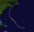
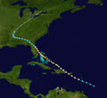
Description2011 Atlantic hurricane season summary map.png English: This map shows the tracks of all tropical cyclones in the 2011 Atlantic hurricane season. The...
(4,000 × 2,476 (6.25 MB)) - 12:18, 12 November 2023
Description1906 Atlantic hurricane season map - 2.png English: 1906 Atlantic hurricane season map Source http://www.aoml.noaa.gov/hrd/hurdat/1906.html...
(2,078 × 1,561 (362 KB)) - 17:57, 17 August 2024
Description1954 Atlantic hurricane season map - 2.png Color version of 1954 Atlantic hurricane season map. Retrieved from HURDAT. Source http://www.aoml...
(2,078 × 1,561 (352 KB)) - 13:13, 17 August 2024
Description1956 Atlantic hurricane season map - 2.png English: Track map of all storms in the 1956 Atlantic hurricane season Date 24 June 2008 Source http://www...
(2,078 × 1,561 (467 KB)) - 12:35, 17 August 2024
Description1909 Atlantic hurricane season summary map.png English: Track map of the 1909 Atlantic hurricane season. The points show the location of the...
(3,000 × 1,998 (3.15 MB)) - 09:50, 23 October 2024
File:Appendix C- Pertinent correspondence, CEPP new water modification final EIS- Previously titled- SFWMD Section 203 Everglades Agricultural Area southern reservoir and stormwater treatment area, Ma ... - USACE-p16021coll7-13248.pdf (section Summary) (matches file content)
image001.gif image002.gif image003.jpg image004.jpg image005.jpg image006.png I am in full support of the EAA Reservoir project as described in CERP....
(1,275 × 1,650 (20.36 MB)) - 08:35, 12 November 2024
File:Appendix C, pertinent correspondence- SFWMD Section 203 Everglades Agricultural Area southern reservoir and stormwater treatment area - USACE-p16021coll7-7168.pdf (section Summary) (matches file content)
image001.gif image002.gif image003.jpg image004.jpg image005.jpg image006.png I am in full support of the EAA Reservoir project as described in CERP....
(1,275 × 1,650 (32.2 MB)) - 08:32, 12 November 2024
Description1926 Atlantic hurricane 2 track.png English: Track map of Hurricane Two of the 1926 Atlantic hurricane season. The points show the location...
(1,024 × 956 (305 KB)) - 03:47, 5 November 2024
Description1926 Atlantic hurricane 5 track.png English: Track map of Hurricane Five of the 1926 Atlantic hurricane season. The points show the location...
(1,024 × 633 (52 KB)) - 03:47, 5 November 2024
Description1926 Atlantic hurricane 4 track.png English: Track map of Hurricane Four of the 1926 Atlantic hurricane season. The points show the location...
(1,024 × 1,024 (504 KB)) - 03:47, 5 November 2024
Description1926 Atlantic hurricane 3 track.png English: Track map of Hurricane Three of the 1926 Atlantic hurricane season. The points show the location...
(1,024 × 671 (598 KB)) - 03:47, 5 November 2024
Description1888 Atlantic hurricane 9 track.png English: Track map of Hurricane Nine of the 1888 Atlantic hurricane season. The points show the location...
(1,024 × 679 (269 KB)) - 19:35, 22 October 2024
Description1929 Atlantic hurricane 5 track.png English: Track map of the Hurricane Five of the 1929 Atlantic hurricane season. The points show the location...
(1,024 × 633 (72 KB)) - 18:49, 26 October 2024
Extreme weather events 2014-2015.png...
(1,275 × 1,650 (986 KB)) - 16:23, 16 August 2024
DescriptionUnnamed Atlantic TS 2011 track.png English: Track map of Unnamed Tropical Storm of the 2011 Atlantic hurricane season. The points show the...
(2,700 × 1,669 (2.05 MB)) - 18:08, 27 February 2023
DescriptionTexas hurricane tracks.png English: Track map of all Texas hurricanes of the 1851-2012 Atlantic hurricane seasons. The points show the location...
(5,000 × 5,000 (23.99 MB)) - 18:13, 27 February 2023
Description1926 Nassau Hurricane track.png English: Track map of the 1926 Nassau hurricane of the 1926 Atlantic hurricane season. The points show the location...
(1,024 × 938 (665 KB)) - 03:55, 5 November 2024
DescriptionGreat Hurricane (1780) areas affected.png English: Areas affected by Great Hurricane (excluding Bermuda) Date 10 October 2011 Source...
(394 × 286 (6 KB)) - 07:50, 16 May 2023
Description1929 Atlantic tropical storm 4 track.png English: Track map of the Tropical Storm Four of the 1929 Atlantic hurricane season. The points show...
(1,024 × 633 (60 KB)) - 05:24, 5 November 2024
Description1929 Atlantic tropical storm 3 track.png English: Track map of the Tropical Storm Three of the 1929 Atlantic hurricane season. The points show...
(1,024 × 633 (257 KB)) - 05:24, 5 November 2024
DescriptionKatia 2011 path.png English: Track map of Hurricane Katia of the 2011 Atlantic hurricane season. The points show the location of the storm...
(2,700 × 2,027 (2.76 MB)) - 10:22, 7 August 2024
DescriptionIrene 2011 path.png English: Track map of Hurricane Irene of the 2011 Atlantic hurricane season. The points show the location of the storm...
(2,700 × 2,700 (4.58 MB)) - 18:29, 19 February 2024
DescriptionLee 2011 track.png English: Track map of Tropical Storm Lee of the 2011 Atlantic hurricane season. The points show the location of the storm...
(2,700 × 1,669 (4.59 MB)) - 13:23, 16 August 2024
DescriptionCindy 2011 track.png English: Track map of Tropical Storm Cindy of the 2011 Atlantic hurricane season. The points show the location of the...
(2,700 × 1,669 (592 KB)) - 21:22, 16 March 2024
DescriptionArlene 2011 path.png English: Track map of Tropical Storm Arlene of the 2011 Atlantic hurricane season. The points show the location of the...
(2,700 × 1,668 (4.12 MB)) - 00:00, 9 March 2024
DescriptionCindy 2011 path.png English: Track map of Tropical Storm Cindy of the 2011 Atlantic hurricane season. The points show the location of the storm...
(2,700 × 1,668 (852 KB)) - 20:15, 17 May 2024
DescriptionArlene 2011 track.png English: Track map of Tropical Storm Arlene of the 2011 Atlantic hurricane season. The points show the location of the...
(2,700 × 1,669 (3.06 MB)) - 11:38, 14 September 2023
DescriptionDon 2011 path.png English: Track map of Tropical Storm Don of the 2011 Atlantic hurricane season. The points show the location of the storm...
(2,700 × 1,669 (4.59 MB)) - 20:19, 17 May 2024
DescriptionDon 2011 track.png English: Track map of Tropical Storm Don of the 2011 Atlantic hurricane season. The points show the location of the storm...
(2,700 × 1,669 (3.8 MB)) - 18:06, 27 February 2023
DescriptionFranklin 2011 track.png English: Track map of Tropical Storm Franklin of the 2011 Atlantic hurricane season. The points show the location of...
(2,700 × 1,669 (759 KB)) - 18:06, 27 February 2023


