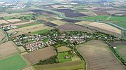
Akeman Street is the name given to a Roman road in eastern England that runs from Cambridgeshire to the north coast of Norfolk. It is approximately 75...
2 KB (229 words) - 09:27, 4 April 2024
is part of the Oxfordshire Way. Akeman Street (Cambridgeshire) Roman Britain Roman roads in Britain RAF Akeman Street Davies 2002, p. 169 Salzman, L.F...
4 KB (279 words) - 22:19, 26 October 2024
Buckinghamshire, England RAF Akeman Street, a former airfield near Minster Lovell, Oxfordshire, England Akeman Street (Cambridgeshire), a Roman road from Wimpole...
590 bytes (102 words) - 12:56, 10 August 2023
known as Babylon ware. A Roman road, Akeman Street, passes through the city; the southern end is at Ermine Street near Wimpole and its northern end is...
141 KB (14,412 words) - 01:34, 25 December 2024
of Cambridge, near junction 12 of the M11 motorway. The Roman road Akeman Street may have passed through the village. Barton, Old English Bartone, is...
9 KB (828 words) - 10:15, 1 December 2024
Arbury (redirect from Arbury, Cambridgeshire)
public house lies on Carlton Way, which follows the route of the Roman Akeman Street. Crime rates are lower here than in many parts of central Cambridge...
6 KB (678 words) - 20:52, 15 June 2024
Landbeach (category Villages in Cambridgeshire)
village's situation on a Roman road will have helped its growth. The road, Akeman Street, which once joined Ely to London, passes close to the village from north...
7 KB (710 words) - 05:16, 5 July 2024
Cottenham (category Villages in Cambridgeshire)
north-east of the parish is bounded by a section of the major Roman road, Akeman Street. The parish is recorded in the Domesday Book of 1086 as housing 60 tenants...
15 KB (1,951 words) - 09:28, 25 November 2024
84 ft) on Ermin Way in Berkshire to 338 pedes (100 m or 330 ft) on Akeman Street in Oxfordshire. A trunk road in Britain would typically be 5–8 m (16–26 ft)...
39 KB (3,422 words) - 15:56, 25 October 2024
River Great Ouse (category Rivers of Cambridgeshire)
Northamptonshire, the Great Ouse flows through Buckinghamshire, Bedfordshire, Cambridgeshire and Norfolk to drain into the Wash and the North Sea near Kings Lynn...
42 KB (4,823 words) - 01:36, 5 November 2024
Impington (category Villages in Cambridgeshire)
main evidence left today of the Roman occupation is the Roman road, Akeman Street (known locally as the Mereway), this cuts through the edge of Impington...
15 KB (1,928 words) - 14:35, 4 November 2024
Wartime military airfields of East Anglia 1939–1945 v. 1. Cambridge, Cambridgeshire, Patrick Stephens Ltd, 1979. ISBN 0-85059-335-2. Bowyer,M,J,F. Action...
89 KB (2,692 words) - 19:42, 24 November 2024
Little Thetford (category Villages in Cambridgeshire)
uncovered an earlier settlement of the Pre-Roman Iron Age. The Roman road Akeman Street passed through the north-west corner of the parish, and the lost 7th...
75 KB (7,376 words) - 16:02, 20 November 2024
(Commonhead) NBR 1930 Airmyn NER 1964 Airth CAL 1954 Akeld NER 1930 Akeman Street GCR 1930 Albert Road Bridge Halt L&SWR/LB&SCR Joint 1914 Albert Road...
26 KB (99 words) - 23:00, 8 October 2024
widely felt in the Roman roads that cross the county. Watling Street and Akeman Street both cross the county from east to west though there is circumspection...
10 KB (1,236 words) - 04:47, 22 August 2024
Ouse Valley Way (category Footpaths in Cambridgeshire)
Valley Way is used on the Pathfinder March. Map all coordinates using OpenStreetMap Download coordinates as: KML GPX (all coordinates) GPX (primary coordinates)...
3 KB (283 words) - 16:34, 2 July 2024
starts on Church Street, Charlbury before heading South and leaving the village via the B4022 before turning off and joining Main Street towards Stonesfield...
7 KB (626 words) - 23:59, 17 January 2024
Majesty's Prison Northumberland (formerly Acklington and Castington) RAF Akeman Street England Oxfordshire 1940 1947 Returned to agricultural use RAF Aldeburgh...
192 KB (1,561 words) - 21:35, 16 December 2024
East West Rail (category Rail transport in Cambridgeshire)
the Mullard Radio Astronomy Observatory), Trumpington Meadows, the Cambridgeshire Guided Busway and National Cycle Route 51 as well as housing at Potton...
80 KB (8,251 words) - 20:26, 1 January 2025
are in Lancaster, northern England, and Cambridge, based at Bar Hill, Cambridgeshire, eastern England. Between 2007 and 2011, OA had offices in Mauguio (OA...
45 KB (1,879 words) - 21:46, 24 March 2024
A428 road (category Roads in Cambridgeshire)
identity. Crossed by the East Coast Main Line, it leaves Bedfordshire for Cambridgeshire. The A428 from here to Cambridge follows the former A45, which became...
13 KB (1,167 words) - 09:22, 23 November 2024
National Cycle Route 51 (category Transport in Cambridgeshire)
crossing the A14 near Histon, routing north to St Ives adjacent to the Cambridgeshire Guided Busway, passing near Oakington and Swavesey, (adjacent to a guided...
10 KB (1,193 words) - 21:31, 6 November 2024
Varsity Line (category Rail transport in Cambridgeshire)
via London and Aylesbury. The fertiliser flow from Ince and Elton to Akeman Street had ended due to changing modal distribution. The Oxford-Bicester section...
47 KB (6,365 words) - 15:11, 15 September 2024
Gambier-Parry, who had business interests in breweries in Northamptonshire and Cambridgeshire. Other opposition included the vicar (Rev J.J. Williams, who admitted...
9 KB (1,070 words) - 20:50, 8 November 2024
Retrieved 25 November 2012. Holt, Jonathan (2007). Somerset Follies. Bath: Akeman Press. pp. 46–47. ISBN 978-0-9546138-7-7. "Barrington Court Park, Barrington"...
64 KB (2,898 words) - 13:36, 6 June 2024
Retrieved 11 November 2007. Holt, Jonathan (2007). Somerset Follies. Bath: Akeman Press. pp. 46–47. ISBN 978-0-9546138-7-7. "The Hanging Chapel and a medieval...
66 KB (5,536 words) - 02:44, 14 December 2024


