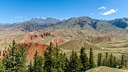
The Barkol Tagh, also known as Barkol Shan (Chinese: 巴里坤山), forms together with the Qarlik Tagh the easternmost end of the Tian Shan mountain range. It...
3 KB (254 words) - 11:54, 16 July 2023
Barkol Tagh (Barkol Shan), Bei Shan, Bogda Shan, Borohoro Shan, Irenchabirga, Qarliq Tagh (Qarlik Shan, Karkik Tagh, Karlik Shan, Harlik Shan), Kyrgyz Ala-Too...
30 KB (2,831 words) - 08:50, 28 December 2024
List of ultras of Central Asia (section Tian Shan)
total; 21 in the Pamirs, 1 in the Karakum, 5 in the Alays, 24 in the Tian Shan and 24 in the Altai and Mongolia. List - Central Asian Republics List - Mongolia...
8 KB (73 words) - 07:53, 25 January 2024
Qarliq Tagh (category Mountain ranges of the Tian Shan)
42º50'N–43º35'N and 93º41'O–95º07'O. In its western end it connects with the Barkol Shan. The highest peak is the Tomort (4,886 m above sea level). The mountain...
3 KB (310 words) - 14:30, 12 July 2024
there were 114,348 Hui and Han in the prefectures of Zhenxi (which included Barköl and Hami) and Ürümqi. In Ürümqi city itself, there were 39,000 people in...
74 KB (5,966 words) - 20:33, 26 December 2024
the Kuruk Tagh mountain range, in the east by the Bei Shan range (between Barkol Tagh and Bogda Shan), in the southeast by the Kumtag Desert and in the south...
12 KB (1,498 words) - 02:14, 23 December 2024
archaeological sites, corresponding to the Shirenzigou culture and Barkol culture in the Barkol County of Xinjiang. This would have positionned the Yuezhi between...
79 KB (9,021 words) - 23:06, 20 November 2024
Pakistan, Russia, and Tajikistan. The rugged Karakoram, Kunlun and Tian Shan mountain ranges occupy much of Xinjiang's borders, as well as its western...
256 KB (21,310 words) - 02:41, 2 January 2025
Autonomous Prefecture) 375th Border Defense Regiment (边防第三七五团) (Kumul City, Barkol Kazakh Autonomous County) The Border Defense regiments cover some of the...
16 KB (1,380 words) - 16:48, 28 December 2024
to circa 4,900 metres or 16,000 feet above sea level in the Qarlik and Barkol mountain ranges. Hami (Kumul) is in a fault depression at 759 m (2,490 ft)...
30 KB (2,454 words) - 11:29, 20 December 2024
northwestern part of the Tarim Basin and the southern slopes of the Tian Shan. The southern part of the prefecture is within the Taklamakan desert. Agriculture...
15 KB (742 words) - 02:00, 29 November 2024
Turfan. It crosses a mountain spur that connects the main Tien Shan with the Bogda Shan to the northeast. As of July 2015 GoogleEarth appears to show road...
16 KB (600 words) - 19:53, 20 October 2024
kilometres (120 mi) southwest from Ürümqi, although, due to the intervening Tian Shan, the road distance is considerably greater. The Iron Gate Pass (Tiemen Pass)...
34 KB (2,136 words) - 10:21, 1 January 2025
Baijiantan District Orku District Turpan Gaochang District Toksun County Shanshan County Kumul / Hami Yizhou District Yiwu County Barkol Kazakh County...
28 KB (3,323 words) - 01:37, 24 December 2024
part of the Pamir Plateau, where the Kunlun, Karakoram, Hindukush and Tian Shan mountains come together, at the borders with Afghanistan (Wakhan Corridor)...
31 KB (1,889 words) - 09:12, 2 January 2025
three Kazakh autonomous counties: Aksai Kazakh Autonomous County in Gansu, Barkol Kazakh Autonomous County and Mori Kazakh Autonomous County in the Xinjiang...
91 KB (8,972 words) - 11:36, 31 December 2024
Mongolian group11,13,14 with a high East-Asian ancestry (around 60%). Dai, Shan-Shan; Sulaiman, Xierzhatijiang; Isakova, Jainagul; Xu, Wei-Fang; Abdulloevich...
199 KB (21,459 words) - 15:18, 24 December 2024
Shihezi is located at the northern foothills of the middle part of the Tian Shan range approximately 136 kilometres (85 mi) from the regional capital of Ürümqi...
20 KB (759 words) - 05:56, 26 August 2024
Surroundings of the Shirenzigou archaeological site in Barkol County...
62 KB (6,056 words) - 22:17, 14 November 2024
Baijiantan District Orku District Turpan Gaochang District Toksun County Shanshan County Kumul / Hami Yizhou District Yiwu County Barkol Kazakh County...
41 KB (3,192 words) - 09:04, 11 December 2024
Duurlig Nars belonged to R1a1 and another to C-M217. Xiongnu remains from Barkol belonged exclusively to haplogroup Q. They argue that the haplogroups C2...
192 KB (22,576 words) - 13:27, 11 December 2024
Baijiantan District Orku District Turpan Gaochang District Toksun County Shanshan County Kumul / Hami Yizhou District Yiwu County Barkol Kazakh County...
4 KB (408 words) - 12:36, 22 April 2024
650422 TOK Yizhou District 伊州区 Hami District 80,791 472,175 650502 YZI Barkol Kazakh Autonomous County 巴里坤哈萨克自治县 Autonomous county (Kazakh) 36,608 75...
310 KB (110 words) - 20:28, 27 November 2024
is situated in the northwest part of the Tarim Basin, south of the Tien Shan mountains. Like most of Xinjiang, Artush has a cool arid climate (Köppen...
23 KB (1,421 words) - 03:02, 3 November 2024
victims. Xiongnu site in Barkol, Xinjiang, all 3 Q-M3 In L. L. Kang et al. (2013), three samples from a Xiongnu) site in Barkol, Xinjiang were found to...
118 KB (13,377 words) - 19:55, 1 January 2025
Yiwulu in 73 CE, evicting them from Turpan and chasing them as far as Lake Barkol before establishing a garrison at Hami. After the new Protector General...
40 KB (4,888 words) - 12:04, 1 January 2025
of Kazakh (mainly Kazakhs) are spread over a vast territory from the Tian Shan to the western shore of the Caspian Sea. Kazakh is the official state language...
40 KB (2,388 words) - 04:31, 26 December 2024
and a group of states in the Tarim Basin almost up to the foot of the Tian Shan range.[citation needed] Ptolemy speaks of Scythia beyond the Imaus, which...
107 KB (10,236 words) - 20:47, 27 December 2024
Irrigated agriculture in the Fukang is enabled by streams flowing from the Tian Shan mountains, as well as by the eastern branch of the Irtysh–Karamay–Ürümqi...
12 KB (385 words) - 15:07, 18 May 2024
an endorheic basin, where several saline lakes are found. Part of Altun Shan National Nature Reserve is located in Qimantag Township, in southern Ruoqiang...
23 KB (1,957 words) - 08:42, 19 December 2024


